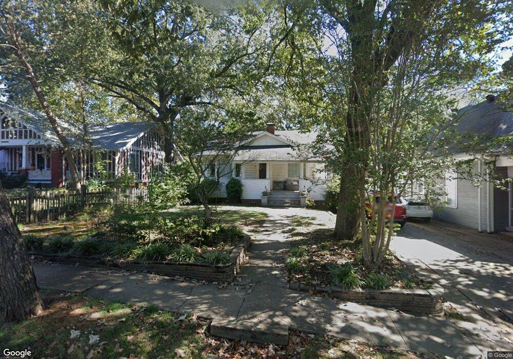
415 N Palm St Little Rock, AR 72205
Hillcrest NeighborhoodEstimated Value: $313,500 - $395,000
--
Bed
2
Baths
1,776
Sq Ft
$197/Sq Ft
Est. Value
About This Home
This home is located at 415 N Palm St, Little Rock, AR 72205 and is currently estimated at $349,125, approximately $196 per square foot. 415 N Palm St is a home located in Pulaski County with nearby schools including Pulaski Heights Elementary School, Pulaski Heights Middle School, and Central High School.
Ownership History
Date
Name
Owned For
Owner Type
Purchase Details
Closed on
Jun 15, 2017
Sold by
Clements Richard K and Clements Carolyn C
Bought by
Wyatt Mark Edward
Current Estimated Value
Home Financials for this Owner
Home Financials are based on the most recent Mortgage that was taken out on this home.
Original Mortgage
$75,000
Outstanding Balance
$38,311
Interest Rate
3.27%
Mortgage Type
New Conventional
Estimated Equity
$310,814
Create a Home Valuation Report for This Property
The Home Valuation Report is an in-depth analysis detailing your home's value as well as a comparison with similar homes in the area
Home Values in the Area
Average Home Value in this Area
Purchase History
| Date | Buyer | Sale Price | Title Company |
|---|---|---|---|
| Wyatt Mark Edward | $250,000 | Pulaski County Title |
Source: Public Records
Mortgage History
| Date | Status | Borrower | Loan Amount |
|---|---|---|---|
| Open | Wyatt Mark Edward | $75,000 |
Source: Public Records
Tax History Compared to Growth
Tax History
| Year | Tax Paid | Tax Assessment Tax Assessment Total Assessment is a certain percentage of the fair market value that is determined by local assessors to be the total taxable value of land and additions on the property. | Land | Improvement |
|---|---|---|---|---|
| 2025 | $2,780 | $54,145 | $10,400 | $43,745 |
| 2024 | $2,780 | $54,145 | $10,400 | $43,745 |
| 2023 | $2,780 | $54,145 | $10,400 | $43,745 |
| 2022 | $2,780 | $54,145 | $10,400 | $43,745 |
| 2021 | $2,800 | $39,720 | $12,800 | $26,920 |
| 2020 | $2,405 | $39,720 | $12,800 | $26,920 |
| 2019 | $2,405 | $39,720 | $12,800 | $26,920 |
| 2018 | $2,430 | $39,720 | $12,800 | $26,920 |
| 2017 | $2,123 | $39,720 | $12,800 | $26,920 |
| 2016 | $2,005 | $33,650 | $8,000 | $25,650 |
| 2015 | $2,355 | $33,588 | $8,000 | $25,588 |
| 2014 | $2,355 | $30,788 | $8,000 | $22,788 |
Source: Public Records
Map
Nearby Homes
- 501 N Palm St
- 326 Ash St
- 214 N Spruce St
- 4819 Lee Ave
- 201 Beechwood St
- 116 Beechwood St
- 324 N Jackson St
- 2501 Kavanaugh Blvd
- 220 Rose St
- 5101 Lee Ave
- 2423 Kavanaugh Blvd Unit 4
- 4119 Lee Ave
- 5101 G St
- 5124 Woodlawn Dr
- 5120 F St
- 5123 B St
- 416 N Spruce St
- 1100 N Palm St
- 131 Fairview Rd
- 1109 N Spruce St
- 409 N Palm St
- 423 N Palm St
- 405 N Palm St
- 401 N Palm St
- 420 Beechwood St
- 402 Beechwood St
- 422 Beechwood St
- 412 N Palm St
- 410 N Palm St
- 323 N Palm St
- 422 N Palm St
- 400 Beechwood St
- 406 N Palm St
- 500 Beechwood St
- 400 N Palm St
- 318 Beechwood St
- 321 N Palm St
- 502 Beechwood St
- 320 N Palm St
- 316 Beechwood St