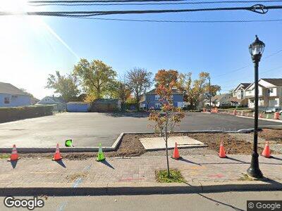
415 New Brunswick Ave Perth Amboy, NJ 08863
Fords NeighborhoodEstimated Value: $747,476 - $811,000
--
Bed
--
Bath
1,194
Sq Ft
$653/Sq Ft
Est. Value
About This Home
This home is located at 415 New Brunswick Ave, Perth Amboy, NJ 08863 and is currently estimated at $779,238, approximately $652 per square foot. 415 New Brunswick Ave is a home located in Middlesex County with nearby schools including Menlo Park Terrace School, Fords Middle School, and Woodbridge High School.
Ownership History
Date
Name
Owned For
Owner Type
Purchase Details
Closed on
Dec 3, 2021
Sold by
Barts Mixed Use Llc
Bought by
Township Of Woodbridge
Current Estimated Value
Purchase Details
Closed on
Jan 13, 2021
Sold by
Bielecki Bartlomiej
Bought by
Barts Mixed Use Llc
Purchase Details
Closed on
Feb 24, 2020
Sold by
Shri Shiv Krupa Llc
Bought by
Bielecki Bartlomiej
Purchase Details
Closed on
Nov 17, 2008
Sold by
Nedeski Robert
Bought by
Jai Sufalam Llc
Create a Home Valuation Report for This Property
The Home Valuation Report is an in-depth analysis detailing your home's value as well as a comparison with similar homes in the area
Home Values in the Area
Average Home Value in this Area
Purchase History
| Date | Buyer | Sale Price | Title Company |
|---|---|---|---|
| Township Of Woodbridge | $600,000 | Westcor Land Title Ins Co | |
| Barts Mixed Use Llc | -- | Chicago Title Insurance Co | |
| Barts Mixed Use Llc | -- | Chicago Title | |
| Bielecki Bartlomiej | $400,000 | Chicago Title Insurance Co | |
| Jai Sufalam Llc | $590,000 | None Available |
Source: Public Records
Mortgage History
| Date | Status | Borrower | Loan Amount |
|---|---|---|---|
| Previous Owner | Nedeski Robert | $200,000 | |
| Previous Owner | Nedeski Robert | $400,000 |
Source: Public Records
Tax History Compared to Growth
Tax History
| Year | Tax Paid | Tax Assessment Tax Assessment Total Assessment is a certain percentage of the fair market value that is determined by local assessors to be the total taxable value of land and additions on the property. | Land | Improvement |
|---|---|---|---|---|
| 2024 | -- | $87,500 | $87,500 | $0 |
| 2023 | -- | $87,500 | $87,500 | $0 |
| 2022 | $0 | $87,500 | $87,500 | $0 |
| 2021 | $10,330 | $87,500 | $87,500 | $0 |
| 2020 | $20,331 | $178,000 | $87,500 | $90,500 |
| 2019 | $19,808 | $178,000 | $87,500 | $90,500 |
| 2018 | $19,416 | $178,000 | $87,500 | $90,500 |
| 2017 | $19,074 | $178,000 | $87,500 | $90,500 |
| 2016 | $18,918 | $178,000 | $87,500 | $90,500 |
| 2015 | $18,549 | $178,000 | $87,500 | $90,500 |
| 2014 | $18,145 | $178,000 | $87,500 | $90,500 |
Source: Public Records
Map
Nearby Homes
- 415 New Brunswick Ave
- 46 Hornsby St
- 40 Hornsby St
- 40 Hornsby St Unit 240
- 37 Lillian St
- 429 New Brunswick Ave
- 45 Hornsby St
- 41 Hornsby St
- 433 New Brunswick Ave
- 34 Hornsby St
- 408 New Brunswick Ave
- 1 Pawlik St
- 39 Hornsby St
- 420 New Brunswick Ave
- 31 Lillian St
- 404 New Brunswick Ave
- 30 Hornsby St
- 424 New Brunswick Ave
- 44 Lillian St
- 33 Hornsby St