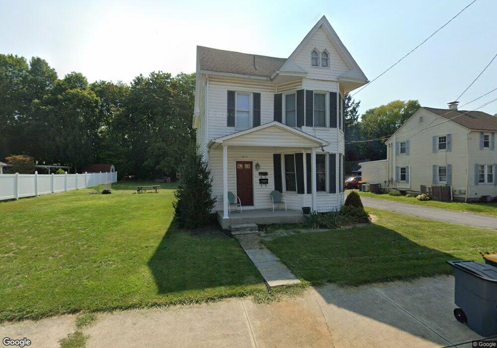
415 S Potomac St Waynesboro, PA 17268
Estimated Value: $216,000 - $345,213
--
Bed
--
Bath
1,876
Sq Ft
$140/Sq Ft
Est. Value
About This Home
This home is located at 415 S Potomac St, Waynesboro, PA 17268 and is currently estimated at $262,553, approximately $139 per square foot. 415 S Potomac St is a home located in Franklin County with nearby schools including Waynesboro Area Senior High School, Noah's Ark Christian Child Care Center, and St. Andrew Catholic School.
Ownership History
Date
Name
Owned For
Owner Type
Purchase Details
Closed on
Apr 18, 2007
Sold by
Shew Mark E
Bought by
Martin Betsy M
Current Estimated Value
Home Financials for this Owner
Home Financials are based on the most recent Mortgage that was taken out on this home.
Original Mortgage
$192,000
Outstanding Balance
$116,598
Interest Rate
6.23%
Mortgage Type
Purchase Money Mortgage
Estimated Equity
$145,955
Create a Home Valuation Report for This Property
The Home Valuation Report is an in-depth analysis detailing your home's value as well as a comparison with similar homes in the area
Home Values in the Area
Average Home Value in this Area
Purchase History
| Date | Buyer | Sale Price | Title Company |
|---|---|---|---|
| Martin Betsy M | $189,000 | None Available |
Source: Public Records
Mortgage History
| Date | Status | Borrower | Loan Amount |
|---|---|---|---|
| Open | Martin Betsy M | $192,000 |
Source: Public Records
Tax History Compared to Growth
Tax History
| Year | Tax Paid | Tax Assessment Tax Assessment Total Assessment is a certain percentage of the fair market value that is determined by local assessors to be the total taxable value of land and additions on the property. | Land | Improvement |
|---|---|---|---|---|
| 2025 | $3,045 | $16,800 | $2,470 | $14,330 |
| 2024 | $2,969 | $16,800 | $2,470 | $14,330 |
| 2023 | $2,904 | $16,800 | $2,470 | $14,330 |
| 2022 | $2,811 | $16,800 | $2,470 | $14,330 |
| 2021 | $2,669 | $16,800 | $2,470 | $14,330 |
| 2020 | $2,648 | $16,800 | $2,470 | $14,330 |
| 2019 | $2,597 | $16,800 | $2,470 | $14,330 |
| 2018 | $2,450 | $16,800 | $2,470 | $14,330 |
| 2017 | $2,404 | $16,800 | $2,470 | $14,330 |
| 2016 | $481 | $16,800 | $2,470 | $14,330 |
| 2015 | $449 | $16,800 | $2,470 | $14,330 |
| 2014 | $449 | $16,800 | $2,470 | $14,330 |
Source: Public Records
Map
Nearby Homes
- 305 W 7th St
- 111 E 5th St
- 405 S Broad St
- 208 Hamilton Ave
- 462 Scott Ave Unit 4
- 824 S Church St
- 217 Fairview Ave
- 911 Park St
- 115 Cleveland Ave
- 422 Cleveland Ave
- 130 Hamilton Ave
- 0 Westview Ave
- 223 E 3rd St
- 144 W Main St
- 105 Fairview Ave
- 0 N Church St Unit PAFL2029878
- 0 N Church St Unit PAFL2027222
- Frankford Plan at Pheasant Run
- Ruby Plan at Pheasant Run
- Pearl Plan at Pheasant Run
- 409 S Potomac St
- 419 S Potomac St
- 8 Wayne Hwy
- LOT #6 Wayne Hwy
- 421 S Potomac St
- 423 S Potomac St
- 420 S Potomac St
- 425 S Potomac St
- 416 S Potomac St
- 412 S Potomac St
- 408 S Potomac St
- 402 S Potomac St
- 493 S Potomac St
- 495 S Potomac St
- 424 S Potomac St
- 102 W 5th St
- 353 S Potomac St
- 428 S Potomac St
- 100 Green St
- 101 Green St