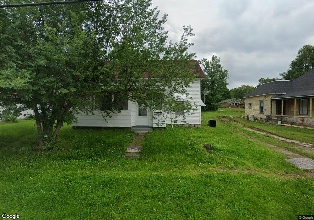
415 W Brook St Neosho, MO 64850
Estimated Value: $113,000 - $128,000
1
Bed
--
Bath
1,180
Sq Ft
$100/Sq Ft
Est. Value
About This Home
This home is located at 415 W Brook St, Neosho, MO 64850 and is currently estimated at $118,086, approximately $100 per square foot. 415 W Brook St is a home with nearby schools including Neosho High School, Ozark Christian Academy, and Neosho Christian Schools.
Ownership History
Date
Name
Owned For
Owner Type
Purchase Details
Closed on
Dec 19, 2022
Sold by
S Anglin & Associates 12 Llc
Bought by
Perry Amy L and Richter John L
Current Estimated Value
Home Financials for this Owner
Home Financials are based on the most recent Mortgage that was taken out on this home.
Original Mortgage
$69,875
Outstanding Balance
$67,828
Interest Rate
7.08%
Mortgage Type
FHA
Estimated Equity
$50,258
Purchase Details
Closed on
Dec 10, 2014
Sold by
Liu Qing Y and Liu Jing
Bought by
S Anglin & Associates 12 Llc
Create a Home Valuation Report for This Property
The Home Valuation Report is an in-depth analysis detailing your home's value as well as a comparison with similar homes in the area
Home Values in the Area
Average Home Value in this Area
Purchase History
| Date | Buyer | Sale Price | Title Company |
|---|---|---|---|
| Perry Amy L | -- | -- | |
| S Anglin & Associates 12 Llc | -- | -- |
Source: Public Records
Mortgage History
| Date | Status | Borrower | Loan Amount |
|---|---|---|---|
| Open | Perry Amy L | $69,875 |
Source: Public Records
Tax History
| Year | Tax Paid | Tax Assessment Tax Assessment Total Assessment is a certain percentage of the fair market value that is determined by local assessors to be the total taxable value of land and additions on the property. | Land | Improvement |
|---|---|---|---|---|
| 2024 | $332 | $6,040 | -- | -- |
| 2023 | $332 | $6,040 | $1,121 | $4,919 |
| 2022 | $332 | $5,300 | -- | -- |
| 2021 | $291 | $5,300 | $0 | $0 |
| 2020 | $218 | $3,990 | $0 | $0 |
| 2019 | $199 | $3,990 | $0 | $0 |
| 2018 | $200 | $3,990 | $0 | $0 |
| 2017 | $215 | $3,990 | $0 | $0 |
| 2016 | $215 | $4,280 | $0 | $0 |
| 2015 | -- | $4,280 | $0 | $0 |
| 2014 | -- | $4,280 | $0 | $0 |
Source: Public Records
Map
Nearby Homes
- 414 W Mccord St
- 340 W Brook St
- 619 W Brook St
- 515 Morrow St
- 515 & 527 Morrow St
- 329 S Ripley St
- 527 Morrow St
- 328 S Lincoln St
- 400 S Jefferson St
- 507 W Hill St
- 0.38 +/- acre S Lincoln St
- 521 Oak Ridge Dr
- 508 Major Ln
- 620 Archer Ct
- 416 E Hickory St
- 501 Washington Ave
- 1310 Reid Rd
- 1121 Skyline Dr
- 701 S High St
- 324 Saint Johns St
- 417 W Brook St
- XXX W Brook St
- 414 W Brook St
- 220 N High St
- 302 N High St
- 423 W Brook St
- 422 W Brook St
- 308 N High St
- 428 W Brook St
- 433 W Brook St
- 422 W Mccord St
- 207 N High St
- 418 W Mccord St Unit B
- 432 W Brook St
- 428 W Mccord St
- 211 N High St
- 201 N High St
- 401 W Coler St
- 401 W Coler St
- 207 N Lincoln St