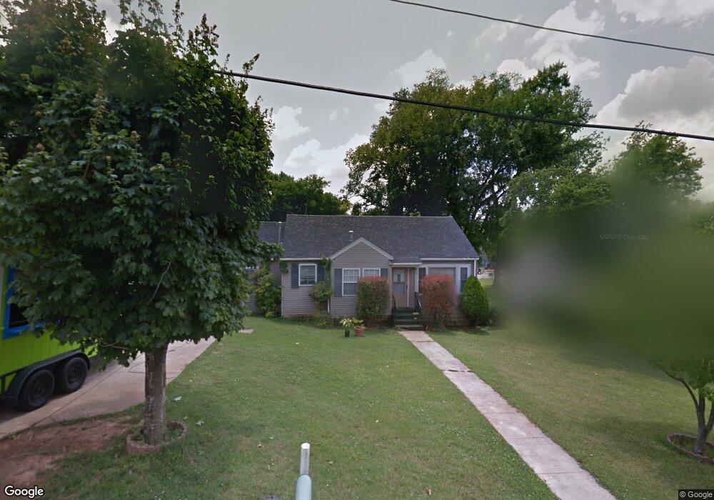
415 W Mcknight Dr Murfreesboro, TN 37129
Estimated Value: $231,628 - $319,000
Studio
2
Baths
1,076
Sq Ft
$262/Sq Ft
Est. Value
About This Home
This home is located at 415 W Mcknight Dr, Murfreesboro, TN 37129 and is currently estimated at $281,907, approximately $261 per square foot. 415 W Mcknight Dr is a home located in Rutherford County with nearby schools including Mitchell-Neilson Elementary, Siegel Middle School, and Siegel High School.
Ownership History
Date
Name
Owned For
Owner Type
Purchase Details
Closed on
Aug 10, 1999
Sold by
Brandon John W
Bought by
Everhart Betty L
Current Estimated Value
Purchase Details
Closed on
Jul 14, 1999
Sold by
Lynn Parker Martin
Bought by
Compton Jerry D and Compton Theresa
Purchase Details
Closed on
Mar 26, 1996
Sold by
Lynn Parker Martin
Bought by
Parker and Melissa
Create a Home Valuation Report for This Property
The Home Valuation Report is an in-depth analysis detailing your home's value as well as a comparison with similar homes in the area
Home Values in the Area
Average Home Value in this Area
Purchase History
| Date | Buyer | Sale Price | Title Company |
|---|---|---|---|
| Everhart Betty L | $135,340 | -- | |
| Compton Jerry D | $66,000 | -- | |
| Parker | -- | -- |
Source: Public Records
Tax History
| Year | Tax Paid | Tax Assessment Tax Assessment Total Assessment is a certain percentage of the fair market value that is determined by local assessors to be the total taxable value of land and additions on the property. | Land | Improvement |
|---|---|---|---|---|
| 2025 | -- | $51,075 | $13,750 | $37,325 |
| 2024 | $958 | $51,075 | $13,750 | $37,325 |
| 2023 | $958 | $51,075 | $13,750 | $37,325 |
| 2022 | $825 | $51,075 | $13,750 | $37,325 |
| 2021 | $728 | $32,800 | $8,750 | $24,050 |
| 2020 | $728 | $32,800 | $8,750 | $24,050 |
| 2019 | $728 | $32,800 | $8,750 | $24,050 |
| 2018 | $1,000 | $32,800 | $0 | $0 |
| 2017 | $908 | $23,375 | $0 | $0 |
| 2016 | $908 | $23,375 | $0 | $0 |
| 2015 | $908 | $23,375 | $0 | $0 |
| 2014 | $581 | $23,375 | $0 | $0 |
| 2013 | -- | $21,600 | $0 | $0 |
Source: Public Records
Map
Nearby Homes
- 1107 Owen Layne Dr
- 1018 Owen Layne Dr
- 1132 Owen Layne Dr
- 418 Lynn St
- 1022 Poplar Ave
- 1306 Grantland Ave
- 301 Kingwood Dr
- 209 Kingwood Dr
- 1022 Jones Blvd
- 904 N Maple St
- 220 Chamberlain Dr
- 1212 N Spring St
- 225 Byrd Ave
- 807 N Maple St
- 718 N Walnut St
- 1611 White Blvd
- 513 N Maple St
- 520 N Maple St Unit 3
- 520 N Maple St Unit 2
- 520 N Maple St Unit 1
- 419 W Mcknight Dr
- 411 W Mcknight Dr
- 410 Knox St
- 406 Knox St
- 407 W Mcknight Dr
- 423 W Mcknight Dr
- 414 Knox St
- 1119 Poplar Ave
- 418 Knox St
- 1115 Poplar Ave
- 403 W Mcknight Dr
- 1200 Allen Ave
- 1104 Owen Layne Dr
- 1124 Owen Layne Dr
- 1010 Owen Layne Dr
- 1127 Owen Layne Dr
- 1015 Owen Layne Dr
- 1123 Owen Layne Dr
- 1128 Owen Layne Dr
- 1002 Owen Layne Dr
Your Personal Tour Guide
Ask me questions while you tour the home.