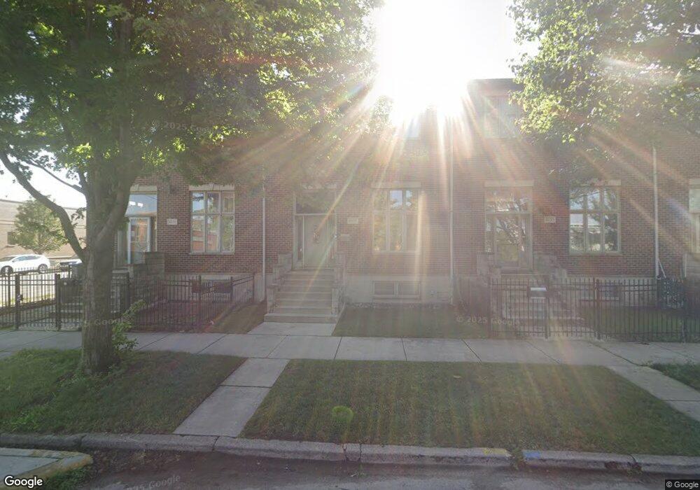
4153 S Lowe Ave Chicago, IL 60609
Bridgeport NeighborhoodEstimated Value: $459,571 - $549,000
3
Beds
3
Baths
1,912
Sq Ft
$258/Sq Ft
Est. Value
About This Home
This home is located at 4153 S Lowe Ave, Chicago, IL 60609 and is currently estimated at $493,393, approximately $258 per square foot. 4153 S Lowe Ave is a home located in Cook County with nearby schools including Hendricks Elementary Community Academy, St Gabriel Elementary School, and Bridgeport Catholic Academy - South Campus.
Ownership History
Date
Name
Owned For
Owner Type
Purchase Details
Closed on
May 11, 2020
Sold by
Chavarria Vincent A and Chavarria Cheryle
Bought by
Chavarria Vincent A
Current Estimated Value
Home Financials for this Owner
Home Financials are based on the most recent Mortgage that was taken out on this home.
Original Mortgage
$252,100
Outstanding Balance
$219,448
Interest Rate
2.75%
Mortgage Type
New Conventional
Estimated Equity
$273,945
Purchase Details
Closed on
Jan 19, 2007
Sold by
R&M Contracting Inc
Bought by
Chavarria Vincent A and Chavarria Victor M
Home Financials for this Owner
Home Financials are based on the most recent Mortgage that was taken out on this home.
Original Mortgage
$292,000
Interest Rate
6.19%
Mortgage Type
Purchase Money Mortgage
Create a Home Valuation Report for This Property
The Home Valuation Report is an in-depth analysis detailing your home's value as well as a comparison with similar homes in the area
Home Values in the Area
Average Home Value in this Area
Purchase History
| Date | Buyer | Sale Price | Title Company |
|---|---|---|---|
| Chavarria Vincent A | -- | Bchh Inc | |
| Chavarria Vincent A | $365,000 | Lasalle Title |
Source: Public Records
Mortgage History
| Date | Status | Borrower | Loan Amount |
|---|---|---|---|
| Open | Chavarria Vincent A | $252,100 | |
| Closed | Chavarria Vincent A | $292,000 |
Source: Public Records
Tax History
| Year | Tax Paid | Tax Assessment Tax Assessment Total Assessment is a certain percentage of the fair market value that is determined by local assessors to be the total taxable value of land and additions on the property. | Land | Improvement |
|---|---|---|---|---|
| 2025 | $6,052 | $37,000 | $1,382 | $35,618 |
| 2024 | $6,052 | $37,000 | $1,382 | $35,618 |
| 2023 | $5,878 | $32,000 | $1,727 | $30,273 |
| 2022 | $5,878 | $32,000 | $1,727 | $30,273 |
| 2021 | $5,765 | $32,000 | $1,727 | $30,273 |
| 2020 | $5,024 | $25,655 | $1,727 | $23,928 |
| 2019 | $5,038 | $28,506 | $1,727 | $26,779 |
| 2018 | $4,952 | $28,506 | $1,727 | $26,779 |
| 2017 | $5,451 | $28,699 | $1,554 | $27,145 |
| 2016 | $5,248 | $28,699 | $1,554 | $27,145 |
| 2015 | $4,778 | $28,699 | $1,554 | $27,145 |
| 2014 | $4,453 | $26,569 | $1,467 | $25,102 |
| 2013 | $4,832 | $26,569 | $1,467 | $25,102 |
Source: Public Records
Map
Nearby Homes
- 4166 S Emerald Ave
- 4167 S Halsted St
- 5131 S Union Ave
- 617 W 43rd Place
- 4411 S Wallace St
- 4353 S Halsted St
- 3816 S Emerald Ave
- 5014 S Union Ave
- 510 W 45th St
- 4206 S Wells St
- 3749 S Union Ave
- 516 W 45th Place
- 245 W 43rd St
- 4250 S Wells St
- 4161 S Wells St
- 4547 S Union Ave
- 4204 S Wentworth Ave
- 4452 S Shields Ave
- 4412 S Wells St
- 642 W 37th St
- 4151 S Lowe Ave
- 619 W Root St
- 4155 S Lowe Ave
- 4157 S Lowe Ave
- 5335 S Lowe Ave
- 4159 S Lowe Ave
- 611 W Root St
- 607 W Root St
- 610 W Root St
- 605 W Root St
- 4167 S Lowe Ave
- 603 W Root St
- 601 W Root St
- 601 W Root St
- 4166 S Wallace St
- 4166 S Wallace St
- 4168 S Wallace St
- 4168 S Wallace St
- 4170 S Wallace St
- 4172 S Wallace St
Your Personal Tour Guide
Ask me questions while you tour the home.