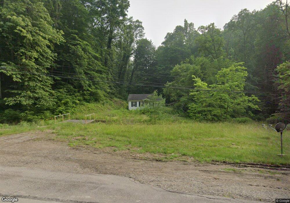
41553 State Route 78 Woodsfield, OH 43793
Estimated Value: $54,265 - $104,000
--
Bed
1
Bath
640
Sq Ft
$125/Sq Ft
Est. Value
About This Home
This home is located at 41553 State Route 78, Woodsfield, OH 43793 and is currently estimated at $80,088, approximately $125 per square foot. 41553 State Route 78 is a home located in Monroe County with nearby schools including Woodsfield Elementary School, River Elementary School, and Monroe Central High School.
Ownership History
Date
Name
Owned For
Owner Type
Purchase Details
Closed on
May 15, 2025
Sold by
Sheriffs Of Monroe County
Bought by
Roberts James M and Roberts Brenda L
Current Estimated Value
Purchase Details
Closed on
Jul 2, 1991
Bought by
Hurt Hobert and Hurt Phyllis M
Create a Home Valuation Report for This Property
The Home Valuation Report is an in-depth analysis detailing your home's value as well as a comparison with similar homes in the area
Home Values in the Area
Average Home Value in this Area
Purchase History
| Date | Buyer | Sale Price | Title Company |
|---|---|---|---|
| Roberts James M | $4,200 | None Listed On Document | |
| Hurt Hobert | $19,000 | -- |
Source: Public Records
Tax History Compared to Growth
Tax History
| Year | Tax Paid | Tax Assessment Tax Assessment Total Assessment is a certain percentage of the fair market value that is determined by local assessors to be the total taxable value of land and additions on the property. | Land | Improvement |
|---|---|---|---|---|
| 2024 | $236 | $7,370 | $5,780 | $1,590 |
| 2023 | $237 | $7,370 | $5,780 | $1,590 |
| 2022 | $236 | $7,370 | $5,780 | $1,590 |
| 2021 | $159 | $4,900 | $3,150 | $1,750 |
| 2020 | $159 | $4,900 | $3,150 | $1,750 |
| 2019 | $401 | $12,570 | $3,150 | $9,420 |
| 2018 | $239 | $11,610 | $2,630 | $8,980 |
| 2017 | $93 | $11,610 | $2,630 | $8,980 |
| 2016 | $94 | $11,610 | $2,630 | $8,980 |
| 2015 | $24 | $9,460 | $2,160 | $7,300 |
| 2014 | $24 | $9,460 | $2,160 | $7,300 |
| 2013 | $18 | $9,240 | $2,100 | $7,140 |
Source: Public Records
Map
Nearby Homes
- 147 Andover Rd
- 123 Andover Rd
- 314 Devon Rd
- 315 Eastern Ave
- 129 Maple Ave
- 407 High St
- 210 E Church St
- 303 High St
- 108.5 S Paul Aly
- 108 S Paul St
- 306 Monroe St
- 108 Oaklawn Ave
- 208 Center St
- 212 Oaklawn Ave
- 333 S Main St
- 218 Oaklawn Ave
- 220 Oaklawn Ave
- 44883 Bondi Ridge Rd
- 0 Lickskillet Rd
- 0 Barber Ridge Rd
- 46245 Buckio Rd
- 42088 State Route 78
- 45002 Sugartree Rd
- 46575 Buckio Rd
- 41234 Paulus Ridge Rd
- 34691 Township Highway 2063
- 42300 Township Road 987
- 42160 State Route 78
- 46382 Buckio Rd
- 42305 Township Road 987
- 46375 Buckio Rd
- 46010 Saw Mill Rd
- 45388 Sugartree Ridge Rd
- 46094 Saw Mill Rd
- 46583 Buckio Rd
- 42184 State Route 78
- 42233 State Route 78
- 42420 Township Road 987
- 46430 Buckio Rd
- 42286 State Route 78