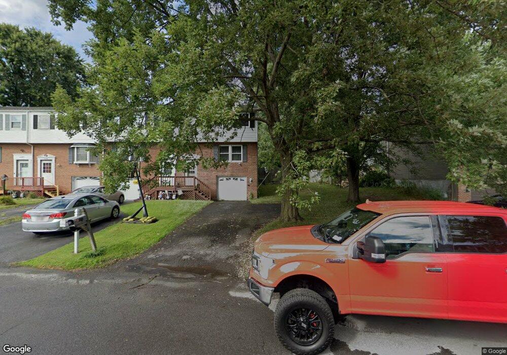
4155B Burningtree Rd Unit B Liverpool, NY 13090
Estimated Value: $139,000 - $180,797
3
Beds
2
Baths
1,260
Sq Ft
$133/Sq Ft
Est. Value
About This Home
This home is located at 4155B Burningtree Rd Unit B, Liverpool, NY 13090 and is currently estimated at $167,949, approximately $133 per square foot. 4155B Burningtree Rd Unit B is a home located in Onondaga County with nearby schools including Soule Road Elementary School, Soule Road Middle School, and Liverpool High School.
Ownership History
Date
Name
Owned For
Owner Type
Purchase Details
Closed on
Jul 28, 2017
Sold by
Budlong Brian
Bought by
Hs Property Funds Llc
Current Estimated Value
Purchase Details
Closed on
Jul 9, 2008
Sold by
Fioramonti Sandra
Bought by
Budlong Brian
Purchase Details
Closed on
Mar 30, 2007
Sold by
Shepard Joshua and Shepard Regan E
Bought by
Fioramonti Sandra
Purchase Details
Closed on
Aug 8, 2005
Sold by
Woods James M
Bought by
Shepard Joshua A and Shepard Regan E
Create a Home Valuation Report for This Property
The Home Valuation Report is an in-depth analysis detailing your home's value as well as a comparison with similar homes in the area
Home Values in the Area
Average Home Value in this Area
Purchase History
| Date | Buyer | Sale Price | Title Company |
|---|---|---|---|
| Hs Property Funds Llc | $73,057 | Mark Farchione | |
| Budlong Brian | $81,000 | -- | |
| Fioramonti Sandra | $83,000 | Charles Grundner | |
| Shepard Joshua A | $58,500 | Kevin P Harrigan |
Source: Public Records
Tax History Compared to Growth
Tax History
| Year | Tax Paid | Tax Assessment Tax Assessment Total Assessment is a certain percentage of the fair market value that is determined by local assessors to be the total taxable value of land and additions on the property. | Land | Improvement |
|---|---|---|---|---|
| 2024 | $2,957 | $3,100 | $600 | $2,500 |
| 2023 | $3,882 | $3,100 | $600 | $2,500 |
| 2022 | $3,887 | $3,100 | $600 | $2,500 |
| 2021 | $3,847 | $3,100 | $600 | $2,500 |
| 2020 | $3,702 | $3,100 | $600 | $2,500 |
| 2019 | $1,515 | $3,100 | $600 | $2,500 |
| 2018 | $3,633 | $3,100 | $600 | $2,500 |
| 2017 | $1,459 | $3,100 | $600 | $2,500 |
| 2016 | $2,705 | $3,100 | $600 | $2,500 |
| 2015 | -- | $3,100 | $600 | $2,500 |
| 2014 | -- | $3,100 | $600 | $2,500 |
Source: Public Records
Map
Nearby Homes
- 8402B Shallowcreek Rd
- 4242 Hunting Creek Dr
- 4124 Buttonwood Trail
- 4287 Amblewood Ln
- 4298 Old Meadow Rd
- 4185 Antler Ln
- 4209 State Route 31
- 8323 Falcon Dr
- 3901 Falcon Ct
- 8621 Morgan Rd
- 8226 Dampier Cir
- 8227 Renfrew Dr
- 3943 Bufflehead Ln
- 8195 Laurie Ln
- 8159 Portobello Way
- 8439 Falcon Dr
- 3952 Merganser Dr
- 8232 Chiffon Path
- 8279 Dampier Cir
- 8267 Warbler Way
- 4155B Burningtree Rd
- 4155A Burningtree Rd
- 4153B Burningtree Rd
- 4153A Burningtree Rd
- 4151 Burningtree Rd
- 4157A Burningtree Rd
- 4151A Burningtree Rd
- 8412A Shallowcreek Rd
- 4157B Burningtree Rd
- 4157B Burningtree Rd Unit B
- 8414A Shallowcreek Rd
- 4151B Burningtree Rd
- 8412B Shallowcreek Rd
- 8416C Shallowcreek Rd
- 8410A Shallowcreek Rd
- 8416B Shallowcreek Rd
- 4157C Burningtree Rd
- 8410B Shallowcreek Rd
- 4159C Burningtree Rd
- 8416A Shallowcreek Rd