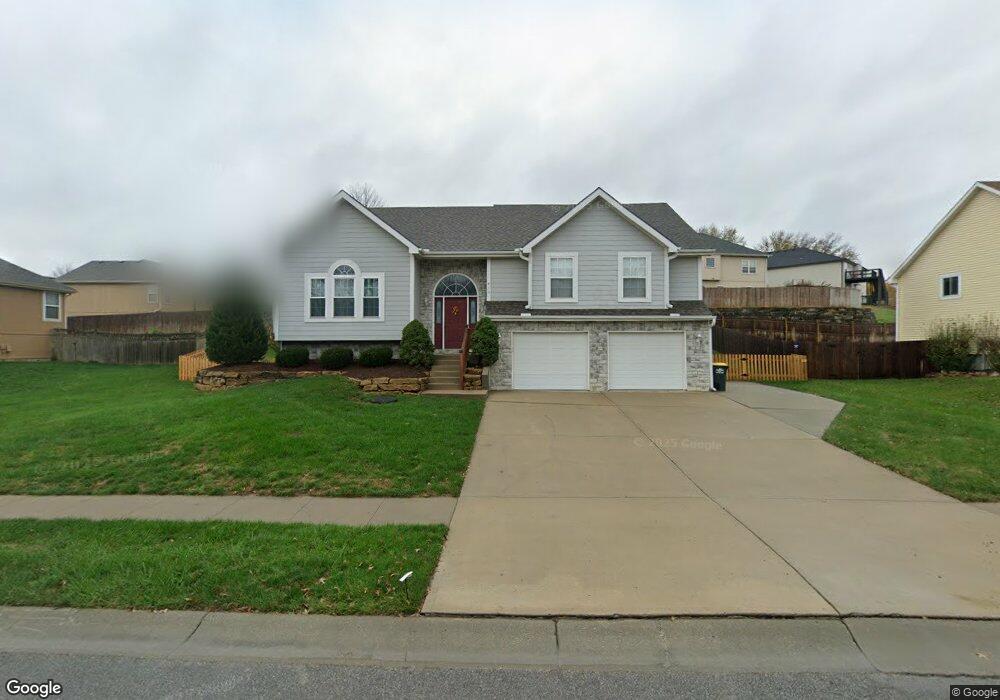
416 Hillbrook Dr Lansing, KS 66043
Estimated Value: $342,468 - $373,000
4
Beds
3
Baths
1,799
Sq Ft
$199/Sq Ft
Est. Value
About This Home
This home is located at 416 Hillbrook Dr, Lansing, KS 66043 and is currently estimated at $357,117, approximately $198 per square foot. 416 Hillbrook Dr is a home located in Leavenworth County with nearby schools including Lansing Elementary School, Lansing Middle 6-8, and Lansing High 9-12.
Ownership History
Date
Name
Owned For
Owner Type
Purchase Details
Closed on
Nov 1, 2001
Bought by
Bradley Hilton C and Hilton Dawn L
Current Estimated Value
Home Financials for this Owner
Home Financials are based on the most recent Mortgage that was taken out on this home.
Original Mortgage
$119,300
Outstanding Balance
$23,987
Interest Rate
6.64%
Mortgage Type
New Conventional
Estimated Equity
$333,130
Create a Home Valuation Report for This Property
The Home Valuation Report is an in-depth analysis detailing your home's value as well as a comparison with similar homes in the area
Home Values in the Area
Average Home Value in this Area
Purchase History
| Date | Buyer | Sale Price | Title Company |
|---|---|---|---|
| Bradley Hilton C | $185,000 | -- |
Source: Public Records
Mortgage History
| Date | Status | Borrower | Loan Amount |
|---|---|---|---|
| Open | Bradley Hilton C | $119,300 | |
| Closed | Bradley Hilton C | $155,565 |
Source: Public Records
Tax History Compared to Growth
Tax History
| Year | Tax Paid | Tax Assessment Tax Assessment Total Assessment is a certain percentage of the fair market value that is determined by local assessors to be the total taxable value of land and additions on the property. | Land | Improvement |
|---|---|---|---|---|
| 2025 | $4,838 | $38,529 | $4,630 | $33,899 |
| 2024 | $4,493 | $36,008 | $3,687 | $32,321 |
| 2023 | $4,493 | $34,623 | $3,687 | $30,936 |
| 2022 | $4,320 | $31,475 | $2,947 | $28,528 |
| 2021 | $3,934 | $27,350 | $2,947 | $24,403 |
| 2020 | $3,806 | $26,047 | $2,947 | $23,100 |
| 2019 | $3,747 | $25,610 | $2,947 | $22,663 |
| 2018 | $3,520 | $24,092 | $2,947 | $21,145 |
| 2017 | $3,389 | $23,149 | $2,947 | $20,202 |
| 2016 | $3,300 | $22,540 | $2,947 | $19,593 |
| 2015 | $3,290 | $22,540 | $2,947 | $19,593 |
| 2014 | $3,351 | $23,425 | $2,947 | $20,478 |
Source: Public Records
Map
Nearby Homes
- 102 S 3rd Ct
- 218 E Kay St
- 209 E Kay St
- 506 1st Terrace
- 104 Olive St
- 202 S Main St
- 124 S Main St
- 901 S Main St
- 527 S Valley Dr
- 624 S Bittersweet Ln
- 129 Brookwood St
- 722 Bittersweet Rd
- 706 N 2nd St
- 922 Southfork St
- 268 Holiday Dr
- 261 Holiday Dr
- 610 Meadowlark Rd
- 115 W Gilman Rd
- 131 Rock Creek Loop
- 415 Fairlane St
- 424 Hillbrook Dr
- 413 Hillbrook Ct
- 415 Hillbrook Dr
- 409 Hillbrook Dr
- 400 Hillbrook Dr
- 526 Hithergreen Dr
- 411 Hillbrook Ct
- 519 Hillbrook Dr
- 401 Hillbrook Dr
- 520 Hillbrook Dr
- 521 Hillbrook Dr
- 410 Hillbrook Ct
- 525 Hithergreen Dr
- 530 Hithergreen Dr
- 524 Hillbrook Dr
- 527 Hithergreen Dr
- 534 Hithergreen Dr
- 525 Hillbrook Dr
- 812 E Mary St
- 531 Hithergreen Dr