Estimated Value: $154,439 - $178,000
2
Beds
1
Bath
1,093
Sq Ft
$150/Sq Ft
Est. Value
About This Home
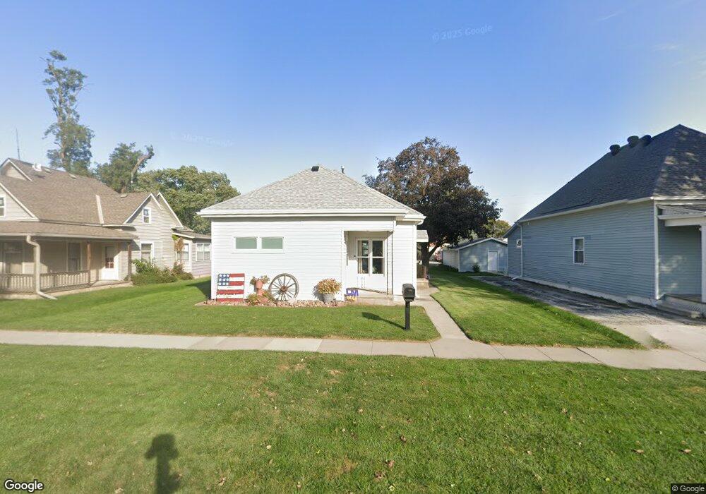
This home is located at 416 N 2nd Ave, Logan, IA 51546 and is currently estimated at $163,610, approximately $149 per square foot. 416 N 2nd Ave is a home located in Harrison County with nearby schools including Logan-Magnolia Elementary School and Logan-Magnolia Junior/Senior High School.
Ownership History
Date
Name
Owned For
Owner Type
Purchase Details
Closed on
Sep 30, 2009
Sold by
Cox Barbara E
Bought by
Scheuring Tiffany A
Current Estimated Value
Home Financials for this Owner
Home Financials are based on the most recent Mortgage that was taken out on this home.
Original Mortgage
$74,500
Outstanding Balance
$53,140
Interest Rate
5.19%
Mortgage Type
USDA
Estimated Equity
$110,470
Create a Home Valuation Report for This Property
The Home Valuation Report is an in-depth analysis detailing your home's value as well as a comparison with similar homes in the area
Purchase History
| Date | Buyer | Sale Price | Title Company |
|---|---|---|---|
| Scheuring Tiffany A | $74,500 | None Available |
Source: Public Records
Mortgage History
| Date | Status | Borrower | Loan Amount |
|---|---|---|---|
| Open | Scheuring Tiffany A | $74,500 |
Source: Public Records
Tax History
| Year | Tax Paid | Tax Assessment Tax Assessment Total Assessment is a certain percentage of the fair market value that is determined by local assessors to be the total taxable value of land and additions on the property. | Land | Improvement |
|---|---|---|---|---|
| 2025 | $1,810 | $125,730 | $12,150 | $113,580 |
| 2024 | $1,810 | $113,210 | $12,150 | $101,060 |
| 2023 | $1,742 | $113,210 | $12,150 | $101,060 |
| 2022 | $1,438 | $82,728 | $12,150 | $70,578 |
| 2021 | $1,438 | $82,728 | $12,150 | $70,578 |
| 2020 | $1,294 | $77,106 | $12,150 | $64,956 |
| 2019 | $1,532 | $77,106 | $12,150 | $64,956 |
| 2018 | $1,498 | $85,029 | $0 | $0 |
| 2017 | $1,540 | $85,029 | $0 | $0 |
| 2016 | $1,570 | $85,029 | $0 | $0 |
| 2015 | $1,570 | $76,603 | $0 | $0 |
| 2014 | $1,362 | $76,603 | $0 | $0 |
Source: Public Records
Map
Nearby Homes
- 217 N 2nd Ave
- 114 E 10th St
- 1010 Skyline Dr
- Lot 18 Mulligan Trail
- 2144 Norton Ave
- LOT 27 Mulligan Trail
- LOT 26 Lmvcc Estates
- 2464 Mulligan Trail
- LOT 20 Lmvcc Estates
- LOT 17 Lmvcc Estates
- LOT 15 Mulligan Trail
- 2853 Preston Place
- TBD Preston Place 3 Parcels
- TBD Preston Place 2 Parcels
- LOTS 5 & 6 Fieldcrest Dr
- LOT D Fieldcrest Dr
- LOT 9 & 10 Fieldcrest Dr
- LOT E & K Fieldcrest Dr
- LOT C Fieldcrest Dr
- LOTS 7 & 8 Fieldcrest Dr
Your Personal Tour Guide
Ask me questions while you tour the home.