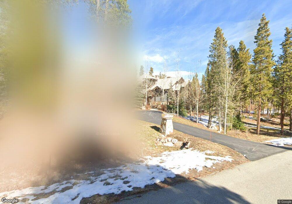
416 Peerless Dr Breckenridge, CO 80424
Estimated Value: $5,818,000 - $9,483,344
5
Beds
8
Baths
4,728
Sq Ft
$1,618/Sq Ft
Est. Value
About This Home
This home is located at 416 Peerless Dr, Breckenridge, CO 80424 and is currently estimated at $7,650,672, approximately $1,618 per square foot. 416 Peerless Dr is a home with nearby schools including Upper Blue Elementary School, Summit Middle School, and Summit High School.
Ownership History
Date
Name
Owned For
Owner Type
Purchase Details
Closed on
Aug 9, 2011
Sold by
Levenick Nancy and Levenick Stuart
Bought by
Levenick Nancy J and Levenick Stuart L
Current Estimated Value
Home Financials for this Owner
Home Financials are based on the most recent Mortgage that was taken out on this home.
Original Mortgage
$1,500,000
Outstanding Balance
$1,010,564
Interest Rate
4%
Mortgage Type
Stand Alone Refi Refinance Of Original Loan
Estimated Equity
$6,640,108
Purchase Details
Closed on
Apr 27, 2007
Sold by
Duston Gene W and Dunston Matthew W
Bought by
Levenick Stuart and Levenick Nancy
Purchase Details
Closed on
Jan 15, 2007
Sold by
Bradford Stephen W and Bradford Leiann
Bought by
Dunston Gene W and Dunston Matthew W
Purchase Details
Closed on
Sep 7, 2005
Sold by
Shock Hill Development Llc
Bought by
Bradford Stephen W and Bradford Leiann
Create a Home Valuation Report for This Property
The Home Valuation Report is an in-depth analysis detailing your home's value as well as a comparison with similar homes in the area
Home Values in the Area
Average Home Value in this Area
Purchase History
| Date | Buyer | Sale Price | Title Company |
|---|---|---|---|
| Levenick Nancy J | -- | Stewart Title | |
| Levenick Stuart | $1,150,000 | Title Company Of The Rockies | |
| Dunston Gene W | $900,000 | Landamerica | |
| Bradford Stephen W | $550,000 | Title Co Of The Rockies Inc |
Source: Public Records
Mortgage History
| Date | Status | Borrower | Loan Amount |
|---|---|---|---|
| Open | Levenick Nancy J | $1,500,000 |
Source: Public Records
Tax History Compared to Growth
Tax History
| Year | Tax Paid | Tax Assessment Tax Assessment Total Assessment is a certain percentage of the fair market value that is determined by local assessors to be the total taxable value of land and additions on the property. | Land | Improvement |
|---|---|---|---|---|
| 2024 | $30,548 | $566,639 | -- | -- |
| 2023 | $30,548 | $562,954 | $0 | $0 |
| 2022 | $23,073 | $400,348 | $0 | $0 |
| 2021 | $23,520 | $411,869 | $0 | $0 |
| 2020 | $24,324 | $422,761 | $0 | $0 |
| 2019 | $24,009 | $422,761 | $0 | $0 |
| 2018 | $18,768 | $321,083 | $0 | $0 |
| 2017 | $17,305 | $321,083 | $0 | $0 |
| 2016 | $17,358 | $317,615 | $0 | $0 |
| 2015 | $16,852 | $317,615 | $0 | $0 |
| 2014 | $14,250 | $265,355 | $0 | $0 |
| 2013 | -- | $265,355 | $0 | $0 |
Source: Public Records
Map
Nearby Homes
- 456 Peerless Dr
- 114 Regent Dr
- 111 Brooks and Snider Rd
- 847 Airport Rd Unit 24
- 847 Airport Rd Unit 12
- 847 Airport Rd Unit 18
- 847 Airport Rd Unit 4
- 847 Airport Rd Unit 21
- 847 Airport Rd
- 63 Twin Pines Ct
- 212 Cucumber Creek Rd
- 127 Windwood Cir
- 166 Woods Dr Unit 2
- 186 Woods Dr Unit 4
- 204 Woods Dr Unit 5
- 164 Woods Dr Unit 1
- 206 Woods Dr Unit 6
- 29 Liberty Ct Unit 16
- 53 Liberty Ct Unit 13
- 62 Liberty Ct Unit 9
- 450 Peerless Dr
- 33 Iron Mask Rd
- 33 Iron Mask Dr
- 474 Peerless Dr
- 61 Iron Mask Rd
- 462 Peerless Dr
- 85 Brooks and Snider Rd
- 497 Peerless Dr
- 345 Peerless Dr
- 68 Iron Mask Rd
- 504 Peerless Dr
- 55 Brooks St
- 67 Brooks Snider Rd
- 60 Iron Mask Rd
- 327 Peerless Dr
- 36 Iron Mask Rd
- 362 Peerless Dr
- 56 Brooks and Snider Rd
- 295 Peerless Dr
- 525 Peerless Dr