Estimated Value: $795,000 - $2,781,312
--
Bed
2
Baths
3,988
Sq Ft
$448/Sq Ft
Est. Value
About This Home
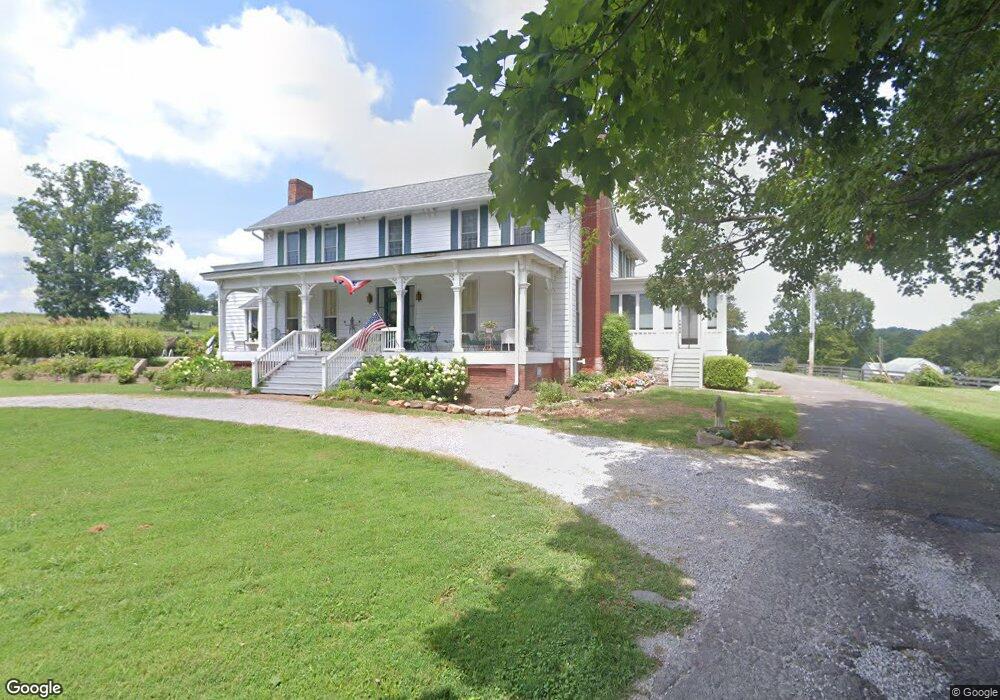
This home is located at 4160 Carr Rd, Adams, TN 37010 and is currently estimated at $1,788,156, approximately $448 per square foot. 4160 Carr Rd is a home located in Robertson County with nearby schools including Jo Byrns Elementary School and Jo Byrns High School.
Ownership History
Date
Name
Owned For
Owner Type
Purchase Details
Closed on
Aug 5, 2024
Sold by
Jones Norma L
Bought by
Russell Joseph Clint and Russell Julie Lynn
Current Estimated Value
Purchase Details
Closed on
Jun 21, 2021
Sold by
Jones Norma L
Bought by
Russell Joseph Clint and Russell Julie
Home Financials for this Owner
Home Financials are based on the most recent Mortgage that was taken out on this home.
Original Mortgage
$112,967
Interest Rate
2.9%
Mortgage Type
Purchase Money Mortgage
Purchase Details
Closed on
May 17, 2017
Sold by
Jones Andrew B and Jones Norma L
Bought by
Converse Jerome M
Purchase Details
Closed on
Sep 24, 1998
Sold by
Jones Andrew B
Bought by
Jones Andrew B
Purchase Details
Closed on
Jun 25, 1955
Bought by
Jones Andrew B
Create a Home Valuation Report for This Property
The Home Valuation Report is an in-depth analysis detailing your home's value as well as a comparison with similar homes in the area
Home Values in the Area
Average Home Value in this Area
Purchase History
| Date | Buyer | Sale Price | Title Company |
|---|---|---|---|
| Russell Joseph Clint | -- | None Listed On Document | |
| Russell Joseph Clint | -- | None Listed On Document | |
| Dorris Jody A | -- | None Listed On Document | |
| Russell Joseph Clint | $85,000 | None Available | |
| Converse Jerome M | -- | None Available | |
| Jones Andrew B | -- | -- | |
| Jones Andrew B | -- | -- |
Source: Public Records
Mortgage History
| Date | Status | Borrower | Loan Amount |
|---|---|---|---|
| Previous Owner | Russell Joseph Clint | $112,967 |
Source: Public Records
Tax History Compared to Growth
Tax History
| Year | Tax Paid | Tax Assessment Tax Assessment Total Assessment is a certain percentage of the fair market value that is determined by local assessors to be the total taxable value of land and additions on the property. | Land | Improvement |
|---|---|---|---|---|
| 2024 | $6,633 | $368,500 | $296,800 | $71,700 |
| 2023 | $6,633 | $368,500 | $296,800 | $71,700 |
| 2022 | $7,037 | $273,200 | $225,200 | $48,000 |
| 2021 | $7,516 | $273,200 | $225,200 | $48,000 |
| 2020 | $7,516 | $291,775 | $243,325 | $48,450 |
| 2019 | $7,516 | $291,775 | $243,325 | $48,450 |
| 2018 | $7,516 | $291,775 | $243,325 | $48,450 |
| 2017 | $6,991 | $226,625 | $186,900 | $39,725 |
| 2016 | $6,991 | $226,625 | $186,900 | $39,725 |
| 2015 | $6,708 | $226,625 | $186,900 | $39,725 |
| 2014 | $6,781 | $229,100 | $186,900 | $42,200 |
Source: Public Records
Map
Nearby Homes
- 2746 Kinneys Rd
- 0 Chester Rd
- 5849 Catholic Church Rd
- 3501 Ridge Rd
- 5845 Catholic Church Rd
- 102 S Main St
- 232 Railroad St
- 0 Us Highway 41
- 0 U S 41
- 3455 Kinneys Rd
- 0 Dunn Rd
- 2942 Ridge Rd
- 5016 Caney Sink Rd
- 3083 Mooneyhan Rd
- 5055 S Bell Cross Rd
- 1 Maxey Rd
- 2867 Jack Teasley Rd
- 5774 Henry Gower Rd
- 2856 Highway 76 W
- 1986 Route 76