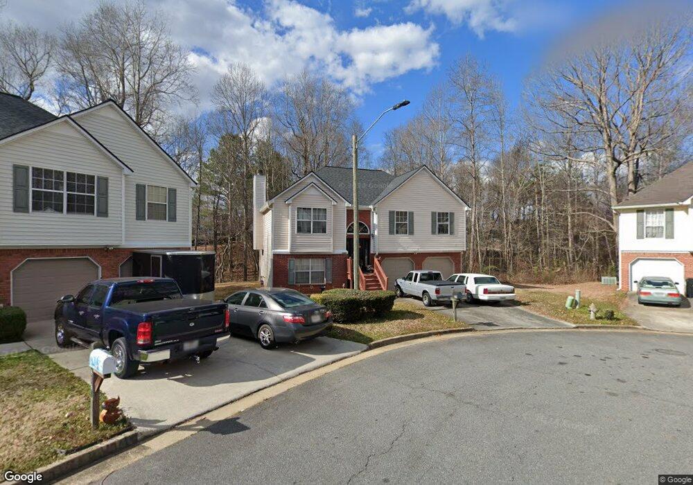
4164 Rhinehart Dr Unit 2 Austell, GA 30106
Estimated Value: $298,000 - $329,000
4
Beds
3
Baths
1,298
Sq Ft
$245/Sq Ft
Est. Value
About This Home
This home is located at 4164 Rhinehart Dr Unit 2, Austell, GA 30106 and is currently estimated at $317,835, approximately $244 per square foot. 4164 Rhinehart Dr Unit 2 is a home located in Cobb County with nearby schools including Deerwood Elementary School, Clarkdale Elementary School, and Garrett Middle School.
Ownership History
Date
Name
Owned For
Owner Type
Purchase Details
Closed on
Oct 13, 1999
Sold by
Palladium Homes Inc
Bought by
Simmons Michelle M and Simmons Justin
Current Estimated Value
Home Financials for this Owner
Home Financials are based on the most recent Mortgage that was taken out on this home.
Original Mortgage
$122,250
Outstanding Balance
$35,909
Interest Rate
7.7%
Mortgage Type
FHA
Estimated Equity
$281,926
Create a Home Valuation Report for This Property
The Home Valuation Report is an in-depth analysis detailing your home's value as well as a comparison with similar homes in the area
Home Values in the Area
Average Home Value in this Area
Purchase History
| Date | Buyer | Sale Price | Title Company |
|---|---|---|---|
| Simmons Michelle M | $122,400 | -- | |
| Palladium Homes Inc | $27,000 | -- |
Source: Public Records
Mortgage History
| Date | Status | Borrower | Loan Amount |
|---|---|---|---|
| Open | Palladium Homes Inc | $122,250 |
Source: Public Records
Tax History Compared to Growth
Tax History
| Year | Tax Paid | Tax Assessment Tax Assessment Total Assessment is a certain percentage of the fair market value that is determined by local assessors to be the total taxable value of land and additions on the property. | Land | Improvement |
|---|---|---|---|---|
| 2025 | $698 | $118,448 | $14,000 | $104,448 |
| 2024 | $701 | $118,448 | $14,000 | $104,448 |
| 2023 | $494 | $118,448 | $14,000 | $104,448 |
| 2022 | $663 | $105,840 | $14,000 | $91,840 |
| 2021 | $575 | $76,584 | $14,000 | $62,584 |
| 2020 | $1,684 | $69,732 | $14,000 | $55,732 |
| 2019 | $1,361 | $54,996 | $12,000 | $42,996 |
| 2018 | $1,361 | $54,996 | $12,000 | $42,996 |
| 2017 | $1,062 | $45,872 | $6,000 | $39,872 |
| 2016 | $1,063 | $45,872 | $6,000 | $39,872 |
| 2015 | $549 | $27,468 | $6,000 | $21,468 |
| 2014 | $554 | $27,468 | $0 | $0 |
Source: Public Records
Map
Nearby Homes
- 4192 Rhinehart Dr
- 4287 Keats Ct
- 2013 Chesley Dr
- 2085 Lenoa Ln
- 2083 Lenoa Ln
- 2081 Lenoa Ln
- 4420 Pink Rose Ct
- 4349 Kousa Rd Unit 4
- 2034 Drennon Ave
- 2300 Anderson Mill Rd
- 2072 Mcduffie Rd
- 3755 Mulkey Cir SW
- 4470 Austell Rd
- 2110 Plum Ln
- 2058 Mulkey Rd SW
- 4390 Chelou Dr
- 3782 Mulkey Cir SW Unit 18
- 3782 Mulkey Cir SW
- 2402 Greenside Ct
- 4168 Rhinehart Dr Unit 2
- 4165 Rhinehart Dr Unit 2
- 4172 Rhinehart Dr
- 4172 Rhinehart D
- 4169 Rhinehart Dr
- 4173 Rhinehart Dr
- 4177 Rhinehart Dr Unit 2
- 4176 Rhinehart Dr
- 4181 Rhinehart Dr
- 4180 Rhinehart Dr Unit 933
- 4180 Rhinehart Dr
- 4180 Rhinehart Dr Unit II
- 4006 Rhinehart Ct Unit II
- 4010 Rhinehart Ct
- 4185 Rhinehart Dr Unit 2
- 4002 Rhinehart Ct
- 4184 Rhinehart Dr
- 0 Rhinehart Dr & Rhinehart Rd Ga (Id 826)
- 4014 Rhinehart Ct Unit 2
- 4189 Rhinehart Dr Unit 2