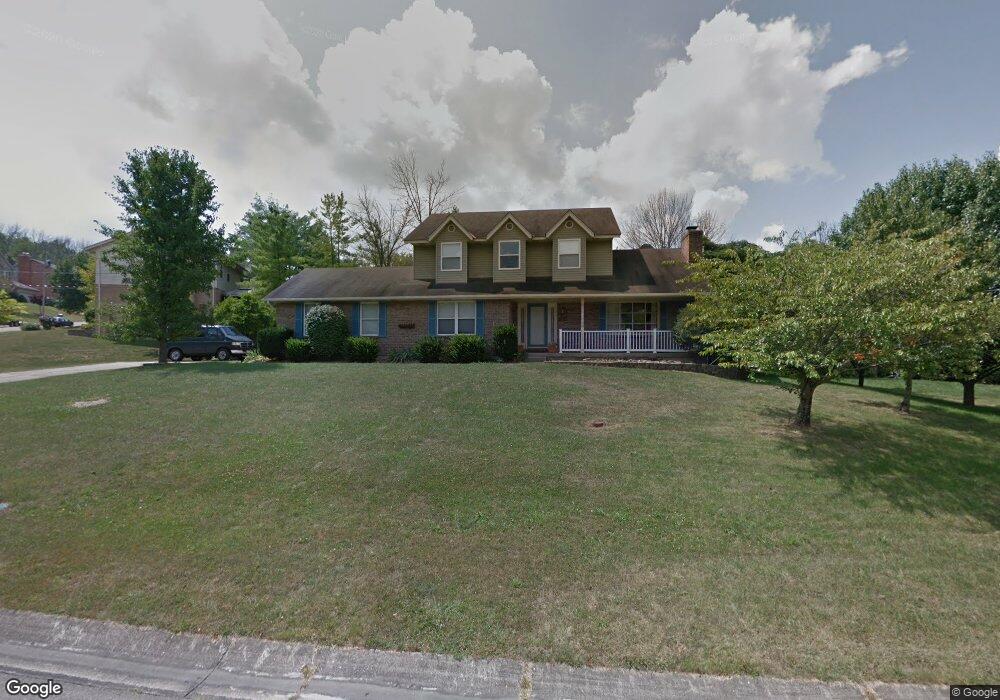
4167 Bennett Dr Fairfield, OH 45011
Estimated Value: $378,000 - $424,100
3
Beds
4
Baths
2,196
Sq Ft
$184/Sq Ft
Est. Value
About This Home
This home is located at 4167 Bennett Dr, Fairfield, OH 45011 and is currently estimated at $404,775, approximately $184 per square foot. 4167 Bennett Dr is a home located in Butler County with nearby schools including Compass Elementary School, Creekside Middle School, and Fairfield Senior High School.
Ownership History
Date
Name
Owned For
Owner Type
Purchase Details
Closed on
Sep 30, 2004
Sold by
Fisher John K and Fisher Mary Ann
Bought by
Kane Kristopher A
Current Estimated Value
Home Financials for this Owner
Home Financials are based on the most recent Mortgage that was taken out on this home.
Original Mortgage
$156,000
Outstanding Balance
$75,696
Interest Rate
5.89%
Mortgage Type
Purchase Money Mortgage
Estimated Equity
$329,079
Purchase Details
Closed on
Oct 1, 1991
Purchase Details
Closed on
May 1, 1991
Create a Home Valuation Report for This Property
The Home Valuation Report is an in-depth analysis detailing your home's value as well as a comparison with similar homes in the area
Home Values in the Area
Average Home Value in this Area
Purchase History
| Date | Buyer | Sale Price | Title Company |
|---|---|---|---|
| Kane Kristopher A | $195,000 | -- | |
| -- | $139,900 | -- | |
| -- | $22,500 | -- |
Source: Public Records
Mortgage History
| Date | Status | Borrower | Loan Amount |
|---|---|---|---|
| Open | Kane Kristopher A | $156,000 |
Source: Public Records
Tax History
| Year | Tax Paid | Tax Assessment Tax Assessment Total Assessment is a certain percentage of the fair market value that is determined by local assessors to be the total taxable value of land and additions on the property. | Land | Improvement |
|---|---|---|---|---|
| 2025 | $4,822 | $127,000 | $13,350 | $113,650 |
| 2024 | $4,822 | $127,000 | $13,350 | $113,650 |
| 2023 | $4,781 | $124,780 | $13,350 | $111,430 |
| 2022 | $4,430 | $85,760 | $13,350 | $72,410 |
| 2021 | $3,931 | $81,660 | $13,350 | $68,310 |
| 2020 | $4,073 | $81,660 | $13,350 | $68,310 |
| 2019 | $6,390 | $67,990 | $14,000 | $53,990 |
| 2018 | $3,864 | $67,990 | $14,000 | $53,990 |
| 2017 | $3,898 | $67,990 | $14,000 | $53,990 |
| 2016 | $3,815 | $63,050 | $14,000 | $49,050 |
| 2015 | $3,802 | $63,050 | $14,000 | $49,050 |
| 2014 | $3,300 | $63,050 | $14,000 | $49,050 |
| 2013 | $3,300 | $60,750 | $14,000 | $46,750 |
Source: Public Records
Map
Nearby Homes
- 4058 Schroeder Dr
- 4401 E Observatory
- 4257 Primary Colors
- 4210 Tylers Estates Dr
- 4224 College Dictionary
- 4387 Tylers Estates Dr
- 7531 Tylers Hill Ct
- 7611 Tylers Hill Ct
- 3835 Schroeder Dr
- 4217 W Arbor Terrace
- 895 Millers Run Ct
- 3798 Riverdowns Ct
- 8400 S Port Dr
- 7267 Clawson Ct
- 4332 R E Smith Dr
- 7210 Keltner Dr
- 4212 R E Smith Dr
- 8018 Jeannes Creek Ln
- 7991 Pinnacle Point Dr
- 7909 Pinnacle Point Dr
- 4177 Bennett Dr
- 4187 Bennett Dr
- 4152 Weiser Ct
- 4164 Bennett Dr
- 4147 Bennett Dr
- 4160 Bennett Dr
- 4176 Bennett Dr
- 4168 Bennett Dr
- 4197 Bennett Dr
- 4161 Weiser Ct
- 4174 Bennett Dr
- 4150 Bennett Dr
- 4180 Bennett Dr
- 4142 Weiser Ct
- 4190 Bennett Dr
- 4139 Bennett Dr
- 4207 Bennett Dr
- 4140 Bennett Dr
- 4170 Bennett Dr
- 4132 Weiser Ct
Your Personal Tour Guide
Ask me questions while you tour the home.