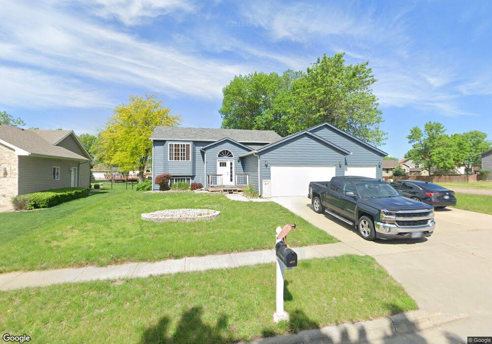
417 N Whitni Ln Sioux Falls, SD 57107
Northwest Sioux Falls NeighborhoodEstimated Value: $352,119 - $401,000
4
Beds
3
Baths
2,452
Sq Ft
$155/Sq Ft
Est. Value
About This Home
This home is located at 417 N Whitni Ln, Sioux Falls, SD 57107 and is currently estimated at $379,280, approximately $154 per square foot. 417 N Whitni Ln is a home located in Minnehaha County with nearby schools including Hayward Elementary School, George McGovern Middle School, and Jefferson High School - 67.
Ownership History
Date
Name
Owned For
Owner Type
Purchase Details
Closed on
Aug 18, 2023
Sold by
O'Hara Tiffany and Luond Tiffany
Bought by
Lib Properties Llc
Current Estimated Value
Purchase Details
Closed on
Feb 3, 2014
Sold by
Craig E Craig E and Baysinger Lisa A
Bought by
Luond Tiffany
Home Financials for this Owner
Home Financials are based on the most recent Mortgage that was taken out on this home.
Original Mortgage
$152,192
Interest Rate
4.4%
Mortgage Type
FHA
Create a Home Valuation Report for This Property
The Home Valuation Report is an in-depth analysis detailing your home's value as well as a comparison with similar homes in the area
Home Values in the Area
Average Home Value in this Area
Purchase History
| Date | Buyer | Sale Price | Title Company |
|---|---|---|---|
| Lib Properties Llc | $366,000 | Getty Abstract & Title Co | |
| Lib Properties Llc | $366,000 | Getty Abstract & Title Co | |
| Luond Tiffany | $155,000 | -- |
Source: Public Records
Mortgage History
| Date | Status | Borrower | Loan Amount |
|---|---|---|---|
| Previous Owner | Luond Tiffany | $152,192 |
Source: Public Records
Tax History Compared to Growth
Tax History
| Year | Tax Paid | Tax Assessment Tax Assessment Total Assessment is a certain percentage of the fair market value that is determined by local assessors to be the total taxable value of land and additions on the property. | Land | Improvement |
|---|---|---|---|---|
| 2024 | $5,361 | $319,700 | $32,400 | $287,300 |
| 2023 | $3,943 | $277,200 | $32,400 | $244,800 |
| 2022 | $3,064 | $200,900 | $32,400 | $168,500 |
| 2021 | $3,165 | $197,600 | $0 | $0 |
| 2020 | $3,165 | $200,200 | $0 | $0 |
| 2019 | $3,057 | $189,791 | $0 | $0 |
| 2018 | $2,680 | $179,557 | $0 | $0 |
| 2017 | $2,638 | $166,451 | $32,449 | $134,002 |
| 2016 | $2,638 | $164,015 | $32,449 | $131,566 |
| 2015 | $2,640 | $157,923 | $32,448 | $125,475 |
| 2014 | $2,578 | $155,801 | $29,592 | $126,209 |
Source: Public Records
Map
Nearby Homes
- 413 N Whitni Ln
- 409 N Whitni Ln
- 7205 W Songbird St
- 7105 W Songbird St
- 412 N Whitni Ln
- 501 N Whitni Ave
- 501 N Whitni Ln
- 405 N Whitni Ln
- 408 N Dominic Ave
- 408 N Whitni Ln
- 500 N Dominic Ave
- 500 N Whitni Ave
- 500 N Whitni Ave Ave
- 404 N Dominic Ave
- 505 N Whitni Ave
- 505 N Whitni Ln
- 404 N Whitni Ln
- 401 N Whitni Ln
- 7101 W 5th Place
- 7101 W Songbird St