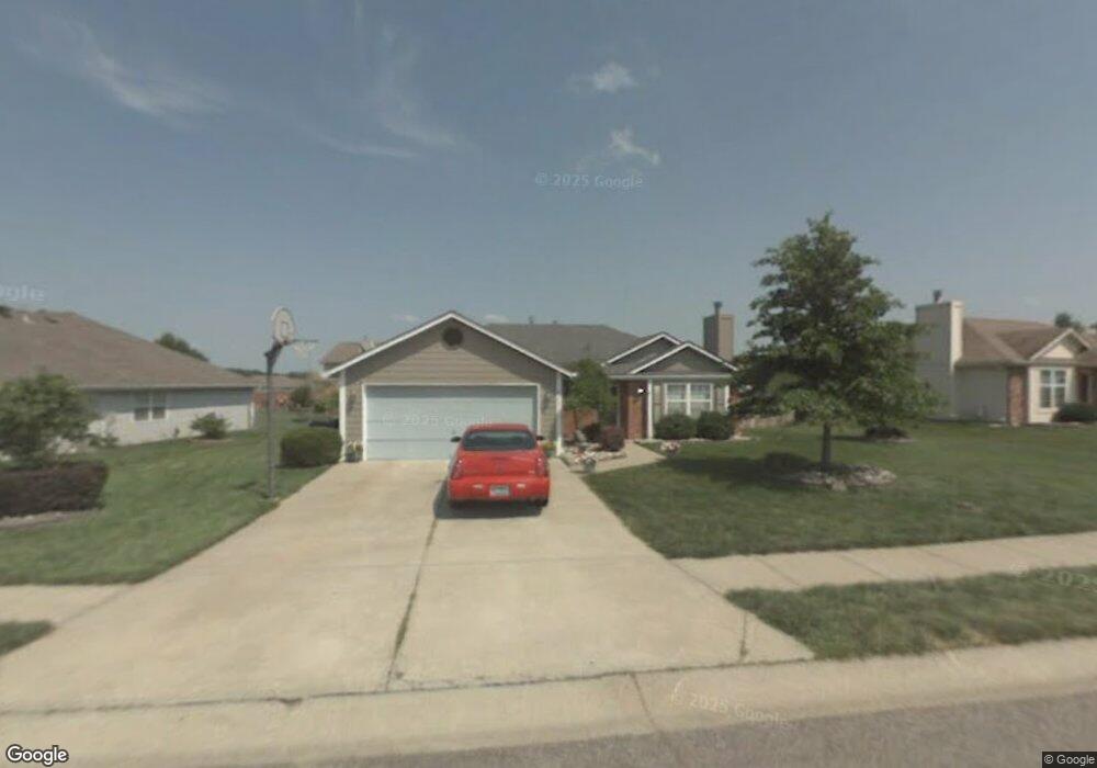
417 SW Hamilton Ln Grain Valley, MO 64029
Estimated Value: $277,000 - $293,000
3
Beds
2
Baths
1,210
Sq Ft
$236/Sq Ft
Est. Value
About This Home
This home is located at 417 SW Hamilton Ln, Grain Valley, MO 64029 and is currently estimated at $285,314, approximately $235 per square foot. 417 SW Hamilton Ln is a home located in Jackson County with nearby schools including Grain Valley High School.
Ownership History
Date
Name
Owned For
Owner Type
Purchase Details
Closed on
Feb 24, 2004
Sold by
Ried Raye F and Ried Yvonne
Bought by
Ried Raye F and Ried Yvonne
Current Estimated Value
Purchase Details
Closed on
Feb 8, 1996
Sold by
Westfall Dennis L and Westfall Anne M
Bought by
Ried Raye F
Home Financials for this Owner
Home Financials are based on the most recent Mortgage that was taken out on this home.
Original Mortgage
$75,665
Outstanding Balance
$2,493
Interest Rate
7.08%
Mortgage Type
FHA
Estimated Equity
$282,821
Create a Home Valuation Report for This Property
The Home Valuation Report is an in-depth analysis detailing your home's value as well as a comparison with similar homes in the area
Home Values in the Area
Average Home Value in this Area
Purchase History
| Date | Buyer | Sale Price | Title Company |
|---|---|---|---|
| Ried Raye F | -- | Commonwealth Title | |
| Ried Raye F | -- | Old Republic Title Company |
Source: Public Records
Mortgage History
| Date | Status | Borrower | Loan Amount |
|---|---|---|---|
| Open | Ried Raye F | $75,665 |
Source: Public Records
Tax History Compared to Growth
Tax History
| Year | Tax Paid | Tax Assessment Tax Assessment Total Assessment is a certain percentage of the fair market value that is determined by local assessors to be the total taxable value of land and additions on the property. | Land | Improvement |
|---|---|---|---|---|
| 2025 | $2,990 | $33,921 | $7,919 | $26,002 |
| 2024 | $2,990 | $36,298 | $5,001 | $31,297 |
| 2023 | $2,878 | $36,298 | $5,719 | $30,579 |
| 2022 | $2,325 | $25,650 | $5,339 | $20,311 |
| 2021 | $2,271 | $25,650 | $5,339 | $20,311 |
| 2020 | $2,307 | $25,701 | $5,339 | $20,362 |
| 2019 | $2,260 | $25,701 | $5,339 | $20,362 |
| 2018 | $910,975 | $22,002 | $2,761 | $19,241 |
| 2017 | $1,998 | $22,002 | $2,761 | $19,241 |
| 2016 | $1,998 | $21,240 | $2,956 | $18,284 |
| 2014 | $1,973 | $20,824 | $2,898 | $17,926 |
Source: Public Records
Map
Nearby Homes
- 509 SW Joseph Ct
- 1024 Christie Ln
- 1418 SW Blue Branch Dr
- 401 S Minter Rd
- 1215 SW Lone Star Ct
- 636 SW Lakeview Dr
- 1214 SW Windcrest Ct
- 1219 SW Windcrest Ct
- 719 S Minter Rd
- 200 Cross Creek Ln
- 1309 SW Graystone Cir
- 209 SW Cross Creek Dr
- 714 SW Brome Dr
- 725 SW Tisha Ln
- 1203 SW Lakeview Dr
- 207 Pebblebrook St
- 1402 NW Broadway Throughway
- 640 SW Crestview Dr
- 1200 SW Foxtail Dr
- 913 SW Abar Dr
- 415 SW Hamilton Ln
- 419 SW Hamilton Ln
- 420 SW Montana Ridge Dr
- 413 SW Hamilton Ln
- 416 SW Montana Ridge Dr
- 422 SW Montana Ridge Dr
- 1221 SW Duster Ct
- 412 SW Hamilton Ln
- 410 SW Hamilton Ln
- 420 SW Hamilton Ln
- 424 SW Montana Ridge Dr
- 423 SW Hamilton Ln
- 422 SW Hamilton Ln
- 417 SW Montana Ridge Dr
- 421 SW Montana Ridge Dr
- 426 SW Montana Ridge Dr
- 1223 SW Duster Ct
- 425 SW Hamilton Ln
- 1222 SW Duster Ct
- 1141 SW Ephraim Dr