Estimated Value: $380,950 - $479,000
--
Bed
3
Baths
2,745
Sq Ft
$153/Sq Ft
Est. Value
About This Home
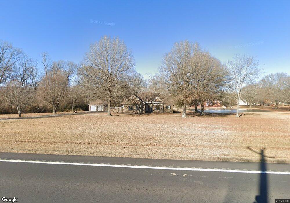
This home is located at 4170 Highway 38, Ward, AR 72176 and is currently estimated at $421,238, approximately $153 per square foot. 4170 Highway 38 is a home located in Lonoke County with nearby schools including Eastside Elementary School, Cabot Middle School North, and Cabot Junior High North.
Ownership History
Date
Name
Owned For
Owner Type
Purchase Details
Closed on
Feb 27, 2018
Sold by
Releford Mia B and Releford Keith C
Bought by
Graves Bradley and Graves Shelby
Current Estimated Value
Home Financials for this Owner
Home Financials are based on the most recent Mortgage that was taken out on this home.
Original Mortgage
$206,400
Outstanding Balance
$173,934
Interest Rate
4.22%
Mortgage Type
New Conventional
Estimated Equity
$247,304
Purchase Details
Closed on
Jan 31, 2006
Bought by
Magg Inc
Purchase Details
Closed on
Sep 1, 2004
Bought by
Releford and Releford Wf
Purchase Details
Closed on
Aug 26, 2004
Bought by
Releford and Releford Wf
Purchase Details
Closed on
Jan 26, 1996
Bought by
Peter Farmer Qc
Purchase Details
Closed on
Aug 16, 1995
Bought by
Farmer
Create a Home Valuation Report for This Property
The Home Valuation Report is an in-depth analysis detailing your home's value as well as a comparison with similar homes in the area
Home Values in the Area
Average Home Value in this Area
Purchase History
| Date | Buyer | Sale Price | Title Company |
|---|---|---|---|
| Graves Bradley | -- | Lenders Title | |
| Magg Inc | -- | -- | |
| Releford | $240,000 | -- | |
| Releford | $240,000 | -- | |
| Peter Farmer Qc | -- | -- | |
| Farmer | $166,000 | -- |
Source: Public Records
Mortgage History
| Date | Status | Borrower | Loan Amount |
|---|---|---|---|
| Open | Graves Bradley | $206,400 |
Source: Public Records
Tax History Compared to Growth
Tax History
| Year | Tax Paid | Tax Assessment Tax Assessment Total Assessment is a certain percentage of the fair market value that is determined by local assessors to be the total taxable value of land and additions on the property. | Land | Improvement |
|---|---|---|---|---|
| 2025 | $2,049 | $53,910 | $7,200 | $46,710 |
| 2024 | $2,049 | $53,910 | $7,200 | $46,710 |
| 2023 | $2,049 | $53,910 | $7,200 | $46,710 |
| 2022 | $2,099 | $53,910 | $7,200 | $46,710 |
| 2021 | $2,083 | $53,910 | $7,200 | $46,710 |
| 2020 | $1,966 | $51,010 | $7,200 | $43,810 |
| 2019 | $1,966 | $51,010 | $7,200 | $43,810 |
| 2018 | $1,991 | $51,010 | $7,200 | $43,810 |
| 2017 | $2,098 | $51,010 | $7,200 | $43,810 |
| 2016 | $1,921 | $51,010 | $7,200 | $43,810 |
| 2015 | $1,813 | $47,120 | $7,200 | $39,920 |
| 2014 | $1,813 | $47,120 | $7,200 | $39,920 |
Source: Public Records
Map
Nearby Homes
- 8 Shady Grove Cove
- 19 Bryson Dr
- 17 Jacob Cove
- 6 Moon Rd
- 2 Moon Rd
- 1 Moon Rd
- 716 Moon Rd
- 39 Bryson Dr
- 31 Oakland Cir
- 64 Lisa Marie Cove
- 69 Smarty Jones Cir
- 271 Trailwood Dr
- 000 Hwy 38
- 21 Crescent Cove
- 11 Crescent Cove
- 23 Libra Ln
- 50 Crescent Cove
- 1175 Stagecoach Blvd
- 1167 Stagecoach Blvd
- 1159 Stagecoach Blvd