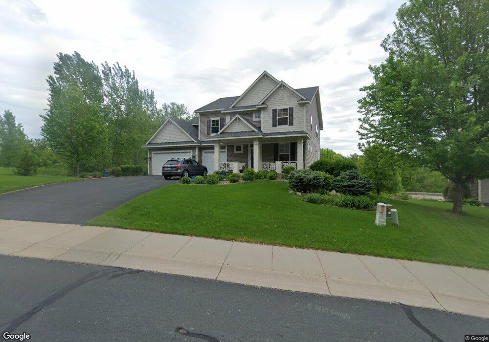
4170 Maple Hurst Dr N Rockford, MN 55373
Estimated Value: $534,000 - $613,000
4
Beds
3
Baths
2,936
Sq Ft
$198/Sq Ft
Est. Value
About This Home
This home is located at 4170 Maple Hurst Dr N, Rockford, MN 55373 and is currently estimated at $581,228, approximately $197 per square foot. 4170 Maple Hurst Dr N is a home located in Wright County with nearby schools including Rockford Elementary Arts Magnet School, Rockford Middle School - Center for Environmental Studies, and Rockford High School.
Ownership History
Date
Name
Owned For
Owner Type
Purchase Details
Closed on
Aug 19, 2020
Sold by
Mitchell Brian S and Mitchell Bernadette R
Bought by
Rice Tiffany and Rice Peter
Current Estimated Value
Purchase Details
Closed on
Sep 21, 2017
Sold by
Denneson Travis J and Denneson Amy B
Bought by
Mitchell Brian R and Mitchell Bernadette S
Purchase Details
Closed on
Feb 19, 2009
Sold by
U S Home Corp
Bought by
Schelper Roger W and Schelper Sandra Jean Moser
Purchase Details
Closed on
Dec 22, 2006
Sold by
Dauel A Fare Development Corp
Bought by
Us Home Corp
Create a Home Valuation Report for This Property
The Home Valuation Report is an in-depth analysis detailing your home's value as well as a comparison with similar homes in the area
Home Values in the Area
Average Home Value in this Area
Purchase History
| Date | Buyer | Sale Price | Title Company |
|---|---|---|---|
| Rice Tiffany | $425,951 | Trademark Title Services Inc | |
| Mitchell Brian R | $394,900 | Multiple | |
| Schelper Roger W | $370,000 | -- | |
| Us Home Corp | $2,592,000 | -- |
Source: Public Records
Tax History Compared to Growth
Tax History
| Year | Tax Paid | Tax Assessment Tax Assessment Total Assessment is a certain percentage of the fair market value that is determined by local assessors to be the total taxable value of land and additions on the property. | Land | Improvement |
|---|---|---|---|---|
| 2025 | $6,318 | $524,400 | $90,000 | $434,400 |
| 2024 | $6,002 | $521,400 | $90,000 | $431,400 |
| 2023 | $6,022 | $526,400 | $90,000 | $436,400 |
| 2022 | $5,972 | $476,200 | $85,000 | $391,200 |
| 2021 | $6,146 | $418,800 | $70,000 | $348,800 |
| 2020 | $6,384 | $421,500 | $70,000 | $351,500 |
| 2019 | $6,444 | $410,900 | $0 | $0 |
| 2018 | $5,606 | $399,500 | $0 | $0 |
| 2017 | $5,270 | $372,800 | $0 | $0 |
| 2016 | $5,116 | $0 | $0 | $0 |
| 2015 | $5,158 | $0 | $0 | $0 |
| 2014 | -- | $0 | $0 | $0 |
Source: Public Records
Map
Nearby Homes
- 4231 Maple Hurst Dr N
- XXX Jansen Ave SE
- 4090 Maple Hurst Dr S
- 4040 Maple Hurst Dr S
- 8530 Fir St
- 7021 Meadow Ct
- 6761 Maple Dr
- 6630 Maple Dr
- 8130 Ravenrock Rd
- 8800 86th Ave N
- 8098 26th St SE
- 8041 Prairie Trail
- 3439 Hall Ave SE
- 7040 Winfield Rd
- 6101 Boulder Ridge Dr
- The Madison Plan at Kettering Creek - Kettering Creek Villas
- The Windsor Villa Plan at Kettering Creek - Kettering Creek Villas
- The Windsor Plan at Kettering Creek - Kettering Creek Villas
- The Madison Villa Plan at Kettering Creek - Kettering Creek Villas
- The Augusta Plan at Kettering Creek - Kettering Creek Villas
- 4170 Maple Hurst Dr Dr N
- 4170 4170 Maple Hurst Dr N
- 4160 Maple Hurst Dr N
- 4160 Maple Hurst Dr N
- 4171 Maple Hurst Dr N
- 4171 4171 Maple Hurst-Drive-n
- 4171 4171 Maple Hurst Dr N
- 3007 Red Maple Ct
- 3007 3007 Red Maple Ct N
- 3007 Red Maple Ct N
- 4180 4180 Maple Hurst Dr N
- 4180 4180 Maple Hurst-Drive-n
- 4180 Maple Hurst Dr N
- 3009 Red Maple Ct
- 3009 3009 Red Maple Ct N
- 3009 3009 Red Maple-Court-n
- 4181 4181 Maple Hurst-Drive-n
- 4181 4181 Maple Hurst Dr N
- 4181 Maple Hurst Dr N
- 3009 Red Maple Ct N