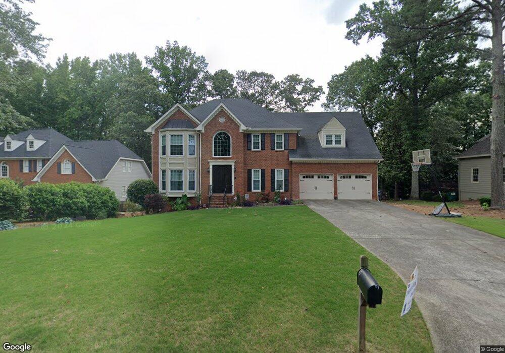
4171 Summit Way Unit 21 Marietta, GA 30066
Sandy Plains NeighborhoodEstimated Value: $784,783 - $907,000
5
Beds
5
Baths
5,059
Sq Ft
$163/Sq Ft
Est. Value
About This Home
This home is located at 4171 Summit Way Unit 21, Marietta, GA 30066 and is currently estimated at $822,446, approximately $162 per square foot. 4171 Summit Way Unit 21 is a home located in Cobb County with nearby schools including Davis Elementary School, Mabry Middle School, and Lassiter High School.
Ownership History
Date
Name
Owned For
Owner Type
Purchase Details
Closed on
Jun 2, 2020
Sold by
Daho John and Daho Mary
Bought by
Daho John and Daho Mary
Current Estimated Value
Purchase Details
Closed on
May 18, 2018
Sold by
Fletcher Carl L
Bought by
Daho John and Daho Mary
Home Financials for this Owner
Home Financials are based on the most recent Mortgage that was taken out on this home.
Original Mortgage
$425,000
Outstanding Balance
$365,153
Interest Rate
4.4%
Mortgage Type
New Conventional
Estimated Equity
$457,293
Purchase Details
Closed on
Jan 28, 1999
Sold by
Sce Joseph S and Sce Pamela P
Bought by
Burke Edward F and Burke Nora J
Home Financials for this Owner
Home Financials are based on the most recent Mortgage that was taken out on this home.
Original Mortgage
$208,800
Interest Rate
6.8%
Mortgage Type
New Conventional
Create a Home Valuation Report for This Property
The Home Valuation Report is an in-depth analysis detailing your home's value as well as a comparison with similar homes in the area
Home Values in the Area
Average Home Value in this Area
Purchase History
| Date | Buyer | Sale Price | Title Company |
|---|---|---|---|
| Daho John | -- | None Available | |
| Daho John | $475,000 | -- | |
| Burke Edward F | $261,000 | -- |
Source: Public Records
Mortgage History
| Date | Status | Borrower | Loan Amount |
|---|---|---|---|
| Open | Daho John | $425,000 | |
| Previous Owner | Burke Edward F | $208,800 |
Source: Public Records
Tax History Compared to Growth
Tax History
| Year | Tax Paid | Tax Assessment Tax Assessment Total Assessment is a certain percentage of the fair market value that is determined by local assessors to be the total taxable value of land and additions on the property. | Land | Improvement |
|---|---|---|---|---|
| 2025 | $6,841 | $260,564 | $50,000 | $210,564 |
| 2024 | $6,847 | $260,564 | $50,000 | $210,564 |
| 2023 | $5,077 | $204,008 | $38,000 | $166,008 |
| 2022 | $5,659 | $204,008 | $38,000 | $166,008 |
| 2021 | $4,988 | $173,348 | $38,000 | $135,348 |
| 2020 | $4,988 | $173,348 | $38,000 | $135,348 |
| 2019 | $4,988 | $173,348 | $38,000 | $135,348 |
| 2018 | $4,312 | $173,348 | $38,000 | $135,348 |
| 2017 | $3,543 | $144,012 | $38,000 | $106,012 |
| 2016 | $3,549 | $144,012 | $38,000 | $106,012 |
| 2015 | $3,305 | $129,776 | $37,240 | $92,536 |
| 2014 | $3,328 | $129,776 | $0 | $0 |
Source: Public Records
Map
Nearby Homes
- 3130 Maley Ct
- 4259 Arbor Club Dr
- 3333 Devaughn Dr NE
- 2713 Arbor Summit
- 4397 Windsor Oaks Cir
- 3798 Upland Dr
- 3043 Sawyer Trace NE
- 2696 S Arbor Dr
- 3901 Hazelhurst Dr
- 3350 Brookhill Cir
- 2855 Lamer Trace
- 3147 Swallow Dr NE
- 4464 Windsor Oaks Dr
- 3238 Mountain Hollow Dr
- 4302 Highborne Dr NE Unit 3
- 4563 Ashmore Cir NE
- 3851 Timber Hollow Way
- 2578 Middle Coray Cir
- 4219 N Mountain Rd NE
- 4171 Summit Way
- 4173 Summit Way
- 4169 Summit Way
- 4194 Parish Dr
- 4196 Parish Dr
- 4192 Parish Dr
- 4175 Summit Way
- 4176 Summit Way
- 4165 Summit Way
- 4174 Summit Way
- 4198 Parish Dr Unit 25
- 4198 Parish Dr
- 4178 Summit Way
- 0 Parish Dr Unit 7510750
- 0 Parish Dr Unit 7458629
- 0 Parish Dr Unit 8013460
- 0 Parish Dr Unit 8421201
- 4190 Parish Dr
- 4172 Summit Way
- 4177 Summit Way