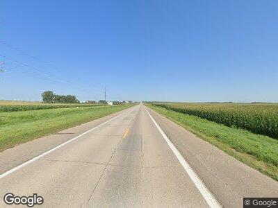
41720 Highway 20 Brothers, OR 97712
Estimated Value: $1,595,000
--
Bed
--
Bath
32,400
Sq Ft
$49/Sq Ft
Est. Value
About This Home
This home is located at 41720 Highway 20, Brothers, OR 97712 and is currently estimated at $1,595,000, approximately $49 per square foot. 41720 Highway 20 is a home with nearby schools including Crooked River Elementary School, Crook County Middle School, and Crook County High School.
Ownership History
Date
Name
Owned For
Owner Type
Purchase Details
Closed on
Apr 6, 2022
Sold by
Roth Stephen F
Bought by
Osullivan Land Holdings Llc
Current Estimated Value
Home Financials for this Owner
Home Financials are based on the most recent Mortgage that was taken out on this home.
Original Mortgage
$3,115,000
Outstanding Balance
$2,966,193
Interest Rate
4.67%
Mortgage Type
New Conventional
Purchase Details
Closed on
Nov 8, 2021
Sold by
Roth Stephen and Roth Clancy
Bought by
Ritchie Brothers Investments Llc
Purchase Details
Closed on
Nov 4, 2021
Sold by
Bar Dr Land & Cattle Llc
Bought by
Roth Stephen F and Roth Clancy R
Create a Home Valuation Report for This Property
The Home Valuation Report is an in-depth analysis detailing your home's value as well as a comparison with similar homes in the area
Home Values in the Area
Average Home Value in this Area
Purchase History
| Date | Buyer | Sale Price | Title Company |
|---|---|---|---|
| Osullivan Land Holdings Llc | $4,100,000 | Western Title | |
| Ritchie Brothers Investments Llc | $8,200,000 | Amerititle | |
| Roth Stephen F | -- | Amerititle |
Source: Public Records
Mortgage History
| Date | Status | Borrower | Loan Amount |
|---|---|---|---|
| Open | Osullivan Land Holdings Llc | $3,115,000 |
Source: Public Records
Tax History Compared to Growth
Tax History
| Year | Tax Paid | Tax Assessment Tax Assessment Total Assessment is a certain percentage of the fair market value that is determined by local assessors to be the total taxable value of land and additions on the property. | Land | Improvement |
|---|---|---|---|---|
| 2024 | $4,765 | $410,584 | -- | -- |
| 2023 | $4,636 | $402,114 | $0 | $0 |
| 2022 | $4,260 | $400,611 | $0 | $0 |
| 2021 | $4,608 | $392,861 | $0 | $0 |
| 2020 | $4,363 | $392,861 | $0 | $0 |
| 2019 | $1,839 | $166,781 | $0 | $0 |
| 2018 | $1,835 | $165,841 | $0 | $0 |
| 2017 | $1,842 | $164,931 | $0 | $0 |
| 2016 | $1,856 | $163,621 | $0 | $0 |
| 2015 | $1,808 | $162,113 | $0 | $0 |
| 2014 | $1,752 | $160,456 | $0 | $0 |
Source: Public Records
Map
Nearby Homes
- 502 Benjamin Lake Rd
- 0 Browns Valley Rd Unit 3007474
- 0 Browns Valley Rd Unit TL 1402 616193832
- 0 Browns Valley Rd Unit TL 1402 220196221
- 0 Browns Valley Rd Unit 3007473
- 0 Browns Valley Rd Unit TL1403 220717362
- 0 Browns Valley Rd Unit TL 1403 220196218
- TL 1402 Browns Valley Rd
- TL 1403 Browns Valley Rd
- 0 Undetermined Unit 123826955
- 31920 Merrill Rd
- 0 Hwy 20 Unit 3007490
- 0 Hwy 20 Unit TL 300 116657840
- 0 Hwy 20 Unit TL 300 220196591
- 0 Hwy 20 Unit 3007265
- 0 Hwy 20 Unit TL - 400 220180474
- 0 Hwy 20 Unit 400 24316776
- 0 Rd
- TL 300 U S 20
- 41645 U S 20
