4174 Watson Rd Unionville, IN 47468
Estimated Value: $277,000 - $534,000
3
Beds
2
Baths
1,710
Sq Ft
$208/Sq Ft
Est. Value
About This Home
This home is located at 4174 Watson Rd, Unionville, IN 47468 and is currently estimated at $356,261, approximately $208 per square foot. 4174 Watson Rd is a home located in Brown County with nearby schools including Brown County High School.
Ownership History
Date
Name
Owned For
Owner Type
Purchase Details
Closed on
May 23, 2024
Sold by
Mcgail Anthony and Day Amber
Bought by
Dunigan Shane
Current Estimated Value
Purchase Details
Closed on
Mar 27, 2020
Sold by
Ison Jill E and Ison Jim
Bought by
Mcgail Anthony
Create a Home Valuation Report for This Property
The Home Valuation Report is an in-depth analysis detailing your home's value as well as a comparison with similar homes in the area
Home Values in the Area
Average Home Value in this Area
Purchase History
| Date | Buyer | Sale Price | Title Company |
|---|---|---|---|
| Dunigan Shane | $335,000 | None Listed On Document | |
| Mcgail Anthony | $335,000 | None Listed On Document | |
| Mcgail Anthony | $163,000 | Security Title Services |
Source: Public Records
Mortgage History
| Date | Status | Borrower | Loan Amount |
|---|---|---|---|
| Previous Owner | Ison Margie A | $60,000 | |
| Previous Owner | Ison David L | $24,500 | |
| Previous Owner | Ison David L | $25,000 |
Source: Public Records
Tax History Compared to Growth
Tax History
| Year | Tax Paid | Tax Assessment Tax Assessment Total Assessment is a certain percentage of the fair market value that is determined by local assessors to be the total taxable value of land and additions on the property. | Land | Improvement |
|---|---|---|---|---|
| 2024 | $3,164 | $243,300 | $50,000 | $193,300 |
| 2023 | $2,751 | $191,000 | $15,000 | $176,000 |
| 2022 | $2,866 | $190,700 | $15,000 | $175,700 |
| 2021 | $2,262 | $168,800 | $12,500 | $156,300 |
| 2020 | $2,290 | $167,000 | $12,500 | $154,500 |
| 2019 | $694 | $155,300 | $12,500 | $142,800 |
| 2018 | $806 | $155,300 | $12,500 | $142,800 |
| 2017 | $745 | $154,900 | $12,500 | $142,400 |
| 2016 | $726 | $154,900 | $12,500 | $142,400 |
| 2014 | $333 | $155,700 | $12,500 | $143,200 |
| 2013 | $333 | $142,800 | $12,500 | $130,300 |
Source: Public Records
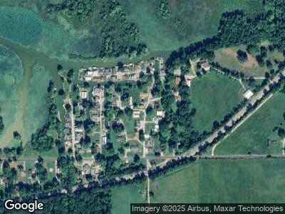
Map
Nearby Homes
- 4047 N Salmon Harbor Rd
- 4047 Salmon Harbor Rd
- 6517 Snug Harbour Ln
- 5374 State Road 45
- 5288 E Northshore Dr
- 7600 N Blue Heron Dr
- 4926 E Northshore Dr
- 7550 N Lakewood Dr
- 5194 Possum Trot Rd
- 9578 E State Road 45
- 5557 Lanam Ridge Rd
- 9550 E Northshore Dr
- 9548 E Northshore Dr
- 9504 E Northshore Dr
- 9494 E Northshore Dr
- 2558 Yellowwood Lake Rd
- 9235 Gray Ave
- 6900 N Richardson Rd
- 8847 E Northshore Dr
- 8899 E Southshore Dr