Estimated Value: $110,000 - $188,000
3
Beds
1
Bath
1,082
Sq Ft
$145/Sq Ft
Est. Value
About This Home
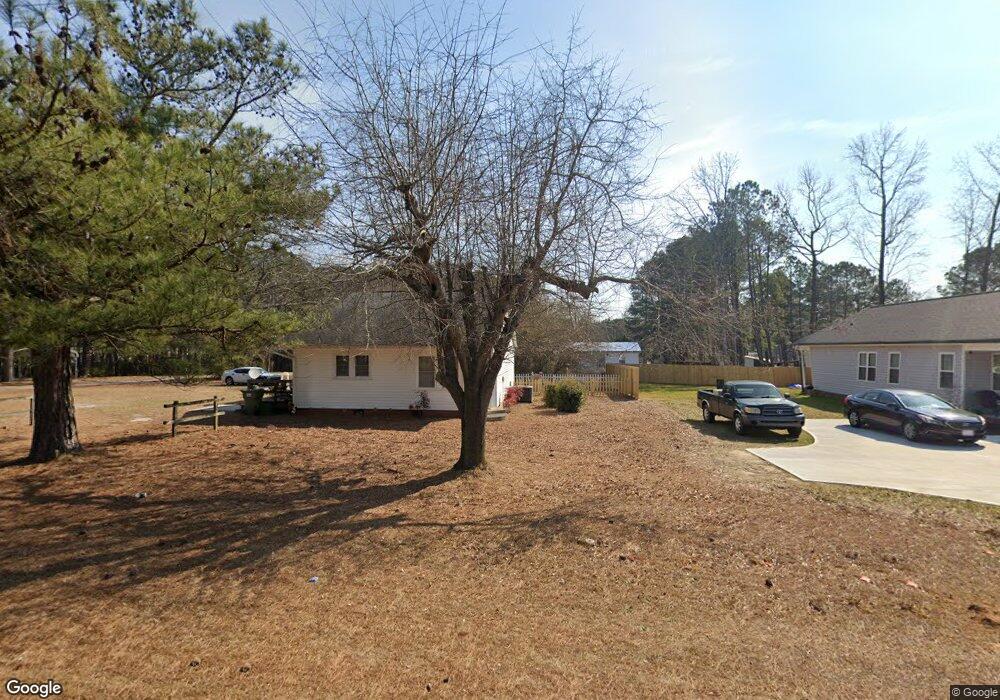
This home is located at 4177 Nc 55 E, Dunn, NC 28334 and is currently estimated at $156,522, approximately $144 per square foot. 4177 Nc 55 E is a home located in Harnett County with nearby schools including Erwin Elementary School, Coats-Erwin Middle School, and Triton High School.
Ownership History
Date
Name
Owned For
Owner Type
Purchase Details
Closed on
Mar 30, 2016
Sold by
Dunn Todd Jeffery
Bought by
United Equitable Properties Ll
Current Estimated Value
Purchase Details
Closed on
Aug 30, 2013
Sold by
Eason Robbie and Eason Jerome Wesley
Bought by
Dunn Todd Jeffery
Home Financials for this Owner
Home Financials are based on the most recent Mortgage that was taken out on this home.
Original Mortgage
$31,000
Interest Rate
4.25%
Mortgage Type
Adjustable Rate Mortgage/ARM
Purchase Details
Closed on
Dec 2, 2010
Sold by
Daughtry Terry W
Bought by
Daughtry Robbie M
Create a Home Valuation Report for This Property
The Home Valuation Report is an in-depth analysis detailing your home's value as well as a comparison with similar homes in the area
Home Values in the Area
Average Home Value in this Area
Purchase History
| Date | Buyer | Sale Price | Title Company |
|---|---|---|---|
| United Equitable Properties Ll | $56,500 | -- | |
| Dunn Todd Jeffery | $30,000 | None Available | |
| Daughtry Robbie M | -- | -- |
Source: Public Records
Mortgage History
| Date | Status | Borrower | Loan Amount |
|---|---|---|---|
| Previous Owner | Dunn Todd Jeffery | $31,000 |
Source: Public Records
Tax History
| Year | Tax Paid | Tax Assessment Tax Assessment Total Assessment is a certain percentage of the fair market value that is determined by local assessors to be the total taxable value of land and additions on the property. | Land | Improvement |
|---|---|---|---|---|
| 2025 | $789 | $101,209 | $0 | $0 |
| 2024 | $779 | $101,209 | $0 | $0 |
| 2023 | $779 | $101,209 | $0 | $0 |
| 2022 | $645 | $101,209 | $0 | $0 |
| 2021 | $645 | $66,330 | $0 | $0 |
| 2020 | $645 | $66,330 | $0 | $0 |
| 2019 | $630 | $66,330 | $0 | $0 |
| 2018 | $624 | $66,330 | $0 | $0 |
| 2017 | $624 | $66,330 | $0 | $0 |
| 2015 | -- | $51,980 | $0 | $0 |
| 2014 | -- | $51,980 | $0 | $0 |
Source: Public Records
Map
Nearby Homes
- 610 Maynard Lake Rd
- 82 Boston River Dr Unit (Lot 4)
- 165 Boston River Dr Unit (Lot 35)
- 123 Maple Dr
- 19 Boston River Dr Unit (Lot 42)
- 163 Maple Dr
- 143 Boston River Dr
- 392 Monroe Ln
- 124 Boston River Dr
- 221 Boston River Dr Unit (Lot 32)
- 77 Boston River Dr
- 12 Baxley Dr Unit Lot 29
- 61 Baxley Dr
- 61 Baxley Dr Unit (Lot 25)
- 80 Baxley Dr Unit (Lot 12)
- 79 Baxley Dr
- 79 Baxley Dr Unit (Lot 24)
- 119 Baxley Dr Unit (Lot 22)
- 148 Baxley Dr Unit (Lot 15)
- 159 Baxley Dr Unit (Lot 20)
- 4195 N Carolina 55
- 4213 Nc Highway 55 E
- 4213 E Nc 55 Hwy
- 4158 Nc-55 E
- 4158 Nc 55 E
- 4158 Nc 55 E
- 4190 Nc Highway 55 E
- 4226 N Carolina 55
- 4226 Nc Highway 55 E
- 4226 Nc 55 E
- 4243 Nc 55 E
- 4206 Nc 55 E
- 4260 Nc Highway 55 E
- 135 Gar Ln
- 4066 Nc 55 E
- 4066 Nc 55 E
- 4294 Nc 55 E
- 0 Gar Ln
- 4033 Nc 55 E
- 4335 Nc 55 E
Your Personal Tour Guide
Ask me questions while you tour the home.