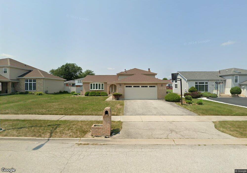
418 Danielle Rd Matteson, IL 60443
West Matteson NeighborhoodEstimated Value: $274,000 - $327,000
3
Beds
3
Baths
1,443
Sq Ft
$207/Sq Ft
Est. Value
About This Home
This home is located at 418 Danielle Rd, Matteson, IL 60443 and is currently estimated at $298,262, approximately $206 per square foot. 418 Danielle Rd is a home located in Cook County with nearby schools including Colin Powell Middle School.
Ownership History
Date
Name
Owned For
Owner Type
Purchase Details
Closed on
Nov 7, 1997
Sold by
Lakeside Bank
Bought by
Dishmon Carolyn
Current Estimated Value
Home Financials for this Owner
Home Financials are based on the most recent Mortgage that was taken out on this home.
Original Mortgage
$155,900
Outstanding Balance
$23,142
Interest Rate
7.43%
Mortgage Type
FHA
Estimated Equity
$275,120
Purchase Details
Closed on
May 20, 1994
Sold by
South Holland Trust & Svgs Bank
Bought by
Lakeside Bank
Home Financials for this Owner
Home Financials are based on the most recent Mortgage that was taken out on this home.
Original Mortgage
$132,000
Interest Rate
8.66%
Create a Home Valuation Report for This Property
The Home Valuation Report is an in-depth analysis detailing your home's value as well as a comparison with similar homes in the area
Home Values in the Area
Average Home Value in this Area
Purchase History
| Date | Buyer | Sale Price | Title Company |
|---|---|---|---|
| Dishmon Carolyn | $109,000 | -- | |
| Lakeside Bank | $144,000 | -- |
Source: Public Records
Mortgage History
| Date | Status | Borrower | Loan Amount |
|---|---|---|---|
| Open | Dishmon Carolyn | $155,900 | |
| Previous Owner | Lakeside Bank | $132,000 |
Source: Public Records
Tax History
| Year | Tax Paid | Tax Assessment Tax Assessment Total Assessment is a certain percentage of the fair market value that is determined by local assessors to be the total taxable value of land and additions on the property. | Land | Improvement |
|---|---|---|---|---|
| 2025 | $7,475 | $23,042 | $5,191 | $17,851 |
| 2024 | $7,475 | $23,042 | $5,191 | $17,851 |
| 2023 | $7,246 | $24,000 | $5,191 | $18,809 |
| 2022 | $7,246 | $16,955 | $4,483 | $12,472 |
| 2021 | $7,363 | $16,954 | $4,483 | $12,471 |
| 2020 | $7,234 | $16,954 | $4,483 | $12,471 |
| 2019 | $5,363 | $13,246 | $4,011 | $9,235 |
| 2018 | $6,232 | $15,010 | $4,011 | $10,999 |
| 2017 | $6,091 | $15,010 | $4,011 | $10,999 |
| 2016 | $6,517 | $15,091 | $3,539 | $11,552 |
| 2015 | $6,335 | $15,091 | $3,539 | $11,552 |
| 2014 | $6,190 | $15,091 | $3,539 | $11,552 |
| 2013 | $5,503 | $14,592 | $3,539 | $11,053 |
Source: Public Records
Map
Nearby Homes
- 443 Danielle Rd
- 6306 Beaver Dam Rd
- 6158 White Birch Ln
- 6125 Sunflower Dr
- 6037 Spring Ln
- 6021 Spring Ln
- 124 Oriole Rd
- 34 Wedgewood Rd
- 152 Oakhurst Rd
- 123 Oriole Rd
- 6128 Wedgewood Ct
- 42 Pheasant Rd
- 25 Pheasant Rd
- 10 Wedgewood Rd
- 5804 Kathryn Ln
- 5808 Allemong Dr
- 6005 Woodgate Dr
- 156 Cloverleaf Rd
- 133 Deerpath Rd
- 6216 Pond View Dr
- 426 Danielle Rd
- 410 Danielle Rd
- 417 Highland Rd
- 433 Highland Rd
- 409 Highland Rd
- 434 Danielle Rd
- 402 Danielle Rd
- 419 Danielle Rd
- 441 Highland Rd
- 427 Danielle Rd
- 411 Danielle Rd
- 401 Highland Rd
- 442 Danielle Rd
- 360 Danielle Rd
- 435 Danielle Rd
- 403 Danielle Rd Unit 2
- 449 Highland Rd
- 357 Highland Rd
- 359 Danielle Rd
- 418 Wheatfield Rd
Your Personal Tour Guide
Ask me questions while you tour the home.