Estimated Value: $302,000 - $341,000
5
Beds
2
Baths
1,792
Sq Ft
$179/Sq Ft
Est. Value
About This Home
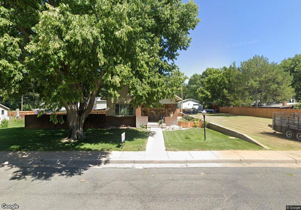
This home is located at 418 Franklin St, Wray, CO 80758 and is currently estimated at $320,503, approximately $178 per square foot. 418 Franklin St is a home located in Yuma County with nearby schools including Wray Elementary School, Buchanan Middle School, and Wray Junior/Senior High School.
Ownership History
Date
Name
Owned For
Owner Type
Purchase Details
Closed on
Apr 12, 2024
Sold by
Richers June and Gartrell Mike
Bought by
Johnson Terrance Wayne and Johnson Katie Marie
Current Estimated Value
Home Financials for this Owner
Home Financials are based on the most recent Mortgage that was taken out on this home.
Original Mortgage
$319,113
Outstanding Balance
$312,922
Interest Rate
6.94%
Mortgage Type
FHA
Estimated Equity
$7,581
Create a Home Valuation Report for This Property
The Home Valuation Report is an in-depth analysis detailing your home's value as well as a comparison with similar homes in the area
Purchase History
| Date | Buyer | Sale Price | Title Company |
|---|---|---|---|
| Johnson Terrance Wayne | $325,000 | None Listed On Document |
Source: Public Records
Mortgage History
| Date | Status | Borrower | Loan Amount |
|---|---|---|---|
| Open | Johnson Terrance Wayne | $319,113 | |
| Closed | Johnson Terrance Wayne | $12,764 |
Source: Public Records
Tax History
| Year | Tax Paid | Tax Assessment Tax Assessment Total Assessment is a certain percentage of the fair market value that is determined by local assessors to be the total taxable value of land and additions on the property. | Land | Improvement |
|---|---|---|---|---|
| 2025 | $2,183 | $22,310 | $0 | $0 |
| 2024 | $1,506 | $15,750 | $0 | $0 |
| 2023 | $1,506 | $23,089 | $955 | $22,134 |
| 2022 | $1,430 | $16,014 | $955 | $15,059 |
| 2021 | $1,401 | $16,014 | $955 | $15,059 |
| 2020 | $1,283 | $14,672 | $955 | $13,717 |
| 2019 | $1,309 | $14,672 | $955 | $13,717 |
| 2018 | $1,219 | $12,150 | $0 | $0 |
| 2017 | $1,083 | $12,150 | $0 | $0 |
| 2016 | $1,158 | $13,020 | $0 | $0 |
| 2015 | $954 | $13,020 | $0 | $0 |
| 2014 | $954 | $12,000 | $0 | $0 |
| 2013 | $954 | $12,000 | $0 | $0 |
Source: Public Records
Map
Nearby Homes
- 549 Emerson St
- 410 Clay St Unit 9
- 731 W 9th St
- 820 Grant St Unit D
- 820 Grant St Unit H
- 820 Grant St Unit G
- 734 W 8th St
- G4 Grant St Unit G4
- 831 Dexter St
- 440 Blake St
- 18124 U S Highway 385
- 924 Grant St
- TBD Dexter St Unit Lot B
- 30342 Us Highway 34
- 303 E 3rd St
- 338 Elm St
- TBD Wray Industrial Park Unit Block 1, Lot 1
- TBD Wray Industrial Park Unit Block 4
- Lot 36-37 Arlyn Way
- Lot 38-39 Arlyn Way
- 434 Franklin St
- 419 Emerson St
- 411 Emerson St
- 403 Emerson St
- 628 W 4th St Unit 642
- 340 Franklin St
- 417 Franklin St
- 425 Franklin St
- 403 Franklin St
- 629 W 4th St
- 435 Franklin St
- 345 Franklin St
- 715 W 5th St
- 437 Emerson St
- 343 Emerson St
- 326 Franklin St
- 644 W 5th St
- 329 Emerson St
- 720 W 4th St
- 404 Emerson St
Your Personal Tour Guide
Ask me questions while you tour the home.