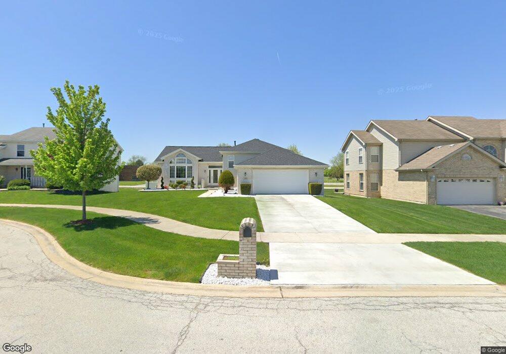
418 Kevin Way Matteson, IL 60443
West Matteson NeighborhoodEstimated Value: $300,000 - $343,000
3
Beds
2
Baths
1,720
Sq Ft
$186/Sq Ft
Est. Value
About This Home
This home is located at 418 Kevin Way, Matteson, IL 60443 and is currently estimated at $319,481, approximately $185 per square foot. 418 Kevin Way is a home located in Cook County with nearby schools including Colin Powell Middle School.
Ownership History
Date
Name
Owned For
Owner Type
Purchase Details
Closed on
Sep 15, 2010
Sold by
Daniel Dorinda D
Bought by
Daniel Dorinda D and Dorinda D Daniel Trust #1
Current Estimated Value
Purchase Details
Closed on
Feb 3, 2004
Sold by
Great Lakes Trust Co Na
Bought by
Daniel Dorinda D
Home Financials for this Owner
Home Financials are based on the most recent Mortgage that was taken out on this home.
Original Mortgage
$173,000
Outstanding Balance
$80,460
Interest Rate
5.71%
Mortgage Type
Unknown
Estimated Equity
$239,021
Create a Home Valuation Report for This Property
The Home Valuation Report is an in-depth analysis detailing your home's value as well as a comparison with similar homes in the area
Home Values in the Area
Average Home Value in this Area
Purchase History
| Date | Buyer | Sale Price | Title Company |
|---|---|---|---|
| Daniel Dorinda D | -- | None Available | |
| Daniel Dorinda D | $231,000 | First American Title Insuran |
Source: Public Records
Mortgage History
| Date | Status | Borrower | Loan Amount |
|---|---|---|---|
| Open | Daniel Dorinda D | $173,000 |
Source: Public Records
Tax History Compared to Growth
Tax History
| Year | Tax Paid | Tax Assessment Tax Assessment Total Assessment is a certain percentage of the fair market value that is determined by local assessors to be the total taxable value of land and additions on the property. | Land | Improvement |
|---|---|---|---|---|
| 2024 | $8,304 | $26,000 | $3,956 | $22,044 |
| 2023 | $5,441 | $26,000 | $3,956 | $22,044 |
| 2022 | $5,441 | $16,319 | $3,461 | $12,858 |
| 2021 | $5,579 | $16,318 | $3,461 | $12,857 |
| 2020 | $5,605 | $16,318 | $3,461 | $12,857 |
| 2019 | $6,263 | $14,893 | $3,213 | $11,680 |
| 2018 | $6,169 | $14,893 | $3,213 | $11,680 |
| 2017 | $6,030 | $14,893 | $3,213 | $11,680 |
| 2016 | $5,450 | $13,028 | $2,966 | $10,062 |
| 2015 | $5,287 | $13,028 | $2,966 | $10,062 |
| 2014 | $5,171 | $13,028 | $2,966 | $10,062 |
| 2013 | $6,046 | $15,773 | $2,966 | $12,807 |
Source: Public Records
Map
Nearby Homes
- 6226 Beechwood Rd
- 6037 Spring Ln
- 433 Wheatfield Rd
- 6230 Streamwood Ln
- 6021 Spring Ln
- 217 Oriole Rd
- 6103 Sunflower Dr
- 6125 Sunflower Dr
- 6306 Beaver Dam Rd
- 123 Oriole Rd
- 6260 Sunflower Dr
- 5808 Allemong Dr
- 749 Old Farm Rd
- 50 Willow Rd
- 6200 Marsh Ln
- 42 Pheasant Rd
- 25 Pheasant Rd
- 111 Deerpath Rd
- 116 Cloverleaf Rd
- 5911 Timberlane Rd