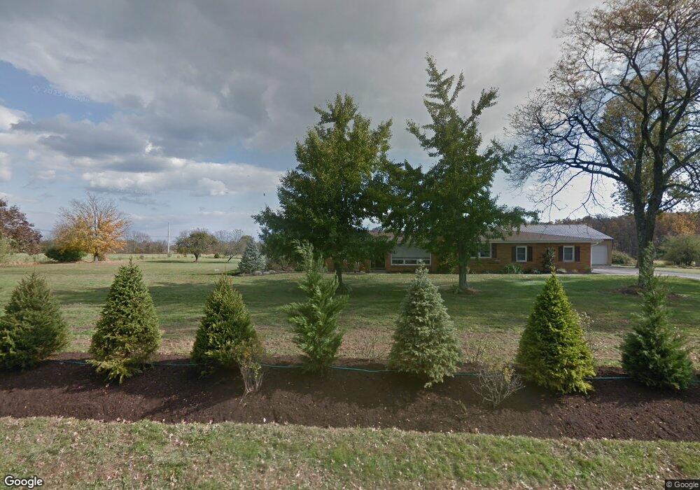
4180 Stump Rd Doylestown, PA 18902
Plumstead NeighborhoodEstimated Value: $651,000 - $890,473
3
Beds
2
Baths
1,962
Sq Ft
$386/Sq Ft
Est. Value
About This Home
This home is located at 4180 Stump Rd, Doylestown, PA 18902 and is currently estimated at $757,868, approximately $386 per square foot. 4180 Stump Rd is a home located in Bucks County with nearby schools including Groveland Elementary School, Tohickon Middle School, and Central Bucks High School-West.
Ownership History
Date
Name
Owned For
Owner Type
Purchase Details
Closed on
Jan 19, 2023
Sold by
Graziano Domenic S
Bought by
Graziano Domenic S and Graziano Joanne
Current Estimated Value
Purchase Details
Closed on
Sep 4, 2014
Sold by
Graziano Domenic S
Bought by
Graziano Domenic S
Home Financials for this Owner
Home Financials are based on the most recent Mortgage that was taken out on this home.
Original Mortgage
$415,000
Interest Rate
4.12%
Mortgage Type
Future Advance Clause Open End Mortgage
Purchase Details
Closed on
Jul 15, 2010
Sold by
Preg Robert J
Bought by
Graziano Domenic S
Home Financials for this Owner
Home Financials are based on the most recent Mortgage that was taken out on this home.
Original Mortgage
$417,000
Interest Rate
4.78%
Mortgage Type
New Conventional
Create a Home Valuation Report for This Property
The Home Valuation Report is an in-depth analysis detailing your home's value as well as a comparison with similar homes in the area
Home Values in the Area
Average Home Value in this Area
Purchase History
| Date | Buyer | Sale Price | Title Company |
|---|---|---|---|
| Graziano Domenic S | -- | None Listed On Document | |
| Graziano Domenic S | -- | None Available | |
| Graziano Domenic S | -- | None Available | |
| Graziano Domenic S | $325,000 | Stewart Title Guaranty Co |
Source: Public Records
Mortgage History
| Date | Status | Borrower | Loan Amount |
|---|---|---|---|
| Previous Owner | Graziano Domenic S | $415,000 | |
| Previous Owner | Graziano Domenic S | $385,000 | |
| Previous Owner | Graziano Domenic S | $417,000 |
Source: Public Records
Tax History Compared to Growth
Tax History
| Year | Tax Paid | Tax Assessment Tax Assessment Total Assessment is a certain percentage of the fair market value that is determined by local assessors to be the total taxable value of land and additions on the property. | Land | Improvement |
|---|---|---|---|---|
| 2025 | $10,899 | $62,730 | $8,350 | $54,380 |
| 2024 | $10,899 | $62,730 | $8,350 | $54,380 |
| 2023 | $10,553 | $62,730 | $8,350 | $54,380 |
| 2022 | $10,435 | $62,730 | $8,350 | $54,380 |
| 2021 | $10,318 | $62,730 | $8,350 | $54,380 |
| 2020 | $10,318 | $62,730 | $8,350 | $54,380 |
| 2019 | $10,256 | $62,730 | $8,350 | $54,380 |
| 2018 | $10,256 | $62,730 | $8,350 | $54,380 |
| 2017 | $10,115 | $62,730 | $8,350 | $54,380 |
| 2016 | $9,323 | $41,410 | $8,350 | $33,060 |
| 2015 | -- | $41,410 | $8,350 | $33,060 |
| 2014 | -- | $36,800 | $11,880 | $24,920 |
Source: Public Records
Map
Nearby Homes
- 4000 Miriam Dr
- 3789 Stump Rd
- 1222 Hockley Dr
- 1214 Hockley Dr
- 204 Pennland Farm Dr
- 4811 Lincoln Aly
- 81 Williams Dr
- Lot 6 Henry Ct
- 319 Pennington Way
- Lot 10 Schadle Rd
- 316 Schadle Rd
- 5068 Kratz Carriage Rd
- 4936 Curly Hill Rd
- 137 S Main St
- 4464 Kleinot Dr
- 4263 Kleinot Dr
- 4317 Kleinot Dr
- 4246 Kleinot Dr
- 4298 Kleinot Dr
- 4306 Kleinot Dr
- 5761 Landis Greene Dr
- 5850 Silo Hill Rd
- 4146 Stump Rd
- 5765 Landis Greene Dr
- 4201 Stump Rd
- 5760 Landis Greene Dr
- 5756 Landis Greene Dr
- 5751 Landis Greene Dr
- 4132 Stump Rd
- 4233 Stump Rd
- 5824 Emily Dr
- 4176 Gregory Dr
- 4182 Gregory Dr
- 4170 Gregory Dr
- 4190 Gregory Dr
- 5829 Emily Dr
- 5820 Emily Dr
- 4100 Stump Rd
- 4168 Gregory Dr
- 5821 Emily Dr