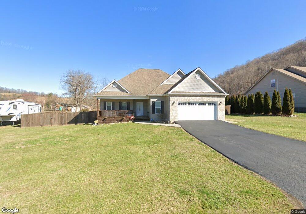
419 Brook Side Dr Elizabethton, TN 37643
Estimated Value: $357,773 - $441,000
3
Beds
2
Baths
2,006
Sq Ft
$200/Sq Ft
Est. Value
About This Home
This home is located at 419 Brook Side Dr, Elizabethton, TN 37643 and is currently estimated at $401,193, approximately $199 per square foot. 419 Brook Side Dr is a home.
Ownership History
Date
Name
Owned For
Owner Type
Purchase Details
Closed on
Jun 26, 2015
Sold by
Tester Kathy C
Bought by
Bartee Lindsey Ann Marie and Ensor Jason Paul
Current Estimated Value
Home Financials for this Owner
Home Financials are based on the most recent Mortgage that was taken out on this home.
Original Mortgage
$170,050
Outstanding Balance
$132,919
Interest Rate
3.93%
Mortgage Type
New Conventional
Estimated Equity
$268,274
Purchase Details
Closed on
Feb 12, 2013
Sold by
Bowers Linda D
Bought by
Tester Kathy C
Home Financials for this Owner
Home Financials are based on the most recent Mortgage that was taken out on this home.
Original Mortgage
$114,000
Interest Rate
3.4%
Mortgage Type
Commercial
Purchase Details
Closed on
Jun 20, 2012
Sold by
Gary Phillips Construction
Bought by
Bowers Laura D
Purchase Details
Closed on
Oct 6, 2009
Bought by
Phillips Gary Construction Llc
Create a Home Valuation Report for This Property
The Home Valuation Report is an in-depth analysis detailing your home's value as well as a comparison with similar homes in the area
Home Values in the Area
Average Home Value in this Area
Purchase History
| Date | Buyer | Sale Price | Title Company |
|---|---|---|---|
| Bartee Lindsey Ann Marie | $179,000 | -- | |
| Tester Kathy C | $169,000 | -- | |
| Bowers Laura D | $59,400 | -- | |
| Phillips Gary Construction Llc | $97,800 | -- |
Source: Public Records
Mortgage History
| Date | Status | Borrower | Loan Amount |
|---|---|---|---|
| Open | Bartee Lindsey Ann Marie | $170,050 | |
| Previous Owner | Tester Kathy C | $114,000 |
Source: Public Records
Tax History Compared to Growth
Tax History
| Year | Tax Paid | Tax Assessment Tax Assessment Total Assessment is a certain percentage of the fair market value that is determined by local assessors to be the total taxable value of land and additions on the property. | Land | Improvement |
|---|---|---|---|---|
| 2024 | $1,209 | $55,450 | $6,400 | $49,050 |
| 2023 | $1,209 | $55,450 | $0 | $0 |
| 2022 | $1,126 | $55,450 | $6,400 | $49,050 |
| 2021 | $1,086 | $55,450 | $6,400 | $49,050 |
| 2020 | $1,187 | $53,500 | $6,400 | $47,100 |
| 2019 | $1,187 | $48,075 | $6,400 | $41,675 |
| 2018 | $1,187 | $48,075 | $6,400 | $41,675 |
| 2017 | $1,187 | $48,075 | $6,400 | $41,675 |
| 2016 | $1,178 | $48,075 | $6,400 | $41,675 |
| 2015 | $1,178 | $48,075 | $6,400 | $41,675 |
| 2014 | $1,030 | $42,050 | $6,400 | $35,650 |
Source: Public Records
Map
Nearby Homes
- 855 Willow Springs Rd
- 1116 Highway 91
- 170 Price Rd
- 112 Holston View Dr
- 131 Eldridge Dr
- 438 Willow Springs Rd
- 212 Alania Ct
- 134 Pinnacle Dr
- 120 Scott Ln
- 105 Bishop Hollow Rd
- 123 Eastland Dr
- 133 Ug Buckles Rd
- 124 Zeb Grindstaff Rd
- 172 Carl Taylor Rd
- Tbd Howard Ct
- 115 Lancelot Dr
- TBD Willshire Dr
- 400 Airport Rd
- 166 Pierce St
- 201 Ron Royce Dr Unit 1
- 421 Brook Side Dr
- 502 Clear Brook Ct
- 501 Clear Brook Ct
- 408 Brook Side Dr
- 417 Brook Side Dr
- 415 Brook Side Dr
- 414 Brook Side Dr
- 431 Brook Side Dr
- 429 Brook Side Dr
- 427 Brook Side Dr
- 423 Brook Side Dr
- 500 Clear Brook Ct
- 416 Brook Side Dr
- 426 Brook Side Dr
- 122 Dc Campbell Rd
- 503 Clear Brook Ct
- 425 Brook Side Dr
- 428 Brook Side Dr
- 505 Clear Brook Ct
- 410 Brook Side Dr