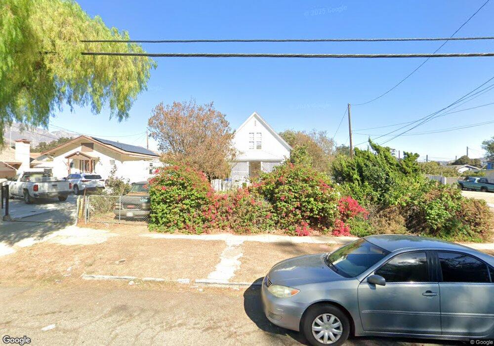
419 N 10th St Santa Paula, CA 93060
Estimated Value: $644,000 - $723,000
4
Beds
2
Baths
1,436
Sq Ft
$467/Sq Ft
Est. Value
About This Home
This home is located at 419 N 10th St, Santa Paula, CA 93060 and is currently estimated at $670,731, approximately $467 per square foot. 419 N 10th St is a home located in Ventura County with nearby schools including McKevett Elementary School, Isbell Middle, and Santa Paula High.
Ownership History
Date
Name
Owned For
Owner Type
Purchase Details
Closed on
May 2, 2008
Sold by
Tavares Eloise M
Bought by
Tavares Eloise M
Current Estimated Value
Home Financials for this Owner
Home Financials are based on the most recent Mortgage that was taken out on this home.
Original Mortgage
$128,000
Interest Rate
5.8%
Mortgage Type
Credit Line Revolving
Purchase Details
Closed on
Apr 10, 2008
Sold by
Tavares Eloise M
Bought by
Tavares Eloise M
Home Financials for this Owner
Home Financials are based on the most recent Mortgage that was taken out on this home.
Original Mortgage
$128,000
Interest Rate
5.8%
Mortgage Type
Credit Line Revolving
Purchase Details
Closed on
Jan 15, 1999
Sold by
Tavares Edna C Trust and Edna C
Bought by
Tavares Edna C
Create a Home Valuation Report for This Property
The Home Valuation Report is an in-depth analysis detailing your home's value as well as a comparison with similar homes in the area
Home Values in the Area
Average Home Value in this Area
Purchase History
| Date | Buyer | Sale Price | Title Company |
|---|---|---|---|
| Tavares Eloise M | -- | First American | |
| Tavares Eloise M | -- | Chicago Title Co 72 | |
| Tavares Edna C | -- | -- |
Source: Public Records
Mortgage History
| Date | Status | Borrower | Loan Amount |
|---|---|---|---|
| Closed | Tavares Eloise M | $128,000 |
Source: Public Records
Tax History Compared to Growth
Tax History
| Year | Tax Paid | Tax Assessment Tax Assessment Total Assessment is a certain percentage of the fair market value that is determined by local assessors to be the total taxable value of land and additions on the property. | Land | Improvement |
|---|---|---|---|---|
| 2025 | $518 | $45,316 | $18,336 | $26,980 |
| 2024 | $518 | $44,428 | $17,977 | $26,451 |
| 2023 | $508 | $43,557 | $17,624 | $25,933 |
| 2022 | $492 | $42,703 | $17,278 | $25,425 |
| 2021 | $489 | $41,866 | $16,939 | $24,927 |
| 2020 | $485 | $41,438 | $16,766 | $24,672 |
| 2019 | $462 | $40,627 | $16,438 | $24,189 |
| 2018 | $456 | $39,831 | $16,116 | $23,715 |
| 2017 | $459 | $39,050 | $15,800 | $23,250 |
| 2016 | $434 | $38,286 | $15,491 | $22,795 |
| 2015 | $416 | $37,712 | $15,259 | $22,453 |
| 2014 | $421 | $36,975 | $14,961 | $22,014 |
Source: Public Records
Map
Nearby Homes
- 317 N Ojai St #Abcde
- 919 E Virginia Terrace
- 1214 Saticoy St
- 963 La Vuelta Place
- 738 E Santa Paula St
- 120 S Ojai St
- 308 Citrus St
- 542 N 13th St
- 864 Montclair Dr
- 0 View Dr Unit V1-32228
- 1500 Richmond Rd Unit 10
- 1500 Richmond Rd Unit 1
- 1500 Richmond Rd Unit 3
- 179 View Dr
- 421 N Palm Ave
- 1234 Woodland Dr
- 100 E Virginia Terrace
- 107 Sonoma Ln
- 1009 Laurel Rd
- 336 E Harvard Blvd