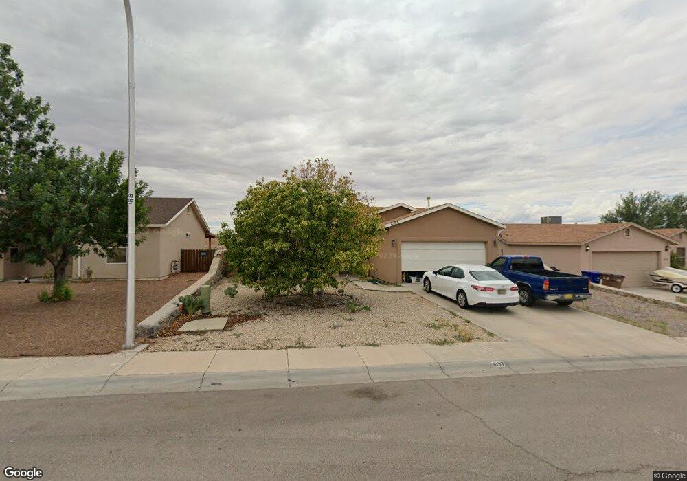
4197 Fireweed Dr Las Cruces, NM 88007
Estimated Value: $249,129 - $277,000
3
Beds
2
Baths
1,413
Sq Ft
$186/Sq Ft
Est. Value
About This Home
This home is located at 4197 Fireweed Dr, Las Cruces, NM 88007 and is currently estimated at $263,065, approximately $186 per square foot. 4197 Fireweed Dr is a home located in Dona Ana County with nearby schools including Columbia Elementary School, Vista Middle School, and Mayfield High School.
Ownership History
Date
Name
Owned For
Owner Type
Purchase Details
Closed on
Aug 9, 2018
Sold by
Baca Leon T
Bought by
Baca Dedra L
Current Estimated Value
Purchase Details
Closed on
Aug 29, 2005
Sold by
Saigh Michael
Bought by
Baca Leon T and Baca Dedra L
Home Financials for this Owner
Home Financials are based on the most recent Mortgage that was taken out on this home.
Original Mortgage
$118,148
Interest Rate
5.61%
Mortgage Type
Balloon
Purchase Details
Closed on
Mar 30, 2005
Sold by
Mesa Mhs Inc
Bought by
Saigh Michael M
Create a Home Valuation Report for This Property
The Home Valuation Report is an in-depth analysis detailing your home's value as well as a comparison with similar homes in the area
Home Values in the Area
Average Home Value in this Area
Purchase History
| Date | Buyer | Sale Price | Title Company |
|---|---|---|---|
| Baca Dedra L | -- | Dona Ana Title Co Inc | |
| Baca Leon T | -- | Dona Ana Title Co Inc | |
| Saigh Michael M | -- | Dona Ana Title Co |
Source: Public Records
Mortgage History
| Date | Status | Borrower | Loan Amount |
|---|---|---|---|
| Closed | Baca Leon T | $118,148 |
Source: Public Records
Tax History Compared to Growth
Tax History
| Year | Tax Paid | Tax Assessment Tax Assessment Total Assessment is a certain percentage of the fair market value that is determined by local assessors to be the total taxable value of land and additions on the property. | Land | Improvement |
|---|---|---|---|---|
| 2024 | $1,436 | $47,144 | $8,310 | $38,834 |
| 2023 | $1,416 | $45,771 | $8,198 | $37,573 |
| 2022 | $1,394 | $44,438 | $8,098 | $36,340 |
| 2021 | $1,349 | $43,144 | $8,001 | $35,143 |
| 2020 | $1,316 | $41,887 | $7,906 | $33,981 |
| 2019 | $1,281 | $40,668 | $7,815 | $32,853 |
| 2018 | $1,274 | $40,668 | $7,815 | $32,853 |
| 2017 | $1,135 | $39,483 | $7,725 | $31,758 |
| 2016 | $1,150 | $39,483 | $7,725 | $31,758 |
| 2015 | $1,123 | $115,000 | $22,500 | $92,500 |
| 2014 | $1,122 | $115,000 | $22,500 | $92,500 |
Source: Public Records
Map
Nearby Homes
- 4004 Elks Dr
- 4165 Mojave Dr
- 1117 Hatfield Rd
- 4406 Paseo Del Oro
- 4052 Gila Trail
- 146 Blacktail Deer Ave
- 1534 Lenox Ave
- 1055 Jasmine Dr
- 958 Jasmine Dr Unit 1
- 901 Jasmine Dr
- 3523 Omaha Ct
- 1109 Hermosillo Dr
- 4056 Lasso Loop
- 3522 Omaha Ct
- 1422 Lenox Ave
- 4008 Lasso Loop
- 1905 Settlers Bend N
- 333 Armstrong Rd
- 4038 Lasso Loop
- 952 Glendale Dr
- 4201 Fireweed Dr
- 4193 Fireweed Dr
- 4154 Aurora Star Ct
- 4205 Fireweed Dr
- 4189 Fireweed Dr
- 4158 Aurora Star Ct
- 915 Mccoy Ave
- 4194 Fireweed Dr
- 4203 Trillium Dr
- 4209 Fireweed Dr
- 4190 Fireweed Dr
- 4162 Aurora Star Ct
- L-26 L Trillium Dr
- 4208 Fireweed Dr
- l-25 L Fireweed Dr
- L-2 L Fireweed Dr
- L-3 L Fireweed Dr
- 4166 Aurora Star Ct
- Lot 7 Aurora Star Ct
- Lot 8 Aurora Star Ct