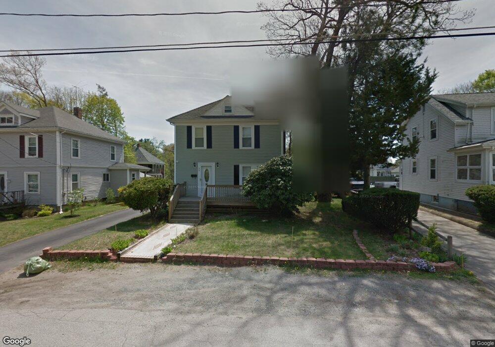
42 Cushing Ave Brockton, MA 02301
Campello NeighborhoodEstimated Value: $426,000 - $509,000
3
Beds
1
Bath
1,400
Sq Ft
$335/Sq Ft
Est. Value
About This Home
This home is located at 42 Cushing Ave, Brockton, MA 02301 and is currently estimated at $469,006, approximately $335 per square foot. 42 Cushing Ave is a home located in Plymouth County with nearby schools including Gilmore Elementary School, Davis K-8 School, and John F. Kennedy Elementary School.
Ownership History
Date
Name
Owned For
Owner Type
Purchase Details
Closed on
Dec 29, 1993
Sold by
Gillis Donald P and Gillis Deborah L
Bought by
Downie Alma E
Current Estimated Value
Home Financials for this Owner
Home Financials are based on the most recent Mortgage that was taken out on this home.
Original Mortgage
$68,400
Interest Rate
7%
Mortgage Type
Purchase Money Mortgage
Purchase Details
Closed on
Apr 26, 1991
Sold by
Hurley Paul L
Bought by
Gillis Donald P and Gillis Deborah L
Home Financials for this Owner
Home Financials are based on the most recent Mortgage that was taken out on this home.
Original Mortgage
$103,900
Interest Rate
9.41%
Mortgage Type
Purchase Money Mortgage
Create a Home Valuation Report for This Property
The Home Valuation Report is an in-depth analysis detailing your home's value as well as a comparison with similar homes in the area
Home Values in the Area
Average Home Value in this Area
Purchase History
| Date | Buyer | Sale Price | Title Company |
|---|---|---|---|
| Downie Alma E | $72,000 | -- | |
| Gillis Donald P | $103,900 | -- |
Source: Public Records
Mortgage History
| Date | Status | Borrower | Loan Amount |
|---|---|---|---|
| Open | Gillis Donald P | $20,000 | |
| Closed | Gillis Donald P | $68,400 | |
| Previous Owner | Gillis Donald P | $103,900 | |
| Previous Owner | Gillis Donald P | $75,000 |
Source: Public Records
Tax History
| Year | Tax Paid | Tax Assessment Tax Assessment Total Assessment is a certain percentage of the fair market value that is determined by local assessors to be the total taxable value of land and additions on the property. | Land | Improvement |
|---|---|---|---|---|
| 2025 | $4,535 | $374,500 | $140,100 | $234,400 |
| 2024 | $4,376 | $364,100 | $140,100 | $224,000 |
| 2023 | $4,233 | $326,100 | $104,600 | $221,500 |
| 2022 | $4,241 | $303,600 | $95,100 | $208,500 |
| 2021 | $3,988 | $275,000 | $79,000 | $196,000 |
| 2020 | $3,762 | $248,300 | $73,900 | $174,400 |
| 2019 | $3,699 | $238,000 | $72,100 | $165,900 |
| 2018 | $3,543 | $220,600 | $72,100 | $148,500 |
| 2017 | $3,159 | $196,200 | $72,100 | $124,100 |
| 2016 | $2,781 | $160,200 | $69,900 | $90,300 |
| 2015 | $2,655 | $146,300 | $69,900 | $76,400 |
| 2014 | $2,497 | $137,700 | $69,900 | $67,800 |
Source: Public Records
Map
Nearby Homes
- 47 Southworth St
- 35 Longworth Ave Unit 25
- 326 Copeland St
- 25 Longworth Ave Unit 4
- 15 Longworth Ave Unit 226
- 9 Longworth Ave Unit 135
- 9 Longworth Ave Unit 113
- 115 Market St
- 34 South St
- 15 Market St
- 26 South St
- 60 Tremont St
- 65 Tremont St
- 25 Tremont St
- 23 E Chestnut St
- 24 E Chestnut St
- 223 Clinton St Unit 16
- 12 Finny's Way
- 82 Carroll Ave
- 127 Hillberg Ave
- 46 Cushing Ave
- 36 Cushing Ave
- 141 Brookside Ave
- 145 Brookside Ave
- 145 Brookside Ave Unit 1
- 54 Cushing Ave
- 32 Cushing Ave
- 137 Brookside Ave
- 153 Brookside Ave
- 71 Grant Ave
- 47 Cushing Ave
- 56 Cushing Ave
- 26 Cushing Ave
- 131 Brookside Ave
- 157 Brookside Ave
- 55 Cushing Ave
- 55 Cushing Ave Unit 1
- 24 Cushing Ave
- 65 Grant Ave
- 129 Brookside Ave
Your Personal Tour Guide
Ask me questions while you tour the home.