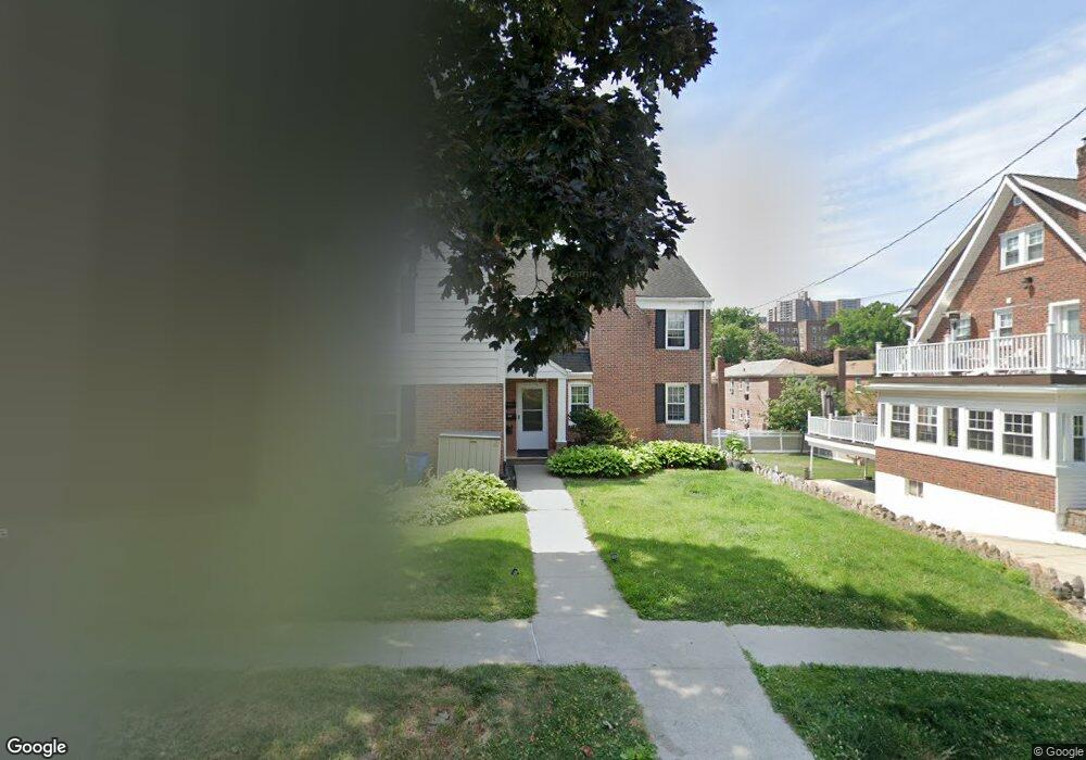
42 Ellsworth Ave Yonkers, NY 10705
Ludlow NeighborhoodEstimated Value: $815,198 - $911,000
5
Beds
2
Baths
3,132
Sq Ft
$272/Sq Ft
Est. Value
About This Home
This home is located at 42 Ellsworth Ave, Yonkers, NY 10705 and is currently estimated at $852,550, approximately $272 per square foot. 42 Ellsworth Ave is a home located in Westchester County with nearby schools including St Margaret Of Cortona School, The Biondi School, and Sar High School.
Ownership History
Date
Name
Owned For
Owner Type
Purchase Details
Closed on
Jul 7, 2020
Sold by
Scanlan Patrick and Scanlan Niala
Bought by
Gojani Kushrim and Gojani Anton
Current Estimated Value
Home Financials for this Owner
Home Financials are based on the most recent Mortgage that was taken out on this home.
Original Mortgage
$516,000
Outstanding Balance
$457,555
Interest Rate
3.1%
Mortgage Type
New Conventional
Estimated Equity
$394,995
Create a Home Valuation Report for This Property
The Home Valuation Report is an in-depth analysis detailing your home's value as well as a comparison with similar homes in the area
Home Values in the Area
Average Home Value in this Area
Purchase History
| Date | Buyer | Sale Price | Title Company |
|---|---|---|---|
| Gojani Kushrim | $645,000 | None Available |
Source: Public Records
Mortgage History
| Date | Status | Borrower | Loan Amount |
|---|---|---|---|
| Open | Gojani Kushrim | $516,000 |
Source: Public Records
Tax History Compared to Growth
Tax History
| Year | Tax Paid | Tax Assessment Tax Assessment Total Assessment is a certain percentage of the fair market value that is determined by local assessors to be the total taxable value of land and additions on the property. | Land | Improvement |
|---|---|---|---|---|
| 2024 | $1,960 | $11,000 | $3,600 | $7,400 |
| 2023 | $1,947 | $11,000 | $3,600 | $7,400 |
| 2022 | $1,936 | $11,000 | $3,600 | $7,400 |
| 2021 | $9,452 | $11,000 | $3,600 | $7,400 |
| 2020 | $8,379 | $11,000 | $3,600 | $7,400 |
| 2019 | $10,400 | $11,000 | $3,600 | $7,400 |
| 2018 | $7,731 | $11,600 | $3,600 | $8,000 |
| 2017 | -- | $11,600 | $3,600 | $8,000 |
| 2016 | $11,380 | $13,800 | $3,600 | $10,200 |
| 2015 | -- | $13,800 | $3,600 | $10,200 |
| 2014 | -- | $13,800 | $3,600 | $10,200 |
| 2013 | -- | $13,800 | $3,600 | $10,200 |
Source: Public Records
Map
Nearby Homes
- 6300 Riverdale Ave Unit 1B
- 6300 Riverdale Ave Unit 5C
- 6300 Riverdale Ave Unit 5E
- 6200 Riverdale Ave Unit 3K
- 6140 Delafield Ave
- 351 W 262nd St
- 6141 Delafield Ave
- 315 W 262nd St
- 21 Pershing Ave
- 6133 Fieldston Rd
- 517 Riverdale Ave Unit 4B/5B
- 517 Riverdale Ave Unit 4A
- 501 Riverdale Ave Unit 2J
- 501 Riverdale Ave Unit 6L
- 6112 Fieldston Rd
- 29 Abeel St Unit 4L
- 29 Abeel St Unit 6G
- 29 Abeel St Unit 3B
- 29 Abeel St Unit 2L
- 29 Abeel St Unit 6K
- 42 aka 44 Ellsworth Ave
- 38 Ellsworth Ave
- 48 Ellsworth Ave
- 44 Ellsworth Ave Unit 2
- 44 Ellsworth Ave Unit RE
- 34 Ellsworth Ave
- 6317 Liebig Ave
- 11 Liebig Ave
- 63 Liebig Ave
- 52 Ellsworth Ave
- 437 W 263rd St
- 6313 Liebig Ave
- 41 Ellsworth Ave
- 439 W 263rd St Unit 1
- 439 W 263 St
- 431 W 263rd St
- 439 W 263rd St
- 439 W 263rd St Unit 1
- 439 W 263rd St Unit 2
- 6309 Liebig Ave