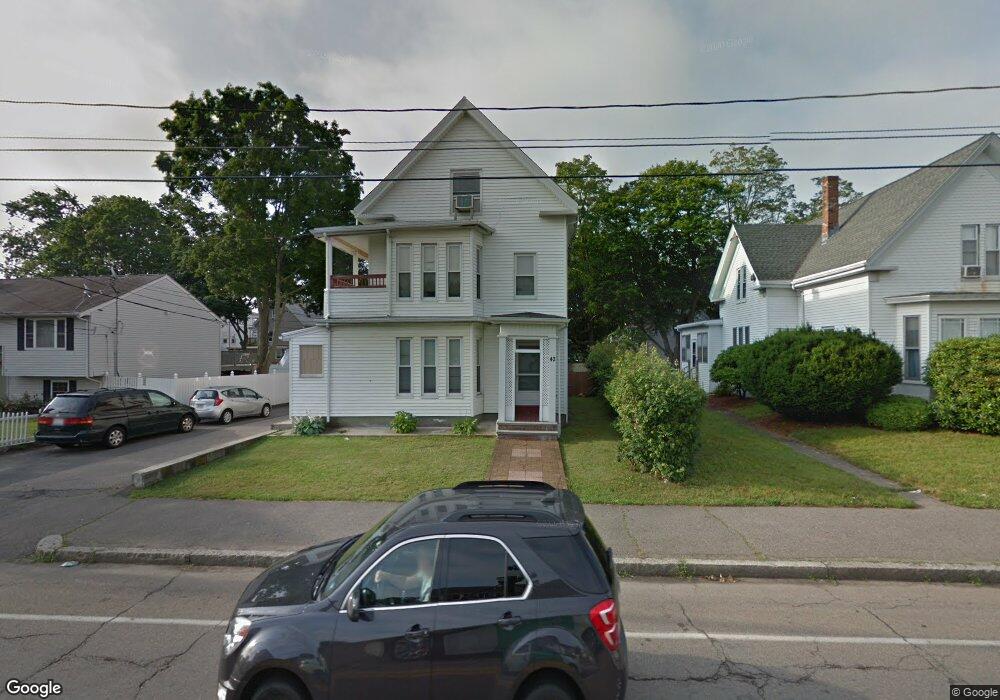
42 Forest Ave Brockton, MA 02301
Clifton Heights NeighborhoodEstimated Value: $746,000 - $914,000
6
Beds
3
Baths
3,243
Sq Ft
$262/Sq Ft
Est. Value
About This Home
This home is located at 42 Forest Ave, Brockton, MA 02301 and is currently estimated at $848,667, approximately $261 per square foot. 42 Forest Ave is a home located in Plymouth County with nearby schools including Gilmore Elementary School, John F. Kennedy Elementary School, and Davis K-8 School.
Ownership History
Date
Name
Owned For
Owner Type
Purchase Details
Closed on
Dec 6, 2017
Sold by
Teixeira Guilherme G
Bought by
Teixeira Guilherme F and Rosa Benvinda M
Current Estimated Value
Purchase Details
Closed on
Sep 29, 2008
Sold by
Sousa Marlon
Bought by
Teixeira Guilherme G and Teixeira Guilherme F
Home Financials for this Owner
Home Financials are based on the most recent Mortgage that was taken out on this home.
Original Mortgage
$183,097
Interest Rate
6.57%
Mortgage Type
Purchase Money Mortgage
Purchase Details
Closed on
Jun 8, 2005
Sold by
Florio Nellie
Bought by
Sousa Marlon
Create a Home Valuation Report for This Property
The Home Valuation Report is an in-depth analysis detailing your home's value as well as a comparison with similar homes in the area
Home Values in the Area
Average Home Value in this Area
Purchase History
| Date | Buyer | Sale Price | Title Company |
|---|---|---|---|
| Teixeira Guilherme F | -- | -- | |
| Teixeira Guilherme G | $185,000 | -- | |
| Sousa Marlon | $399,900 | -- |
Source: Public Records
Mortgage History
| Date | Status | Borrower | Loan Amount |
|---|---|---|---|
| Previous Owner | Sousa Marlon | $183,097 | |
| Previous Owner | Sousa Marlon | $30,859 | |
| Previous Owner | Sousa Marlon | $373,600 |
Source: Public Records
Tax History
| Year | Tax Paid | Tax Assessment Tax Assessment Total Assessment is a certain percentage of the fair market value that is determined by local assessors to be the total taxable value of land and additions on the property. | Land | Improvement |
|---|---|---|---|---|
| 2025 | $8,089 | $668,000 | $140,200 | $527,800 |
| 2024 | $7,876 | $655,200 | $140,200 | $515,000 |
| 2023 | $7,752 | $597,200 | $104,700 | $492,500 |
| 2022 | $7,739 | $554,000 | $95,200 | $458,800 |
| 2021 | $7,233 | $498,800 | $79,100 | $419,700 |
| 2020 | $6,310 | $416,500 | $74,000 | $342,500 |
| 2019 | $6,232 | $401,000 | $72,200 | $328,800 |
| 2018 | $5,499 | $342,400 | $72,200 | $270,200 |
| 2017 | $5,210 | $323,600 | $72,200 | $251,400 |
| 2016 | $4,557 | $262,500 | $70,000 | $192,500 |
| 2015 | $3,733 | $205,700 | $70,000 | $135,700 |
| 2014 | $3,407 | $187,900 | $70,000 | $117,900 |
Source: Public Records
Map
Nearby Homes
- 21 Forest Ave
- 18 Florence St
- 33 Menlo St
- 15 1st St
- 99 Tribou St Unit 6
- 0 W Park St
- 20 Custer St
- 18 Lawrence St
- 228 Forest Ave
- 936 Warren Ave
- 23 Ridgeway Ct Unit 23
- 118 Bartlett St
- 38 Howard Square
- 34 Hillberg Ave
- 184 Myrtle St
- 146 Manomet St
- 103 Clinton St
- 127 Hillberg Ave
- 65 Tremont St
- 25 Tremont St
- 44 Forest Ave
- 34 Forest Ave
- 36 (aka34) Forest Ave
- 36 Forest Ave Unit AKA34
- 36 Forest Ave
- 0 Forest Ave
- 650 Warren Ave
- 39 Florence St
- 30 Forest Ave
- 35 Florence St
- 43 Florence St
- 29 Florence St
- 35 Central Square
- 35 Forest Ave
- 660 Warren Ave Unit C
- 660 Warren Ave Unit B
- 660 Warren Ave Unit A
- 47 Forest Ave
- 41 Forest Ave
- 23 Florence St
Your Personal Tour Guide
Ask me questions while you tour the home.