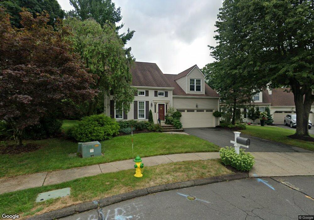
42 Foxtail Rd Middletown, CT 06457
Westfield NeighborhoodEstimated Value: $422,374 - $477,000
3
Beds
3
Baths
1,844
Sq Ft
$249/Sq Ft
Est. Value
About This Home
This home is located at 42 Foxtail Rd, Middletown, CT 06457 and is currently estimated at $459,094, approximately $248 per square foot. 42 Foxtail Rd is a home located in Middlesex County with nearby schools including The Lawrence School and Middletown High School.
Ownership History
Date
Name
Owned For
Owner Type
Purchase Details
Closed on
Mar 21, 2019
Sold by
Nicholson Thomas F
Bought by
Daversa Richard S
Current Estimated Value
Home Financials for this Owner
Home Financials are based on the most recent Mortgage that was taken out on this home.
Original Mortgage
$267,602
Outstanding Balance
$233,198
Interest Rate
4.37%
Mortgage Type
FHA
Estimated Equity
$225,896
Purchase Details
Closed on
Jun 19, 2009
Sold by
Jordan David G and Jordan Beatrice D
Bought by
Daversa Richard S and Nicholson Thomas F
Home Financials for this Owner
Home Financials are based on the most recent Mortgage that was taken out on this home.
Original Mortgage
$281,635
Interest Rate
4.91%
Purchase Details
Closed on
Aug 29, 2002
Sold by
Berkey Joan F
Bought by
Jordan David G and Jordan Beatrice D
Purchase Details
Closed on
Jul 23, 1999
Sold by
Podjaski Lynne M and Podjaski Krzysztof
Bought by
Berkey Joan F
Create a Home Valuation Report for This Property
The Home Valuation Report is an in-depth analysis detailing your home's value as well as a comparison with similar homes in the area
Home Values in the Area
Average Home Value in this Area
Purchase History
| Date | Buyer | Sale Price | Title Company |
|---|---|---|---|
| Daversa Richard S | -- | -- | |
| Daversa Richard S | $308,000 | -- | |
| Jordan David G | $244,000 | -- | |
| Berkey Joan F | $191,900 | -- |
Source: Public Records
Mortgage History
| Date | Status | Borrower | Loan Amount |
|---|---|---|---|
| Open | Daversa Richard S | $267,602 | |
| Previous Owner | Berkey Joan F | $281,635 | |
| Previous Owner | Berkey Joan F | $50,000 | |
| Previous Owner | Berkey Joan F | $249,000 |
Source: Public Records
Tax History
| Year | Tax Paid | Tax Assessment Tax Assessment Total Assessment is a certain percentage of the fair market value that is determined by local assessors to be the total taxable value of land and additions on the property. | Land | Improvement |
|---|---|---|---|---|
| 2025 | $7,440 | $220,850 | $68,080 | $152,770 |
| 2024 | $7,054 | $220,850 | $68,080 | $152,770 |
| 2023 | $6,635 | $220,850 | $68,080 | $152,770 |
| 2022 | $5,934 | $158,170 | $45,390 | $112,780 |
| 2021 | $5,920 | $158,170 | $45,390 | $112,780 |
| 2020 | $3,911 | $158,170 | $45,390 | $112,780 |
| 2019 | $5,960 | $158,170 | $45,390 | $112,780 |
| 2018 | $5,749 | $158,170 | $45,390 | $112,780 |
| 2017 | $5,925 | $167,150 | $44,100 | $123,050 |
| 2016 | $5,811 | $167,150 | $44,100 | $123,050 |
| 2015 | $5,686 | $167,150 | $44,100 | $123,050 |
| 2014 | $5,687 | $167,150 | $44,100 | $123,050 |
Source: Public Records
Map
Nearby Homes
- 70 Timothy Dr
- 227 Burgundy Hill Ln Unit 227
- 3 E Lake Place
- 47 Trolley Crossing Ln Unit 47
- 59 Trolley Crossing Ln Unit 59
- 58 Morning Glory Dr
- 36 Rising Trail Dr Unit 36
- 886 East St
- 1 Forest Glen Cir Unit 11
- 14 Forest Glen Cir Unit 10
- 37 Coles Rd
- 14 Redwood Ct Unit 14
- 3 Braeburn Ln
- 3 Sunridge Ln Unit 3
- 11 Valley Run Dr Unit 11
- 3 Avon Dale Rd Unit 3
- 43 Sunridge Ln
- 10 Dogwood Ct Unit 10
- 22 Linda Ct Unit 22
- 159 Carriage Crossing Ln Unit 159
Your Personal Tour Guide
Ask me questions while you tour the home.