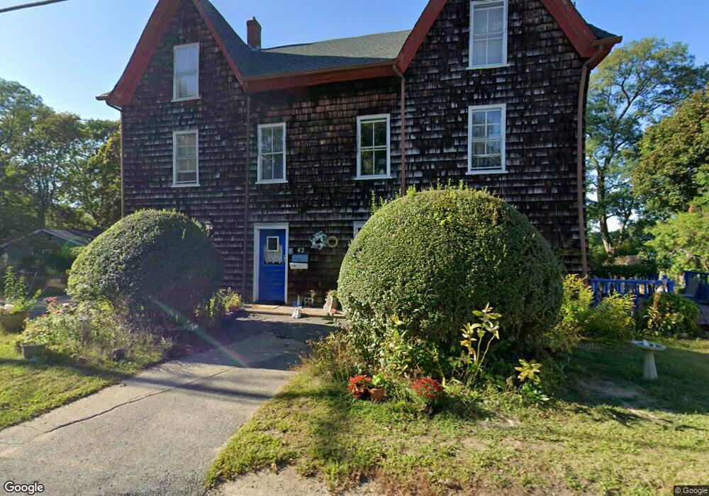
42 Langsford St Gloucester, MA 01930
Estimated Value: $873,581 - $1,072,000
5
Beds
3
Baths
2,402
Sq Ft
$405/Sq Ft
Est. Value
About This Home
This home is located at 42 Langsford St, Gloucester, MA 01930 and is currently estimated at $972,145, approximately $404 per square foot. 42 Langsford St is a home located in Essex County with nearby schools including Plum Cove School, Ralph B O'maley Middle School, and Gloucester High School.
Ownership History
Date
Name
Owned For
Owner Type
Purchase Details
Closed on
Sep 29, 2015
Sold by
Wonson Judith
Bought by
Wonson Judith and Wonson Michael S
Current Estimated Value
Purchase Details
Closed on
May 19, 2014
Sold by
Weigand Dorothy F
Bought by
Wonson Judith
Purchase Details
Closed on
Apr 16, 2004
Sold by
Wonson Judith
Bought by
Weigand Dorothy Fulford
Create a Home Valuation Report for This Property
The Home Valuation Report is an in-depth analysis detailing your home's value as well as a comparison with similar homes in the area
Purchase History
| Date | Buyer | Sale Price | Title Company |
|---|---|---|---|
| Wonson Judith | -- | -- | |
| Wonson Judith | -- | -- | |
| Weigand Dorothy Fulford | -- | -- |
Source: Public Records
Mortgage History
| Date | Status | Borrower | Loan Amount |
|---|---|---|---|
| Previous Owner | Weigand Dorothy Fulford | $50,000 |
Source: Public Records
Tax History
| Year | Tax Paid | Tax Assessment Tax Assessment Total Assessment is a certain percentage of the fair market value that is determined by local assessors to be the total taxable value of land and additions on the property. | Land | Improvement |
|---|---|---|---|---|
| 2025 | $6,835 | $703,200 | $217,500 | $485,700 |
| 2024 | $6,742 | $692,900 | $207,200 | $485,700 |
| 2023 | $6,447 | $608,800 | $185,000 | $423,800 |
| 2022 | $6,191 | $527,800 | $157,200 | $370,600 |
| 2021 | $5,970 | $479,900 | $142,900 | $337,000 |
| 2020 | $5,958 | $483,200 | $142,900 | $340,300 |
| 2019 | $5,722 | $450,900 | $142,900 | $308,000 |
| 2018 | $5,543 | $428,700 | $142,900 | $285,800 |
| 2017 | $5,368 | $407,000 | $136,200 | $270,800 |
| 2016 | $5,196 | $381,800 | $136,700 | $245,100 |
| 2015 | $4,951 | $362,700 | $136,700 | $226,000 |
Source: Public Records
Map
Nearby Homes
- 10 Emerald St
- 43 High St Unit B
- 7 Colburn St
- 13 Phillips Ave
- 32 Haven Ave
- 33 Quarry Ridge Ln Unit 33
- 5 Smith St Unit R
- 672 Washington St
- 1 Main St Unit R
- 1 Main St Unit C
- 1 Charte Ct
- 177 Main St
- 16 Hodgkins Rd Unit 2
- 27 Hodgkins Rd
- 4 Norwood Ave
- 226 Atlantic St
- 34R Summer St
- 2 Breezy Point Rd
- 2 Finch Ln
- 167 Atlantic St
- 44 Langsford St
- 3 Ships Bell Rd
- 4 Wishart Rd
- 39 Langsford St
- 37 Langsford St
- 37 Langsford St Unit B
- 37 Langsford St Unit A
- 2 Ships Bell Rd
- 41 Langsford St
- 6 Wishart Rd
- 43 Langsford St
- 5 Ships Bell Rd
- 46 Langsford St
- 45 Langsford St
- 17 Mclellan St
- 5 Wishart Rd
- 31 Langsford St
- 7 Wishart Rd
- 8 Wishart Rd
- 48 Langsford St
Your Personal Tour Guide
Ask me questions while you tour the home.