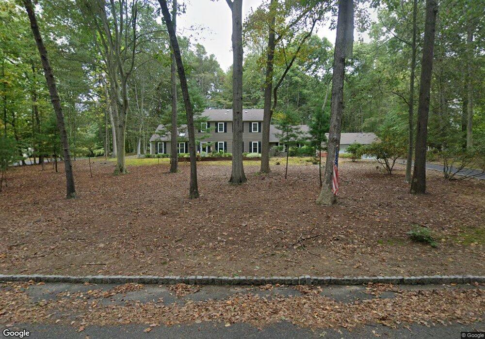
42 Laurel Brook Rd Lincroft, NJ 07738
Estimated Value: $1,017,586 - $1,099,000
4
Beds
3
Baths
2,536
Sq Ft
$418/Sq Ft
Est. Value
About This Home
This home is located at 42 Laurel Brook Rd, Lincroft, NJ 07738 and is currently estimated at $1,060,147, approximately $418 per square foot. 42 Laurel Brook Rd is a home located in Monmouth County with nearby schools including Lincroft Elementary School, Thompson Middle School, and Middletown - South High School.
Ownership History
Date
Name
Owned For
Owner Type
Purchase Details
Closed on
Apr 27, 2017
Sold by
Zide William J and Zide Carol T
Bought by
Baresh Pavel and Baresh Miriam
Current Estimated Value
Home Financials for this Owner
Home Financials are based on the most recent Mortgage that was taken out on this home.
Original Mortgage
$464,000
Outstanding Balance
$386,329
Interest Rate
4.23%
Mortgage Type
New Conventional
Estimated Equity
$673,818
Create a Home Valuation Report for This Property
The Home Valuation Report is an in-depth analysis detailing your home's value as well as a comparison with similar homes in the area
Home Values in the Area
Average Home Value in this Area
Purchase History
| Date | Buyer | Sale Price | Title Company |
|---|---|---|---|
| Baresh Pavel | $580,000 | None Available |
Source: Public Records
Mortgage History
| Date | Status | Borrower | Loan Amount |
|---|---|---|---|
| Open | Baresh Pavel | $464,000 |
Source: Public Records
Tax History Compared to Growth
Tax History
| Year | Tax Paid | Tax Assessment Tax Assessment Total Assessment is a certain percentage of the fair market value that is determined by local assessors to be the total taxable value of land and additions on the property. | Land | Improvement |
|---|---|---|---|---|
| 2025 | $14,553 | $926,900 | $422,400 | $504,500 |
| 2024 | $12,953 | $884,700 | $422,400 | $462,300 |
| 2023 | $12,953 | $745,300 | $351,700 | $393,600 |
| 2022 | $12,430 | $640,100 | $256,000 | $384,100 |
| 2021 | $12,430 | $597,600 | $256,000 | $341,600 |
| 2020 | $12,723 | $595,100 | $256,000 | $339,100 |
| 2019 | $12,526 | $593,100 | $256,000 | $337,100 |
| 2018 | $13,076 | $603,400 | $271,000 | $332,400 |
| 2017 | $13,581 | $639,400 | $281,000 | $358,400 |
| 2016 | $12,863 | $603,600 | $281,000 | $322,600 |
| 2015 | $12,807 | $599,600 | $281,000 | $318,600 |
| 2014 | $12,547 | $573,200 | $281,000 | $292,200 |
Source: Public Records
Map
Nearby Homes
- 185 Ballantine Rd
- 246 Sunnyside Rd
- 86 Stillwell Rd
- 234 Borden Rd
- 7 Cormorant Dr
- 20 Cormorant Dr
- 7 Mccampbell Rd
- 111 Crawfords Corner Rd
- 83 Green Meadow Blvd
- 911 Middletown Lincroft Rd
- 1476 W Front St
- 1497 W Front St
- 17 Spalding Dr
- 17 Terry Ln
- 7 Bordeaux Ln
- 23 Stratford Ln Unit 483
- 11 Jansky Dr
- 63 Eckert Dr
- 107 Lawley Dr
- 45 Galloping Hill Cir
- 34 Laurel Brook Rd
- 49 White Oak Ridge Rd
- 50 White Oak Ridge Rd
- 65 White Oak Ridge Rd
- 42 White Oak Ridge Rd
- 33 Laurel Brook Rd
- 59 Cypress Neck Rd
- 58 White Oak Ridge Rd
- 63 Cypress Neck Rd
- 30 Laurel Brook Rd
- 41 White Oak Ridge Rd
- 1 Walnut Hollow Ln
- 55 Cypress Neck Rd
- 73 White Oak Ridge Rd
- 9 Walnut Hollow Ln
- 25 Laurel Brook Rd
- 67 Cypress Neck Rd
- 81 White Oak Ridge Rd
- 51 Cypress Neck Rd
- 64 White Oak Ridge Rd