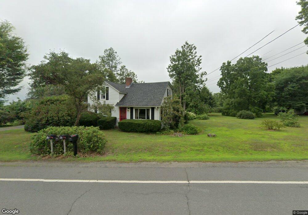
42 Long Plain Rd Leverett, MA 01054
Estimated Value: $349,000 - $473,000
3
Beds
1
Bath
1,515
Sq Ft
$273/Sq Ft
Est. Value
About This Home
This home is located at 42 Long Plain Rd, Leverett, MA 01054 and is currently estimated at $413,245, approximately $272 per square foot. 42 Long Plain Rd is a home located in Franklin County with nearby schools including Leverett Elementary School, Amherst Regional Middle School, and Amherst Regional High School.
Ownership History
Date
Name
Owned For
Owner Type
Purchase Details
Closed on
Jul 15, 2011
Sold by
Zuzgo Patricia A and Wrona Judith M
Bought by
Holesovsky Christine E and Holesovsky Nathaniel J
Current Estimated Value
Home Financials for this Owner
Home Financials are based on the most recent Mortgage that was taken out on this home.
Original Mortgage
$251,750
Outstanding Balance
$173,768
Interest Rate
4.58%
Mortgage Type
Purchase Money Mortgage
Estimated Equity
$239,477
Purchase Details
Closed on
Sep 26, 2008
Sold by
Kuzmeski Ft
Bought by
Wrona Judith Mae and Goscenski Linda Marie
Create a Home Valuation Report for This Property
The Home Valuation Report is an in-depth analysis detailing your home's value as well as a comparison with similar homes in the area
Home Values in the Area
Average Home Value in this Area
Purchase History
| Date | Buyer | Sale Price | Title Company |
|---|---|---|---|
| Holesovsky Christine E | $265,000 | -- | |
| Wrona Judith Mae | -- | -- |
Source: Public Records
Mortgage History
| Date | Status | Borrower | Loan Amount |
|---|---|---|---|
| Open | Holesovsky Christine E | $251,750 | |
| Previous Owner | Holesovsky Christine E | $140,000 |
Source: Public Records
Tax History
| Year | Tax Paid | Tax Assessment Tax Assessment Total Assessment is a certain percentage of the fair market value that is determined by local assessors to be the total taxable value of land and additions on the property. | Land | Improvement |
|---|---|---|---|---|
| 2025 | $5,233 | $344,700 | $73,600 | $271,100 |
| 2024 | $5,419 | $344,700 | $73,600 | $271,100 |
| 2023 | $5,580 | $348,300 | $85,100 | $263,200 |
| 2022 | $5,189 | $275,400 | $79,400 | $196,000 |
| 2021 | $5,262 | $266,700 | $75,700 | $191,000 |
| 2020 | $5,397 | $263,400 | $75,700 | $187,700 |
| 2019 | $5,314 | $254,400 | $66,700 | $187,700 |
| 2018 | $5,311 | $252,300 | $74,500 | $177,800 |
| 2017 | $5,286 | $252,300 | $74,500 | $177,800 |
| 2016 | $5,149 | $252,300 | $74,500 | $177,800 |
| 2015 | $5,016 | $252,300 | $74,500 | $177,800 |
Source: Public Records
Map
Nearby Homes
- 113 Juggler Meadow Rd
- 38 S Plain Rd
- 10 Depot Rd
- 6 Shattuck Rd
- 100 Depot Rd
- 12 Teawaddle Ln
- 167 Rolling Ridge Rd
- 3 Frost Ln
- Lot A Kingman Rd
- 185 Cherry Ln
- Lot A January Hills Rd
- Lot 3 Roosevelt St
- 60 Red Gate Ln
- 260 Montague Rd
- 0 Red Gate Ln Unit 73348273
- 242 N East St Unit 24
- 26 Falls Rd
- 174 Lincoln Ave
- 75 Amity Place Unit 75
- 63 Amity Place Unit 63
- 42 Long Plain Rd
- 52 Long Plain Rd
- 48 Long Plain Rd
- 1 Juggler Meadow Rd
- 43 Long Plain Rd
- 36 Long Plain Rd
- 8 Juggler Meadow Rd
- 37 Long Plain Rd
- 5 Old Long Plain Rd
- 16 Juggler Meadow Rd
- 33 Long Plain Rd
- 7 Old Long Plain Rd
- 20 Juggler Meadow Rd
- 5 Two Mile Rd
- 63 Long Plain Rd
- 18 Lead Mine Rd
- 10 Old Long Plain Rd
- 24 Juggler Meadow Rd
- 27 Juggler Meadow Rd
- 15 Drummer Hill Rd
Your Personal Tour Guide
Ask me questions while you tour the home.