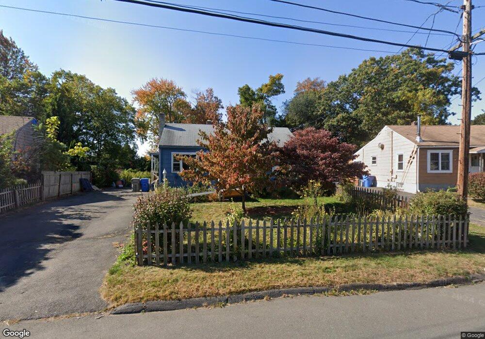
42 Morningside Dr W Bristol, CT 06010
Forestville NeighborhoodEstimated Value: $236,000 - $262,285
3
Beds
1
Bath
896
Sq Ft
$280/Sq Ft
Est. Value
About This Home
This home is located at 42 Morningside Dr W, Bristol, CT 06010 and is currently estimated at $251,321, approximately $280 per square foot. 42 Morningside Dr W is a home located in Hartford County with nearby schools including Northeast Middle School, Bristol Eastern High School, and St Matthew School.
Ownership History
Date
Name
Owned For
Owner Type
Purchase Details
Closed on
Jul 31, 2014
Sold by
Citimortgage Inc
Bought by
Faust Jennie
Current Estimated Value
Purchase Details
Closed on
May 2, 2014
Sold by
Alfieri Patricia A
Bought by
Citimortgage Inc
Purchase Details
Closed on
May 15, 2003
Sold by
Dallaire Bauloy T and Dallaire Rolad R
Bought by
Alfieri Patricia A
Create a Home Valuation Report for This Property
The Home Valuation Report is an in-depth analysis detailing your home's value as well as a comparison with similar homes in the area
Home Values in the Area
Average Home Value in this Area
Purchase History
| Date | Buyer | Sale Price | Title Company |
|---|---|---|---|
| Faust Jennie | $77,000 | -- | |
| Citimortgage Inc | -- | -- | |
| Alfieri Patricia A | $125,000 | -- |
Source: Public Records
Mortgage History
| Date | Status | Borrower | Loan Amount |
|---|---|---|---|
| Previous Owner | Alfieri Patricia A | $170,500 | |
| Previous Owner | Alfieri Patricia A | $43,300 | |
| Previous Owner | Alfieri Patricia A | $108,800 |
Source: Public Records
Tax History Compared to Growth
Tax History
| Year | Tax Paid | Tax Assessment Tax Assessment Total Assessment is a certain percentage of the fair market value that is determined by local assessors to be the total taxable value of land and additions on the property. | Land | Improvement |
|---|---|---|---|---|
| 2025 | $4,219 | $125,020 | $45,080 | $79,940 |
| 2024 | $3,948 | $123,970 | $45,080 | $78,890 |
| 2023 | $3,762 | $123,970 | $45,080 | $78,890 |
| 2022 | $3,573 | $93,170 | $36,610 | $56,560 |
| 2021 | $3,573 | $93,170 | $36,610 | $56,560 |
| 2020 | $3,573 | $93,170 | $36,610 | $56,560 |
| 2019 | $3,545 | $93,170 | $36,610 | $56,560 |
| 2018 | $3,436 | $93,170 | $36,610 | $56,560 |
| 2017 | $3,052 | $84,700 | $31,850 | $52,850 |
| 2016 | $3,052 | $84,700 | $31,850 | $52,850 |
| 2015 | $2,931 | $84,700 | $31,850 | $52,850 |
| 2014 | $2,931 | $84,700 | $31,850 | $52,850 |
Source: Public Records
Map
Nearby Homes
- 58 Matilda Dr
- 73 Carol Dr
- 437 Stafford Ave
- 79 Beths Ave Unit 100
- 52 Barbara Rd
- 31 Morris Ave
- 163 Mark St
- 107 Brace Ave
- 27 Adeline Ave
- 30 Adeline Ave
- 35 Ruth St Unit 45
- 36 Douglas Rd
- 3 Sandra St
- 123 Garfield Rd
- 115 Garfield Rd
- 245 Mark St
- 73 Grove Ave
- 1325 Farmington Ave Unit 8
- 1325 Farmington Ave Unit 52
- 1325 Farmington Ave Unit 2
- 52 Morningside Dr W
- 41 Morningside Dr W
- 15 Pine Ct
- 29 Morningside Dr W
- 47 Morningside Dr W
- 30 Morningside Dr W
- 11 Pine Ct
- 155 Carol Dr
- 58 Morningside Dr W
- 53 Morningside Dr W
- 149 Carol Dr
- 6 Pine Ct
- 10 Pine Ct
- 63 Morningside Dr W
- 55 Brookside Dr
- 62 Morningside Dr W
- 21 Morningside Dr W
- 51 Brookside Dr
- 14 Pine Ct