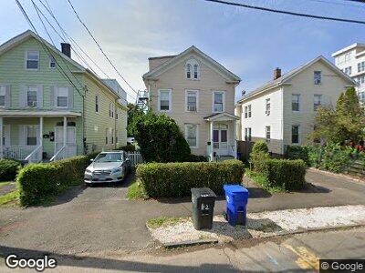
42 Orchard St Norwalk, CT 06850
Downtown Norwalk NeighborhoodEstimated Value: $537,000 - $841,000
4
Beds
2
Baths
2,509
Sq Ft
$260/Sq Ft
Est. Value
About This Home
This home is located at 42 Orchard St, Norwalk, CT 06850 and is currently estimated at $652,557, approximately $260 per square foot. 42 Orchard St is a home located in Fairfield County with nearby schools including Tracey School, West Rocks Middle School, and Norwalk High School.
Ownership History
Date
Name
Owned For
Owner Type
Purchase Details
Closed on
Dec 19, 2000
Sold by
Turner-Carter Alicia
Bought by
Turner David
Current Estimated Value
Home Financials for this Owner
Home Financials are based on the most recent Mortgage that was taken out on this home.
Original Mortgage
$182,500
Outstanding Balance
$79,834
Interest Rate
7.7%
Estimated Equity
$607,688
Create a Home Valuation Report for This Property
The Home Valuation Report is an in-depth analysis detailing your home's value as well as a comparison with similar homes in the area
Home Values in the Area
Average Home Value in this Area
Purchase History
| Date | Buyer | Sale Price | Title Company |
|---|---|---|---|
| Turner David | $185,000 | -- | |
| Turner David | $185,000 | -- |
Source: Public Records
Mortgage History
| Date | Status | Borrower | Loan Amount |
|---|---|---|---|
| Open | Turner David | $182,500 | |
| Closed | Turner David | $182,500 | |
| Closed | Turner David | $5,500 |
Source: Public Records
Tax History Compared to Growth
Tax History
| Year | Tax Paid | Tax Assessment Tax Assessment Total Assessment is a certain percentage of the fair market value that is determined by local assessors to be the total taxable value of land and additions on the property. | Land | Improvement |
|---|---|---|---|---|
| 2024 | $9,502 | $403,580 | $137,590 | $265,990 |
| 2023 | $6,964 | $277,590 | $108,110 | $169,480 |
| 2022 | $6,813 | $277,590 | $108,110 | $169,480 |
| 2021 | $6,654 | $277,590 | $108,110 | $169,480 |
| 2020 | $6,650 | $277,590 | $108,110 | $169,480 |
| 2019 | $6,472 | $277,590 | $108,110 | $169,480 |
| 2018 | $5,581 | $209,760 | $112,140 | $97,620 |
| 2017 | $5,387 | $209,760 | $112,140 | $97,620 |
| 2016 | $5,336 | $209,760 | $112,140 | $97,620 |
| 2015 | $5,322 | $209,760 | $112,140 | $97,620 |
| 2014 | $5,253 | $209,760 | $112,140 | $97,620 |
Source: Public Records
Map
Nearby Homes
- 30 Merwin St Unit 6
- 30 Merwin St Unit 10
- 142 East Ave Unit A101
- 142 East Ave Unit 303
- 22 Leonard St
- 19 Isaacs St Unit 301
- 29 Van Buren Ave Unit L6
- 29 Van Buren Ave Unit H2
- 2 Olmstead Place
- 30-32-34 Charles St
- 1 Armstrong Ct
- 51 Fort Point St
- 39 Olmstead Place
- 9 Park St Unit 2A (door 201)
- 12 Magnolia Ave
- 19 Fairview Ave Unit A
- 0 Highway 7 Unit 160027
- 35 Magnolia Ave
- 32 Pine St Unit 6
- 32 Pine St Unit 23
- 42 Orchard St
- 40 Orchard St
- 44 Orchard St
- 46 Orchard St
- 38 Orchard St
- 36 Orchard St
- 36 Orchard St Unit 1
- 34 Orchard St
- 131 Harbor Ave Unit 1
- 131 Harbor Ave Unit 2
- 131 Harbor Ave Unit 3
- 131 Harbor Ave Unit 13
- 131 Harbor Ave Unit 4
- 129 Harbor Ave Unit 11
- 129 Harbor Ave Unit 16
- 129 Harbor Ave Unit 15
- 129 Harbor Ave Unit 10
- 129 Harbor Ave Unit 7
- 129 Harbor Ave Unit 9
- 129 Harbor Ave Unit 14