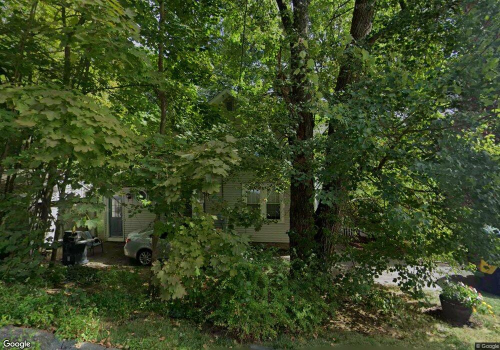
42 Raymond Ave Holyoke, MA 01040
Estimated Value: $285,000 - $311,852
3
Beds
3
Baths
1,588
Sq Ft
$186/Sq Ft
Est. Value
About This Home
This home is located at 42 Raymond Ave, Holyoke, MA 01040 and is currently estimated at $294,963, approximately $185 per square foot. 42 Raymond Ave is a home located in Hampden County with nearby schools including Lt. Clayre Sullivan Elementary School, Holyoke High School, and First Lutheran Christian School.
Ownership History
Date
Name
Owned For
Owner Type
Purchase Details
Closed on
Apr 25, 2008
Sold by
Dulaski Daniel M
Bought by
Dulaski Michael D
Current Estimated Value
Home Financials for this Owner
Home Financials are based on the most recent Mortgage that was taken out on this home.
Original Mortgage
$155,000
Interest Rate
6.22%
Mortgage Type
Purchase Money Mortgage
Purchase Details
Closed on
Sep 18, 2001
Sold by
Lambert Thomas J and Lambert Aline J
Bought by
Dulaski Daniel M
Home Financials for this Owner
Home Financials are based on the most recent Mortgage that was taken out on this home.
Original Mortgage
$103,550
Interest Rate
6.99%
Mortgage Type
Purchase Money Mortgage
Create a Home Valuation Report for This Property
The Home Valuation Report is an in-depth analysis detailing your home's value as well as a comparison with similar homes in the area
Home Values in the Area
Average Home Value in this Area
Purchase History
| Date | Buyer | Sale Price | Title Company |
|---|---|---|---|
| Dulaski Michael D | $165,000 | -- | |
| Dulaski Daniel M | $109,000 | -- |
Source: Public Records
Mortgage History
| Date | Status | Borrower | Loan Amount |
|---|---|---|---|
| Open | Dulaski Daniel M | $148,000 | |
| Closed | Dulaski Michael D | $155,000 | |
| Previous Owner | Dulaski Daniel M | $103,550 | |
| Previous Owner | Dulaski Daniel M | $81,500 | |
| Previous Owner | Dulaski Daniel M | $80,000 |
Source: Public Records
Tax History Compared to Growth
Tax History
| Year | Tax Paid | Tax Assessment Tax Assessment Total Assessment is a certain percentage of the fair market value that is determined by local assessors to be the total taxable value of land and additions on the property. | Land | Improvement |
|---|---|---|---|---|
| 2025 | $4,185 | $239,700 | $49,500 | $190,200 |
| 2024 | $3,936 | $207,700 | $47,300 | $160,400 |
| 2023 | $3,765 | $200,700 | $47,300 | $153,400 |
| 2022 | $3,607 | $187,300 | $47,300 | $140,000 |
| 2021 | $4,679 | $175,600 | $43,100 | $132,500 |
| 2020 | $3,205 | $168,000 | $43,100 | $124,900 |
| 2019 | $3,192 | $165,500 | $43,100 | $122,400 |
| 2018 | $4,477 | $142,600 | $43,100 | $99,500 |
| 2017 | $2,734 | $142,600 | $43,100 | $99,500 |
| 2016 | $2,684 | $140,400 | $44,300 | $96,100 |
| 2015 | $2,673 | $140,400 | $44,300 | $96,100 |
Source: Public Records
Map
Nearby Homes
- 43 Woods Ave
- 1705-1707 Northampton St
- 1678 Northampton St
- 68 Shawmut Ave
- 15 Chapman Ave
- 1793 Northampton St
- 267-269 Sargeant St
- 268-270 Sargeant St
- 12 Saint James Ave
- 23 Scott Hollow Dr
- 1225 Hampden St
- 46 Cherry Hill
- 1421 Dwight St
- 1114 Hampden St
- 9-11 Arlington St
- 165 Lincoln St
- 201 Locust St
- 68 Fairfield Ave
- 34 Maple Crest Cir Unit D
- 16 Maple Crest Cir Unit B
- 50 Raymond Ave
- Lot 3 Raymond Ave
- 51 Francis Ave
- 26 Raymond Ave
- 55 Francis Ave
- 47 Francis Ave
- 33 Raymond Ave
- 25 Raymond Ave
- 49 Raymond Ave
- 51 Raymond Ave
- 37 Francis Ave
- 67 Francis Ave
- 19 Raymond Ave
- 33 Francis Ave
- 50 Francis Ave
- 56 Francis Ave
- 15 Raymond Ave
- 62 Francis Ave
- 60 Francis Ave
- 46 Francis Ave