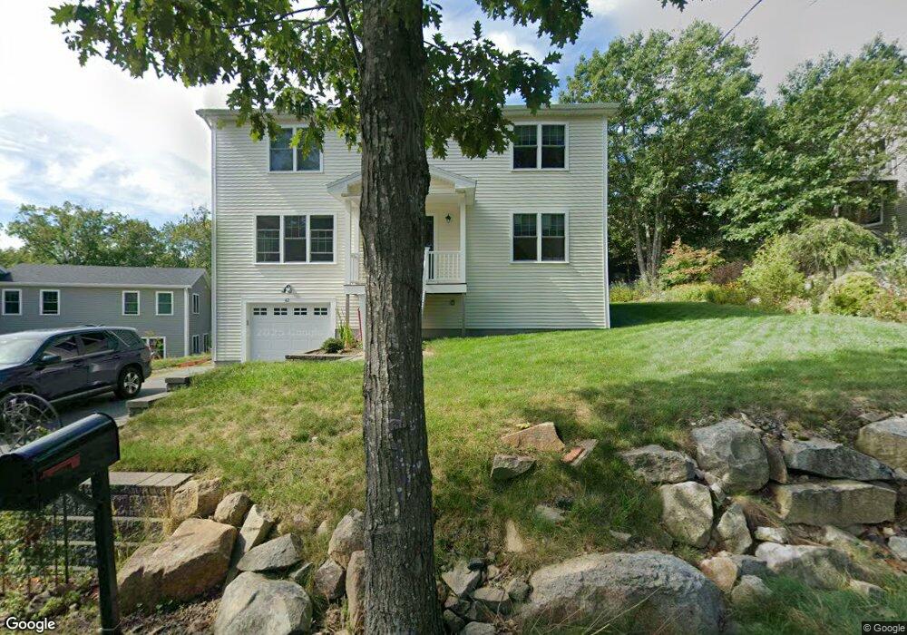
42 Riverview Rd Gloucester, MA 01930
Riverview NeighborhoodEstimated Value: $765,000 - $815,000
3
Beds
3
Baths
1,408
Sq Ft
$556/Sq Ft
Est. Value
About This Home
This home is located at 42 Riverview Rd, Gloucester, MA 01930 and is currently estimated at $783,080, approximately $556 per square foot. 42 Riverview Rd is a home located in Essex County with nearby schools including Beeman Memorial, Ralph B O'maley Middle School, and Gloucester High School.
Ownership History
Date
Name
Owned For
Owner Type
Purchase Details
Closed on
Jan 5, 2026
Sold by
Lemoine Elen F and Lemoine William J
Bought by
Silva Tiffany A
Current Estimated Value
Home Financials for this Owner
Home Financials are based on the most recent Mortgage that was taken out on this home.
Original Mortgage
$425,000
Outstanding Balance
$425,000
Interest Rate
6.26%
Mortgage Type
New Conventional
Estimated Equity
$358,080
Purchase Details
Closed on
Jun 12, 2014
Sold by
Carrigan Development L
Bought by
Scott Real Estate Llc
Home Financials for this Owner
Home Financials are based on the most recent Mortgage that was taken out on this home.
Original Mortgage
$756,000
Interest Rate
4.27%
Mortgage Type
Commercial
Create a Home Valuation Report for This Property
The Home Valuation Report is an in-depth analysis detailing your home's value as well as a comparison with similar homes in the area
Home Values in the Area
Average Home Value in this Area
Purchase History
| Date | Buyer | Sale Price | Title Company |
|---|---|---|---|
| Silva Tiffany A | $785,000 | -- | |
| Scott Real Estate Llc | $270,000 | -- |
Source: Public Records
Mortgage History
| Date | Status | Borrower | Loan Amount |
|---|---|---|---|
| Open | Silva Tiffany A | $425,000 | |
| Previous Owner | Scott Real Estate Llc | $756,000 |
Source: Public Records
Tax History
| Year | Tax Paid | Tax Assessment Tax Assessment Total Assessment is a certain percentage of the fair market value that is determined by local assessors to be the total taxable value of land and additions on the property. | Land | Improvement |
|---|---|---|---|---|
| 2025 | $5,740 | $590,500 | $245,700 | $344,800 |
| 2024 | $5,839 | $600,100 | $234,000 | $366,100 |
| 2023 | $5,531 | $522,300 | $208,900 | $313,400 |
| 2022 | $5,142 | $438,400 | $177,600 | $260,800 |
| 2021 | $5,036 | $404,800 | $161,500 | $243,300 |
| 2020 | $4,990 | $404,700 | $161,500 | $243,200 |
| 2019 | $5,062 | $398,900 | $161,500 | $237,400 |
| 2018 | $4,838 | $374,200 | $161,500 | $212,700 |
| 2017 | $4,582 | $347,400 | $153,800 | $193,600 |
| 2016 | $4,524 | $332,400 | $154,300 | $178,100 |
| 2015 | $4,364 | $319,700 | $154,300 | $165,400 |
Source: Public Records
Map
Nearby Homes
- 13 Honeysuckle Rd
- 3 Deacon Farm Ln
- 31 Echo Ave
- 2 Breezy Point Rd
- 5 Samoset Rd Unit B
- 145 Essex Ave Unit 402
- 6 Monroe Ct
- 24 Cobblestone Ln Unit 603
- 5 Lepage Ln
- 13 Mystic Ave
- 8 Mystic Ave
- 167 Atlantic St
- 98 Maplewood Ave
- 15 Harvard St
- 178 Atlantic St
- 9 Cleveland Place
- 12 Arthur St
- 40 Sargent St
- 20 Beacon St
- 20 Beacon St Unit 2
- 38 Riverview Rd Unit 1
- 40 Riverview Rd
- 38 Riverview Rd
- 44 Riverview Rd
- 46 Riverview Rd
- 35 Riverview Rd
- 10 Riverview Way Unit 10A
- 10 Riverview Way Unit B
- 10 Riverview Way Unit A
- 10B Riverview Way Unit B
- 10B Riverview Way Unit B-D
- 8 Riverview Way Unit B
- 8 Riverview Way Unit A
- 35 Riverview Rd
- 41 Riverview Rd Unit 2
- 41 Riverview Rd Unit 1
- 41 Riverview Rd
- 50 Riverview Rd
- 6 Riverview Way Unit B
- 6 Riverview Way Unit A
Your Personal Tour Guide
Ask me questions while you tour the home.