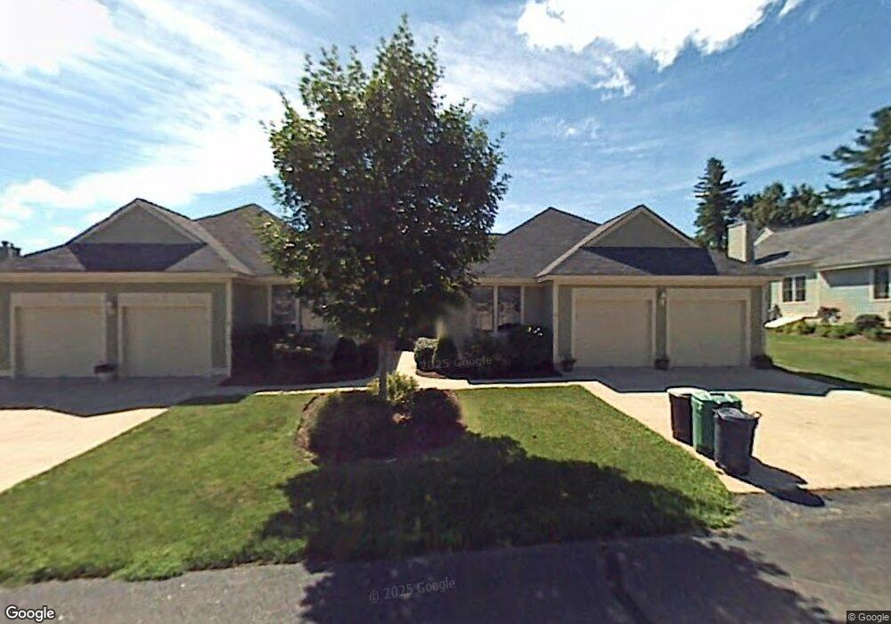
42 Saint Andrews Dr Bedford, NH 03110
Bedford NeighborhoodEstimated Value: $829,000 - $858,000
3
Beds
2
Baths
1,826
Sq Ft
$461/Sq Ft
Est. Value
About This Home
This home is located at 42 Saint Andrews Dr, Bedford, NH 03110 and is currently estimated at $842,162, approximately $461 per square foot. 42 Saint Andrews Dr is a home located in Hillsborough County with nearby schools including Mckelvie Intermediate School, Ross A. Lurgio Middle School, and Bedford High School.
Ownership History
Date
Name
Owned For
Owner Type
Purchase Details
Closed on
Oct 28, 2003
Sold by
Coors Darden K
Bought by
Woods Penny L
Current Estimated Value
Purchase Details
Closed on
Jan 24, 2001
Sold by
Thurston Katherine A
Bought by
Coors Darden K
Purchase Details
Closed on
Aug 8, 2000
Sold by
Thompson Assoc I Peter
Bought by
Thurston Katherine A
Create a Home Valuation Report for This Property
The Home Valuation Report is an in-depth analysis detailing your home's value as well as a comparison with similar homes in the area
Home Values in the Area
Average Home Value in this Area
Purchase History
| Date | Buyer | Sale Price | Title Company |
|---|---|---|---|
| Woods Penny L | $336,000 | -- | |
| Coors Darden K | $255,900 | -- | |
| Thurston Katherine A | $241,300 | -- |
Source: Public Records
Mortgage History
| Date | Status | Borrower | Loan Amount |
|---|---|---|---|
| Open | Thurston Katherine A | $50,000 | |
| Open | Thurston Katherine A | $145,000 | |
| Closed | Thurston Katherine A | $158,500 |
Source: Public Records
Tax History Compared to Growth
Tax History
| Year | Tax Paid | Tax Assessment Tax Assessment Total Assessment is a certain percentage of the fair market value that is determined by local assessors to be the total taxable value of land and additions on the property. | Land | Improvement |
|---|---|---|---|---|
| 2024 | $10,697 | $676,600 | $0 | $676,600 |
| 2023 | $10,014 | $676,600 | $0 | $676,600 |
| 2022 | $9,629 | $547,100 | $0 | $547,100 |
| 2021 | $9,377 | $547,100 | $0 | $547,100 |
| 2020 | $8,895 | $444,300 | $0 | $444,300 |
| 2019 | $8,419 | $444,300 | $0 | $444,300 |
| 2018 | $8,809 | $431,800 | $0 | $431,800 |
| 2017 | $8,165 | $431,800 | $0 | $431,800 |
| 2016 | $6,852 | $306,300 | $0 | $306,300 |
| 2015 | $6,971 | $306,300 | $0 | $306,300 |
| 2014 | $6,892 | $306,300 | $0 | $306,300 |
| 2013 | $6,791 | $306,300 | $0 | $306,300 |
Source: Public Records
Map
Nearby Homes
- 29 Pebble Beach Dr
- 15 Spyglass Point Cir
- 20 Pebble Beach Dr Unit 22-89-20
- 12 Knoll Crest Dr Unit Lot 5 - The Hannah
- 82 Pilgrim Dr
- 34 Briston Ct
- 10 Pimlico Ct Unit UN66
- 112 Riverdale Ave
- 32 Puritan Dr
- 3 Churchill Ct Unit UN111
- 80 Wendover Way
- 412 W Mitchell St
- 20 Liberty Hill Rd
- 545 Calef Rd Unit 26
- 60 Geneva St
- 46 Geneva St
- 197 Liberty Hill Rd
- 145 Fox St
- 80 Billings St
- 139 Dunbar St
- 44 Saint Andrews Dr
- 4 St Andrews Dr
- 27 St Andrews Dr Unit 27
- 5 Turnberry Cir Unit 5
- 41 St Andrews Dr
- 9 Pebble Beach Dr
- 40 Saint Andrews Dr
- 4 Augusta National Dr
- 2 Augusta National Dr
- 6 Augusta National Dr
- 3 Augusta National Dr
- 1 Augusta National Dr
- 47 Pebble Beach Dr
- 4 Saint Andrews Dr
- 11 Muirfield Rd
- 9 Muirfield Rd
- 7 Muirfield Rd
- 5 Muirfield Rd
- 3 Muirfield Rd
- 2 Muirfield Rd