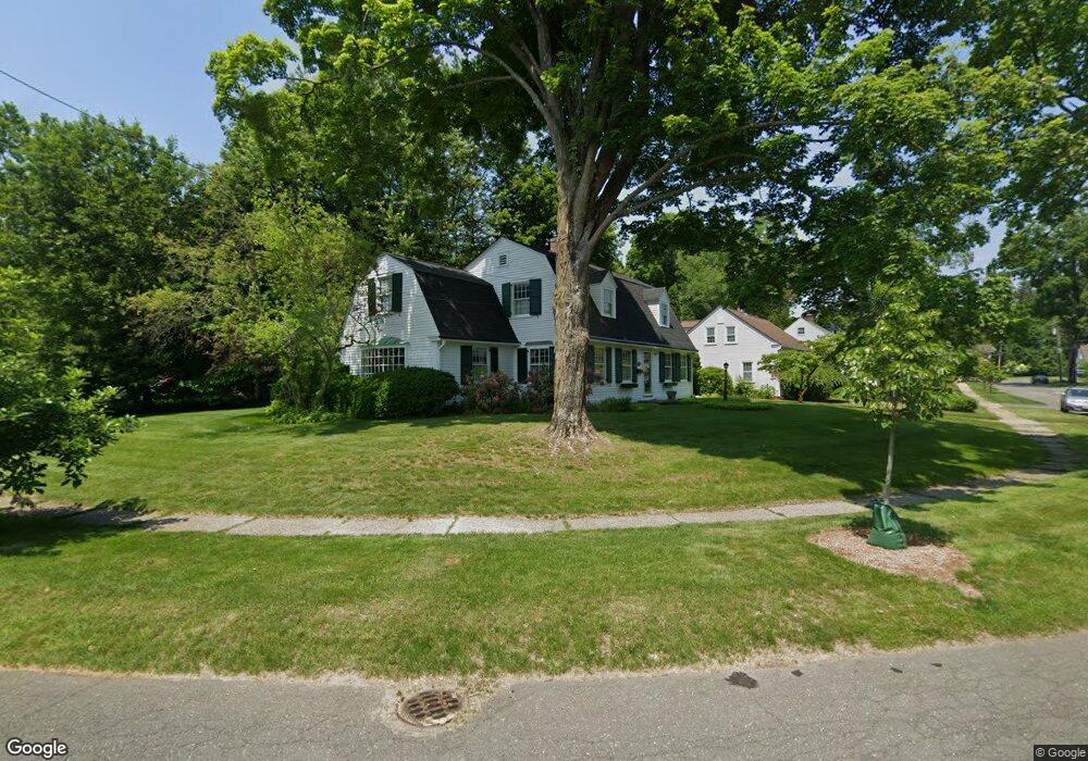
42 Summit Ave Longmeadow, MA 01106
Estimated Value: $447,000 - $511,000
3
Beds
3
Baths
2,080
Sq Ft
$230/Sq Ft
Est. Value
About This Home
This home is located at 42 Summit Ave, Longmeadow, MA 01106 and is currently estimated at $477,385, approximately $229 per square foot. 42 Summit Ave is a home located in Hampden County with nearby schools including Center Elementary School, Glenbrook Middle School, and Longmeadow High School.
Ownership History
Date
Name
Owned For
Owner Type
Purchase Details
Closed on
Oct 24, 1997
Sold by
Phillips Peter J and Phillips Linda Smith
Bought by
Jarocki Ii Stanley A
Current Estimated Value
Home Financials for this Owner
Home Financials are based on the most recent Mortgage that was taken out on this home.
Original Mortgage
$108,000
Outstanding Balance
$17,397
Interest Rate
7.48%
Mortgage Type
Purchase Money Mortgage
Estimated Equity
$459,988
Create a Home Valuation Report for This Property
The Home Valuation Report is an in-depth analysis detailing your home's value as well as a comparison with similar homes in the area
Home Values in the Area
Average Home Value in this Area
Purchase History
| Date | Buyer | Sale Price | Title Company |
|---|---|---|---|
| Jarocki Ii Stanley A | $216,000 | -- |
Source: Public Records
Mortgage History
| Date | Status | Borrower | Loan Amount |
|---|---|---|---|
| Open | Jarocki Ii Stanley A | $108,000 |
Source: Public Records
Tax History Compared to Growth
Tax History
| Year | Tax Paid | Tax Assessment Tax Assessment Total Assessment is a certain percentage of the fair market value that is determined by local assessors to be the total taxable value of land and additions on the property. | Land | Improvement |
|---|---|---|---|---|
| 2025 | $7,398 | $350,300 | $164,200 | $186,100 |
| 2024 | $7,244 | $350,300 | $164,200 | $186,100 |
| 2023 | $7,511 | $327,700 | $149,600 | $178,100 |
| 2022 | $7,375 | $299,300 | $149,600 | $149,700 |
| 2021 | $8,743 | $353,400 | $142,500 | $210,900 |
| 2020 | $8,454 | $349,200 | $142,500 | $206,700 |
| 2019 | $8,061 | $334,600 | $142,500 | $192,100 |
| 2018 | $7,618 | $313,000 | $162,100 | $150,900 |
| 2017 | $7,381 | $313,000 | $162,100 | $150,900 |
| 2016 | $6,983 | $287,000 | $145,300 | $141,700 |
| 2015 | $6,744 | $285,500 | $143,800 | $141,700 |
Source: Public Records
Map
Nearby Homes
- 117 Crescent Rd
- 0 Mill Rd
- Lot 114 Bark Haul Rd
- 1423 Longmeadow St
- 124 Longfellow Dr
- 70 Tennyson Dr
- 1636 Longmeadow St
- 0 Dennis Rd
- 41 Dennis Rd
- 95 Albemarle Rd
- 1705 Longmeadow St
- 2 Nevins Ave
- 60 Roosevelt Blvd
- 35 Plymouth Rd
- 408 Maple Rd
- 43 Sword Ave
- 27 Booth St
- 61 Prynne Ridge Rd
- 124 Tecumseh Dr
- 49 Booth Rd
- 64 Sylvan Place
- 60 Summit Ave
- 56 Sylvan Place
- 129 Longview Dr
- 33 Summit Ave
- 27 Summit Ave
- 43 Summit Ave
- 51 Summit Ave
- 59 Summit Ave
- 48 Sylvan Place
- 53 Sylvan Place
- 105 Longview Dr
- 207 Longview Dr
- 40 Sylvan Place
- 213 Longview Dr
- 45 Sylvan Place
- 5 Summit Ave
- 1198 Longmeadow St
- 140 Longview Dr
- 93 Longview Dr