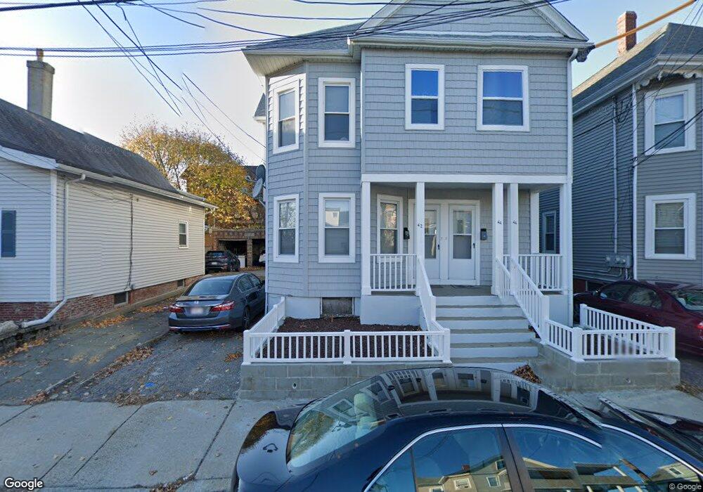
42 Trull St Somerville, MA 02145
Magoun Square NeighborhoodEstimated Value: $946,000 - $1,102,000
5
Beds
2
Baths
2,340
Sq Ft
$442/Sq Ft
Est. Value
About This Home
This home is located at 42 Trull St, Somerville, MA 02145 and is currently estimated at $1,034,993, approximately $442 per square foot. 42 Trull St is a home located in Middlesex County with nearby schools including Somerville High School and Saint Theresa School.
Ownership History
Date
Name
Owned For
Owner Type
Purchase Details
Closed on
Jul 29, 1991
Sold by
Heyward Robert E and Heyward Elaine J
Bought by
Brunache Emmanuel and Brunache Marie G
Current Estimated Value
Home Financials for this Owner
Home Financials are based on the most recent Mortgage that was taken out on this home.
Original Mortgage
$155,250
Interest Rate
9.58%
Mortgage Type
Purchase Money Mortgage
Create a Home Valuation Report for This Property
The Home Valuation Report is an in-depth analysis detailing your home's value as well as a comparison with similar homes in the area
Home Values in the Area
Average Home Value in this Area
Purchase History
| Date | Buyer | Sale Price | Title Company |
|---|---|---|---|
| Brunache Emmanuel | $172,500 | -- |
Source: Public Records
Mortgage History
| Date | Status | Borrower | Loan Amount |
|---|---|---|---|
| Closed | Brunache Emmanuel | $155,250 |
Source: Public Records
Tax History Compared to Growth
Tax History
| Year | Tax Paid | Tax Assessment Tax Assessment Total Assessment is a certain percentage of the fair market value that is determined by local assessors to be the total taxable value of land and additions on the property. | Land | Improvement |
|---|---|---|---|---|
| 2025 | $8,930 | $818,500 | $488,100 | $330,400 |
| 2024 | $8,428 | $801,100 | $488,100 | $313,000 |
| 2023 | $8,230 | $795,900 | $488,100 | $307,800 |
| 2022 | $7,599 | $746,500 | $464,800 | $281,700 |
| 2021 | $7,223 | $708,800 | $442,700 | $266,100 |
| 2020 | $6,927 | $686,500 | $425,700 | $260,800 |
| 2019 | $6,227 | $578,700 | $361,300 | $217,400 |
| 2018 | $6,761 | $597,800 | $348,500 | $249,300 |
| 2017 | $6,454 | $553,000 | $325,000 | $228,000 |
| 2016 | $6,537 | $521,700 | $281,000 | $240,700 |
| 2015 | $6,142 | $487,100 | $250,600 | $236,500 |
Source: Public Records
Map
Nearby Homes
- 301 Lowell Street Condo Unit 31
- 303 Lowell St Unit 1
- 466 Medford St Unit 4
- 496 Medford St
- 35 Richardson St Unit 2
- 35 Richardson St Unit 4
- 35 Richardson St Unit 1
- 35 Richardson St Unit Cottage
- 456 Medford St Unit 3
- 79 Partridge Ave
- 32 Richardson St
- 3 Vinal St
- 7 Woodbine St
- 10 Roberts St Unit 14
- 34 Fiske Ave Unit C
- 34 Fiske Ave Unit B
- 34 Fiske Ave Unit A
- 474 Broadway Unit 26
- 441 Broadway
- 8 Albion Terrace
- 46 Trull St
- 38 Trull St
- 48 Trull St
- 36 Trull St
- 36 Trull St Unit 1
- 36 Trull St Unit 2
- 50 Trull St
- 32 Trull St Unit 1
- 32 Trull St
- 34 Trull St Unit 34
- 34 Trull St Unit 2
- 319 Lowell St
- 39 Trull St Unit 2
- 41 Trull St
- 41 Trull St Unit 41-43 #2
- 37 Trull St
- 43 Trull St
- 47 Trull St Unit A
- 45 Trull St Unit 3
- 47 Trull St Unit 2