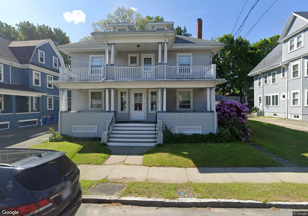
42 Waldemar Ave Winthrop, MA 02152
Downtown Winthrop NeighborhoodEstimated Value: $844,000 - $1,246,000
6
Beds
2
Baths
3,238
Sq Ft
$325/Sq Ft
Est. Value
About This Home
This home is located at 42 Waldemar Ave, Winthrop, MA 02152 and is currently estimated at $1,053,222, approximately $325 per square foot. 42 Waldemar Ave is a home located in Suffolk County with nearby schools including William P. Gorman/Fort Banks Elementary School, Arthur T. Cummings Elementary School, and Winthrop Middle School.
Ownership History
Date
Name
Owned For
Owner Type
Purchase Details
Closed on
Sep 27, 1995
Sold by
Cash Thomas D and Cash Irene M
Bought by
Mazzone Mario J and Mazzone Maria J
Current Estimated Value
Purchase Details
Closed on
Apr 23, 1991
Sold by
Hunter John M and Haley Richard F
Bought by
Cash Thomas D and Cash Irene M
Create a Home Valuation Report for This Property
The Home Valuation Report is an in-depth analysis detailing your home's value as well as a comparison with similar homes in the area
Home Values in the Area
Average Home Value in this Area
Purchase History
| Date | Buyer | Sale Price | Title Company |
|---|---|---|---|
| Mazzone Mario J | $210,000 | -- | |
| Cash Thomas D | $210,000 | -- |
Source: Public Records
Mortgage History
| Date | Status | Borrower | Loan Amount |
|---|---|---|---|
| Open | Cash Thomas D | $175,000 | |
| Closed | Cash Thomas D | $266,500 |
Source: Public Records
Tax History Compared to Growth
Tax History
| Year | Tax Paid | Tax Assessment Tax Assessment Total Assessment is a certain percentage of the fair market value that is determined by local assessors to be the total taxable value of land and additions on the property. | Land | Improvement |
|---|---|---|---|---|
| 2025 | $10,038 | $972,700 | $452,000 | $520,700 |
| 2024 | $9,007 | $864,400 | $434,400 | $430,000 |
| 2023 | $9,727 | $909,100 | $397,600 | $511,500 |
| 2022 | $9,566 | $813,400 | $354,600 | $458,800 |
| 2021 | $9,352 | $737,500 | $316,700 | $420,800 |
| 2020 | $9,122 | $722,800 | $316,700 | $406,100 |
| 2019 | $8,968 | $680,400 | $291,800 | $388,600 |
| 2018 | $8,931 | $630,700 | $250,500 | $380,200 |
| 2017 | $8,394 | $582,500 | $238,900 | $343,600 |
| 2016 | $7,960 | $517,900 | $207,800 | $310,100 |
| 2015 | $7,077 | $493,500 | $201,700 | $291,800 |
| 2014 | $6,349 | $407,500 | $155,300 | $252,200 |
Source: Public Records
Map
Nearby Homes
- 35 Somerset Ave Unit 6
- 70 Edgehill Rd
- 10 Somerset Ave Unit 405
- 10 Somerset Ave Unit 403
- 10 Somerset Ave Unit 404
- 10 Somerset Ave Unit 408
- 10 Somerset Ave Unit 201
- 10 Somerset Ave Unit 211
- 10 Somerset Ave Unit 206
- 105 Circuit Rd
- 62 Lowell Rd
- 66 Lowell Rd
- 47 Bellevue Ave
- 34 Fremont St
- 142 Pleasant St Unit 12
- 142 Pleasant St Unit 2
- 9 Marshall St
- 170 Cottage Park Rd
- 174 Winthrop St Unit 2
- 87 Hermon St
- 36 Waldemar Ave
- 48-50 Waldemar Ave
- 48 Waldemar Ave Unit 50
- 48 Waldemar Ave Unit 1
- 50 Waldemar Ave Unit 2
- 50 Waldemar Ave Unit 1
- 30 Waldemar Ave
- 173 Pauline St
- 52 Waldemar Ave
- 179 Pauline St
- 177 Pauline St
- 177 Pauline St Unit 2
- 177 Pauline St Unit 1
- 169 Pauline St
- 169 Pauline St Unit 1
- 56 Waldemar Ave
- 39 Waldemar Ave
- 45 Waldemar Ave Unit 2
- 45 Waldemar Ave Unit 1
- 14 Waldemar Ave