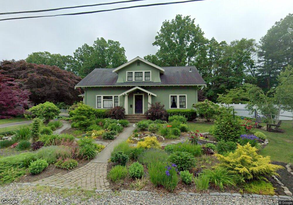
42 Woodside Ave Brockton, MA 02301
Campello NeighborhoodEstimated Value: $598,000 - $637,000
3
Beds
2
Baths
2,332
Sq Ft
$266/Sq Ft
Est. Value
About This Home
This home is located at 42 Woodside Ave, Brockton, MA 02301 and is currently estimated at $619,757, approximately $265 per square foot. 42 Woodside Ave is a home located in Plymouth County with nearby schools including Davis K-8 School, John F. Kennedy Elementary School, and South Middle School.
Ownership History
Date
Name
Owned For
Owner Type
Purchase Details
Closed on
Aug 14, 2015
Sold by
Centamore Stephen G and Centamore Donna M
Bought by
Segal Wolf M and Griffin Carol M
Current Estimated Value
Home Financials for this Owner
Home Financials are based on the most recent Mortgage that was taken out on this home.
Original Mortgage
$272,000
Outstanding Balance
$206,144
Interest Rate
3%
Mortgage Type
Adjustable Rate Mortgage/ARM
Estimated Equity
$413,613
Purchase Details
Closed on
Jan 29, 1999
Sold by
Conroy Ft
Bought by
Centamore Stephen G and Centamore Donna M
Create a Home Valuation Report for This Property
The Home Valuation Report is an in-depth analysis detailing your home's value as well as a comparison with similar homes in the area
Home Values in the Area
Average Home Value in this Area
Purchase History
| Date | Buyer | Sale Price | Title Company |
|---|---|---|---|
| Segal Wolf M | $340,000 | -- | |
| Centamore Stephen G | $170,000 | -- |
Source: Public Records
Mortgage History
| Date | Status | Borrower | Loan Amount |
|---|---|---|---|
| Open | Segal Wolf M | $272,000 | |
| Previous Owner | Centamore Stephen G | $60,000 | |
| Previous Owner | Centamore Stephen G | $250,000 | |
| Previous Owner | Centamore Stephen G | $95,000 | |
| Previous Owner | Centamore Stephen G | $20,000 |
Source: Public Records
Tax History Compared to Growth
Tax History
| Year | Tax Paid | Tax Assessment Tax Assessment Total Assessment is a certain percentage of the fair market value that is determined by local assessors to be the total taxable value of land and additions on the property. | Land | Improvement |
|---|---|---|---|---|
| 2025 | $6,275 | $518,200 | $150,300 | $367,900 |
| 2024 | $5,969 | $496,600 | $150,300 | $346,300 |
| 2023 | $5,757 | $443,500 | $115,600 | $327,900 |
| 2022 | $5,865 | $419,800 | $105,300 | $314,500 |
| 2021 | $6,900 | $377,100 | $98,300 | $278,800 |
| 2020 | $5,499 | $363,000 | $94,200 | $268,800 |
| 2019 | $6,719 | $318,300 | $88,200 | $230,100 |
| 2018 | $4,672 | $290,900 | $88,200 | $202,700 |
| 2017 | $6,146 | $295,700 | $88,200 | $207,500 |
| 2016 | $4,467 | $257,300 | $84,400 | $172,900 |
| 2015 | $4,149 | $228,600 | $84,400 | $144,200 |
| 2014 | $3,985 | $219,800 | $84,400 | $135,400 |
Source: Public Records
Map
Nearby Homes
- 358 Copeland St
- 15 Fieldstone Dr
- 13 Finny's Way
- 47 Southworth St
- 1 Fairway Dr
- 15 Longworth Ave Unit 231
- 35 Longworth Ave Unit 17
- 21 Roosevelt Ave
- 57 Copeland St
- 115 Leach Ave
- 115 Market St
- 1036 Ash St
- 16 Friendship Dr
- 163 S Leyden St
- 65 Tremont St
- 137 Channing Ave
- 223 Clinton St Unit 10
- 223 Clinton St Unit 3
- 56 Cottage Grove Ave
- 18 American Ave
- 34 Woodside Ave
- 50 Woodside Ave
- 39 Woodside Ave
- 26 Woodside Ave
- 58 Woodside Ave
- 49 Woodside Ave
- 27 Woodside Ave
- 22 Woodside Ave
- 59 Woodside Ave
- 64 Woodside Ave
- 26 Oakside Ave
- 34 Oakside Ave
- 21 Woodside Ave
- 20 Oakside Ave
- 38 Oakside Ave
- 10 Oakside Ave
- 14 Woodside Ave
- 69 Woodside Ave
- 46 Oakside Ave
- 345 Copeland St