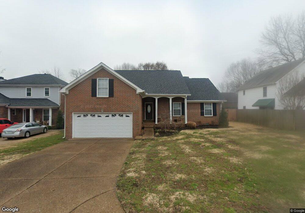
420 N Cardinal Ct Franklin, TN 37067
McEwen NeighborhoodEstimated Value: $557,776 - $624,000
--
Bed
3
Baths
1,740
Sq Ft
$343/Sq Ft
Est. Value
About This Home
This home is located at 420 N Cardinal Ct, Franklin, TN 37067 and is currently estimated at $597,194, approximately $343 per square foot. 420 N Cardinal Ct is a home located in Williamson County with nearby schools including Liberty Elementary School, Freedom Intermediate School, and Freedom Middle School.
Ownership History
Date
Name
Owned For
Owner Type
Purchase Details
Closed on
Aug 14, 2007
Sold by
Turner Barbara Todd and Hester Kathleen Todd
Bought by
Pringle Robert and Pringle Linda N
Current Estimated Value
Home Financials for this Owner
Home Financials are based on the most recent Mortgage that was taken out on this home.
Original Mortgage
$208,000
Outstanding Balance
$130,414
Interest Rate
6.56%
Mortgage Type
Purchase Money Mortgage
Estimated Equity
$466,780
Purchase Details
Closed on
Aug 14, 1995
Sold by
Hunter Robinson Louis
Bought by
Todd Robert A
Create a Home Valuation Report for This Property
The Home Valuation Report is an in-depth analysis detailing your home's value as well as a comparison with similar homes in the area
Home Values in the Area
Average Home Value in this Area
Purchase History
| Date | Buyer | Sale Price | Title Company |
|---|---|---|---|
| Pringle Robert | $238,000 | Southland Title & Escrow Co | |
| Todd Robert A | $150,000 | -- |
Source: Public Records
Mortgage History
| Date | Status | Borrower | Loan Amount |
|---|---|---|---|
| Open | Pringle Robert | $208,000 |
Source: Public Records
Tax History Compared to Growth
Tax History
| Year | Tax Paid | Tax Assessment Tax Assessment Total Assessment is a certain percentage of the fair market value that is determined by local assessors to be the total taxable value of land and additions on the property. | Land | Improvement |
|---|---|---|---|---|
| 2025 | $2,699 | $134,100 | $55,000 | $79,100 |
| 2024 | $2,699 | $95,350 | $30,000 | $65,350 |
| 2023 | $2,594 | $95,350 | $30,000 | $65,350 |
| 2022 | $2,594 | $95,350 | $30,000 | $65,350 |
| 2021 | $2,594 | $95,350 | $30,000 | $65,350 |
| 2020 | $2,300 | $71,250 | $21,250 | $50,000 |
| 2019 | $2,300 | $71,250 | $21,250 | $50,000 |
| 2018 | $2,250 | $71,250 | $21,250 | $50,000 |
| 2017 | $2,214 | $71,250 | $21,250 | $50,000 |
| 2016 | $0 | $71,250 | $21,250 | $50,000 |
| 2015 | -- | $56,375 | $18,750 | $37,625 |
| 2014 | -- | $56,375 | $18,750 | $37,625 |
Source: Public Records
Map
Nearby Homes
- 253 Freedom Dr
- 701 Calloway Ct
- 304 Hay Market Ct
- 224 Logans Cir
- 125 Stanwick Dr
- 229 Cambridge Place
- 909 Miranda Place
- 1311 Huffines Ridge Dr
- 769 Glen Oaks Dr
- 831 Pintail Ct
- 633 Grant Park Ct
- 523 Grant Park Ct
- 1011 Murfreesboro Rd Unit E3
- 1011 Murfreesboro Rd Unit B2
- 125 Grant Park Dr
- 0 Liberty Pike
- 1183 Buckingham Cir
- 118 Brevet Dr
- 2433 Kennedy Ct Unit 2433
- 520 Castlebury Ct
- 416 N Cardinal Ct
- 252 Freedom Dr
- 256 Freedom Dr
- 412 N Cardinal Ct
- 421 N Cardinal Ct
- 513 Dale Ct
- 248 Freedom Dr
- 417 N Cardinal Ct
- 517 Dale Ct
- 260 Freedom Dr
- 505 Dale Ct
- 413 N Cardinal Ct
- 408 N Cardinal Ct
- 509 Dale Ct
- 249 Freedom Dr
- 240 N Clematis Ct
- 244 Freedom Dr
- 521 Dale Ct
- 409 N Cardinal Ct
- 404 N Cardinal Ct