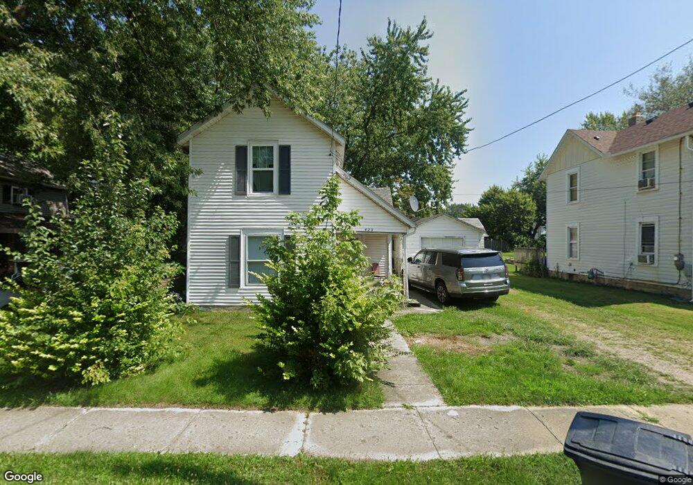
420 Scranton Ave Marion, OH 43302
Estimated Value: $62,028 - $87,000
2
Beds
1
Bath
1,138
Sq Ft
$65/Sq Ft
Est. Value
About This Home
This home is located at 420 Scranton Ave, Marion, OH 43302 and is currently estimated at $73,507, approximately $64 per square foot. 420 Scranton Ave is a home located in Marion County with nearby schools including Rutherford B. Hayes Elementary School, Ulysses S. Grant Middle School, and Harding High School.
Ownership History
Date
Name
Owned For
Owner Type
Purchase Details
Closed on
Mar 30, 2022
Sold by
Roger Camm Trust
Bought by
Pineda Otto Alexander Al
Current Estimated Value
Purchase Details
Closed on
Sep 10, 2021
Sold by
Camm Roger R
Bought by
Camm Roger and The Roger Camm Trust
Purchase Details
Closed on
Jul 28, 1992
Bought by
Camm Roger R
Create a Home Valuation Report for This Property
The Home Valuation Report is an in-depth analysis detailing your home's value as well as a comparison with similar homes in the area
Home Values in the Area
Average Home Value in this Area
Purchase History
| Date | Buyer | Sale Price | Title Company |
|---|---|---|---|
| Pineda Otto Alexander Al | -- | None Listed On Document | |
| Camm Roger | -- | None Available | |
| Camm Roger R | $25,000 | -- |
Source: Public Records
Tax History Compared to Growth
Tax History
| Year | Tax Paid | Tax Assessment Tax Assessment Total Assessment is a certain percentage of the fair market value that is determined by local assessors to be the total taxable value of land and additions on the property. | Land | Improvement |
|---|---|---|---|---|
| 2024 | $1,266 | $15,870 | $1,590 | $14,280 |
| 2023 | $1,266 | $15,870 | $1,590 | $14,280 |
| 2022 | $617 | $15,870 | $1,590 | $14,280 |
| 2021 | $490 | $12,360 | $1,380 | $10,980 |
| 2020 | $491 | $12,360 | $1,380 | $10,980 |
| 2019 | $491 | $12,360 | $1,380 | $10,980 |
| 2018 | $515 | $12,960 | $1,360 | $11,600 |
| 2017 | $564 | $12,960 | $1,360 | $11,600 |
| 2016 | $517 | $12,960 | $1,360 | $11,600 |
| 2015 | $518 | $12,680 | $1,300 | $11,380 |
| 2014 | $803 | $12,680 | $1,300 | $11,380 |
| 2012 | $596 | $14,480 | $1,370 | $13,110 |
Source: Public Records
Map
Nearby Homes
- 531 Toledo Ave
- 523 Thompson St
- 520 Toledo Ave
- 485 Avondale Ave
- 468 Avondale Ave
- 355 Lee St
- 641 Blake Ave
- 134 Waterloo St
- 551 Universal Ave Unit 555
- 178 Leader St
- 343 Commercial St
- 213 Sharp St
- 347 Mary St
- 233 Tully St
- 636 Mary St
- 325 Holmes Place
- 552 N Prospect St
- 395 N Main St
- 374 Nunin Ct
- 429 W Columbia St
- 414 Scranton Ave
- 428 Scranton Ave
- 408 Scranton Ave
- 429 Scranton Ave
- 429 Milburn Ave
- 429 Milburn Ave
- 440 Scranton Ave
- 402 Scranton Ave
- 415 Milburn Ave
- 435 Scranton Ave
- 409 Milburn Ave
- 425 Scranton Ave
- 415 Scranton Ave
- 394 Scranton Ave
- 443 Milburn Ave
- 401 Milburn Ave
- 409 Scranton Ave
- 441 Scranton Ave
- 403 Scranton Ave
- 395 Milburn Ave