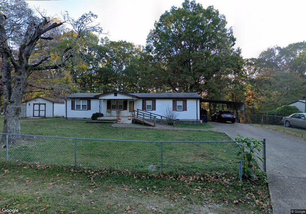
420 Spring St Monteagle, TN 37356
Estimated Value: $169,320 - $306,000
Studio
1
Bath
1,040
Sq Ft
$210/Sq Ft
Est. Value
About This Home
This home is located at 420 Spring St, Monteagle, TN 37356 and is currently estimated at $218,330, approximately $209 per square foot. 420 Spring St is a home located in Marion County with nearby schools including Monteagle Elementary School, South Pittsburg Elementary School, and Jasper Elementary School.
Ownership History
Date
Name
Owned For
Owner Type
Purchase Details
Closed on
May 22, 2024
Sold by
Butner Hamby Esther Carol and Butner Carol Esther
Bought by
Anderson Jay Dee
Current Estimated Value
Home Financials for this Owner
Home Financials are based on the most recent Mortgage that was taken out on this home.
Original Mortgage
$168,884
Outstanding Balance
$166,348
Interest Rate
7.17%
Mortgage Type
FHA
Estimated Equity
$51,982
Purchase Details
Closed on
Jul 26, 1976
Bought by
Butner Esther
Create a Home Valuation Report for This Property
The Home Valuation Report is an in-depth analysis detailing your home's value as well as a comparison with similar homes in the area
Home Values in the Area
Average Home Value in this Area
Purchase History
| Date | Buyer | Sale Price | Title Company |
|---|---|---|---|
| Anderson Jay Dee | $172,000 | None Listed On Document | |
| Butner Esther | -- | -- |
Source: Public Records
Mortgage History
| Date | Status | Borrower | Loan Amount |
|---|---|---|---|
| Open | Anderson Jay Dee | $168,884 |
Source: Public Records
Tax History
| Year | Tax Paid | Tax Assessment Tax Assessment Total Assessment is a certain percentage of the fair market value that is determined by local assessors to be the total taxable value of land and additions on the property. | Land | Improvement |
|---|---|---|---|---|
| 2025 | $342 | $19,425 | $4,025 | $15,400 |
| 2024 | $342 | $19,425 | $4,025 | $15,400 |
| 2023 | $342 | $19,425 | $0 | $0 |
| 2022 | $342 | $19,425 | $4,025 | $15,400 |
| 2021 | $342 | $19,425 | $4,025 | $15,400 |
| 2020 | $287 | $19,425 | $4,025 | $15,400 |
| 2019 | $287 | $13,250 | $3,500 | $9,750 |
| 2018 | $287 | $13,250 | $3,500 | $9,750 |
| 2017 | $287 | $13,250 | $3,500 | $9,750 |
| 2016 | $287 | $13,250 | $0 | $0 |
| 2015 | $314 | $13,250 | $0 | $0 |
| 2014 | $314 | $14,475 | $0 | $0 |
Source: Public Records
Map
Nearby Homes
- 408 Spring St
- 51 Mossy Rock Ln
- 210 Mountain Laurel Ln
- 84 Sunset Bluff Way
- 233 S Central Ave
- 0 Spring St
- 0 Laurel Lake Dr Unit 1513629
- 0 Laurel Lake Dr Unit 1513636
- 0 Laurel Lake Dr Unit 4
- 0 Laurel Lake Dr Unit 25353272
- 0 Laurel Lake Dr Unit 1513632
- 0 Laurel Lake Dr Unit RTC2891059
- 0 Laurel Lake Dr Unit 1513634
- 115 1st St
- 520 Lautzenheiser Place
- 31 Chickory Ln
- 42 Chickory Ln
- 107 Chickory Ln
- 227 Blackberry Farm Rd
- 221 Blackberry Farm Rd
- 419 Spring St
- 415 Spring St
- 433 Spring St
- 310 Spring St Unit 18
- 310 Spring St Unit 1
- 310 Spring St Unit 5
- 310 Spring St Unit 4
- 310 Spring St
- 229 Spring Place
- 223 Spring Place
- 51 Mossy Rock Ln Unit 55
- 0 Wildcat Branch Fork Unit RTC2434806
- 310 Timberwood Trace
- 408 S Central Ave
- 402 S Central Ave
- 281 Spring St
- 284 Spring St
- 219 Spring Place
- 26 Parker St
- 1695 Oliver Dr
Your Personal Tour Guide
Ask me questions while you tour the home.