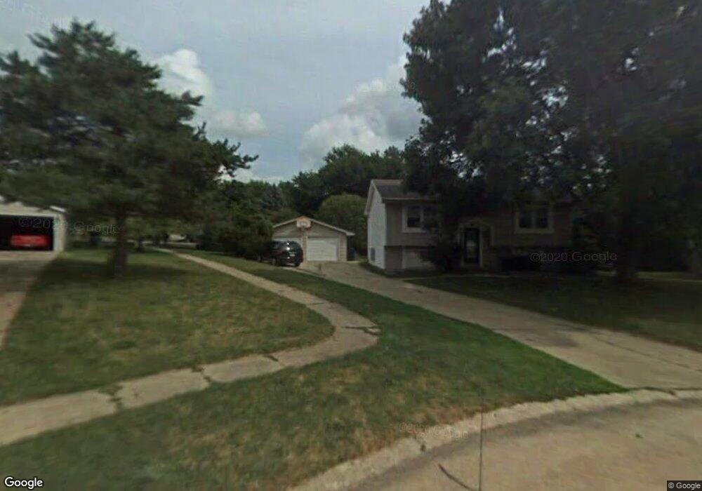
4203 89th St Urbandale, IA 50322
Estimated Value: $273,000 - $284,000
2
Beds
2
Baths
912
Sq Ft
$306/Sq Ft
Est. Value
About This Home
This home is located at 4203 89th St, Urbandale, IA 50322 and is currently estimated at $279,519, approximately $306 per square foot. 4203 89th St is a home located in Polk County with nearby schools including Urbandale Middle School, Urbandale High School, and St Pius X School.
Ownership History
Date
Name
Owned For
Owner Type
Purchase Details
Closed on
Dec 18, 2013
Sold by
Augspurger Jon L and Augspurger Lynn
Bought by
Augspurger Jon L and Augspurger Lynn
Current Estimated Value
Purchase Details
Closed on
Jun 29, 1998
Sold by
Johnson Terry L and Johnson Deborah A
Bought by
Augspurger Jon
Home Financials for this Owner
Home Financials are based on the most recent Mortgage that was taken out on this home.
Original Mortgage
$82,400
Interest Rate
7.18%
Mortgage Type
Balloon
Create a Home Valuation Report for This Property
The Home Valuation Report is an in-depth analysis detailing your home's value as well as a comparison with similar homes in the area
Home Values in the Area
Average Home Value in this Area
Purchase History
| Date | Buyer | Sale Price | Title Company |
|---|---|---|---|
| Augspurger Jon L | -- | None Available | |
| Augspurger Jon | $102,500 | -- |
Source: Public Records
Mortgage History
| Date | Status | Borrower | Loan Amount |
|---|---|---|---|
| Previous Owner | Augspurger Jon | $82,400 |
Source: Public Records
Tax History Compared to Growth
Tax History
| Year | Tax Paid | Tax Assessment Tax Assessment Total Assessment is a certain percentage of the fair market value that is determined by local assessors to be the total taxable value of land and additions on the property. | Land | Improvement |
|---|---|---|---|---|
| 2025 | $4,098 | $243,200 | $84,300 | $158,900 |
| 2024 | $4,098 | $226,300 | $75,900 | $150,400 |
| 2023 | $3,866 | $226,300 | $75,900 | $150,400 |
| 2022 | $3,822 | $180,200 | $62,700 | $117,500 |
| 2021 | $3,980 | $180,200 | $62,700 | $117,500 |
| 2020 | $3,912 | $178,100 | $56,900 | $121,200 |
| 2019 | $3,912 | $178,100 | $56,900 | $121,200 |
| 2018 | $3,770 | $170,100 | $53,300 | $116,800 |
| 2017 | $3,468 | $170,100 | $53,300 | $116,800 |
| 2016 | $3,382 | $153,800 | $47,700 | $106,100 |
| 2015 | $3,382 | $153,800 | $47,700 | $106,100 |
| 2014 | $3,062 | $143,600 | $43,900 | $99,700 |
Source: Public Records
Map
Nearby Homes
- 8914 Valdez Dr
- 4221 90th St
- 4460 90th St
- 8505 Airline Ave
- 8501 Airline Ave
- 8626 Alpine Dr Unit D
- 8220 Twana Dr
- 4117 83rd St
- 9107 Tanglewood Dr
- 8641 Alpine Dr Unit E
- 4473 89th St
- 4480 87th St Unit 10
- 3900 Rolling Green Dr
- 3957 92nd Dr
- 4529 91st St
- 8005 Airline Ave
- 3889 92nd Dr
- 3916 Greenview Dr
- 3924 80th St
- 7901 Airline Ave