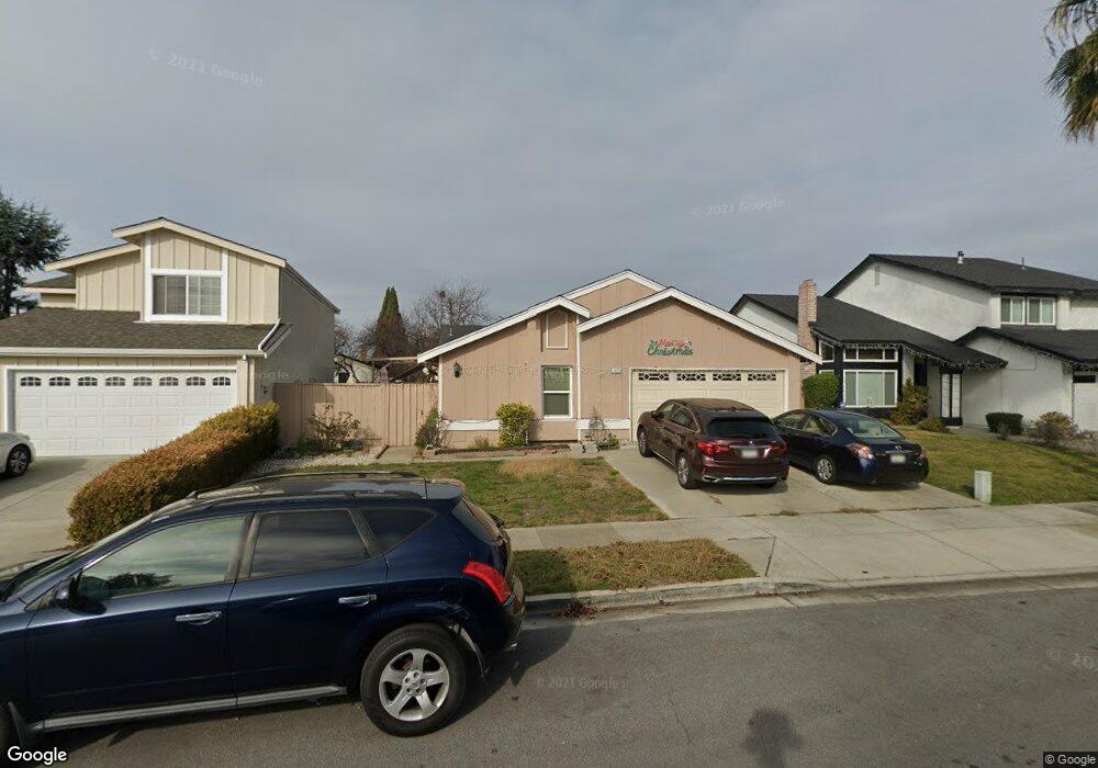
4205 Nerissa Cir Fremont, CA 94555
Ardenwood NeighborhoodEstimated Value: $1,314,451 - $1,999,000
3
Beds
--
Bath
1,380
Sq Ft
$1,201/Sq Ft
Est. Value
About This Home
This home is located at 4205 Nerissa Cir, Fremont, CA 94555 and is currently estimated at $1,657,363, approximately $1,200 per square foot. 4205 Nerissa Cir is a home located in Alameda County with nearby schools including Ardenwood Elementary, Thornton Middle School, and American High School.
Ownership History
Date
Name
Owned For
Owner Type
Purchase Details
Closed on
May 27, 1998
Sold by
Aninao Alcutse S
Bought by
Aninao Editha C
Current Estimated Value
Home Financials for this Owner
Home Financials are based on the most recent Mortgage that was taken out on this home.
Original Mortgage
$140,000
Interest Rate
6.78%
Mortgage Type
Purchase Money Mortgage
Purchase Details
Closed on
Feb 17, 1995
Sold by
Aninao Alcutse S
Bought by
Aninao Editha C
Create a Home Valuation Report for This Property
The Home Valuation Report is an in-depth analysis detailing your home's value as well as a comparison with similar homes in the area
Home Values in the Area
Average Home Value in this Area
Purchase History
| Date | Buyer | Sale Price | Title Company |
|---|---|---|---|
| Aninao Editha C | -- | Fidelity National Title | |
| Aninao Editha C | -- | -- |
Source: Public Records
Mortgage History
| Date | Status | Borrower | Loan Amount |
|---|---|---|---|
| Closed | Aninao Editha C | $140,000 |
Source: Public Records
Tax History
| Year | Tax Paid | Tax Assessment Tax Assessment Total Assessment is a certain percentage of the fair market value that is determined by local assessors to be the total taxable value of land and additions on the property. | Land | Improvement |
|---|---|---|---|---|
| 2025 | $3,468 | $238,456 | $82,814 | $162,642 |
| 2024 | $3,468 | $233,643 | $81,190 | $159,453 |
| 2023 | $3,358 | $235,925 | $79,598 | $156,327 |
| 2022 | $3,291 | $224,300 | $78,038 | $153,262 |
| 2021 | $3,215 | $219,766 | $76,508 | $150,258 |
| 2020 | $3,100 | $220,342 | $75,724 | $144,618 |
| 2019 | $3,068 | $216,021 | $74,239 | $141,782 |
| 2018 | $3,004 | $211,787 | $72,784 | $139,003 |
| 2017 | $2,929 | $207,635 | $71,357 | $136,278 |
| 2016 | $2,866 | $203,564 | $69,958 | $133,606 |
| 2015 | $2,816 | $200,506 | $68,907 | $131,599 |
| 2014 | $2,758 | $196,580 | $67,558 | $129,022 |
Source: Public Records
Map
Nearby Homes
- 4141 Deep Creek Rd Unit 89
- 4141 Deep Creek Rd Unit 106
- 4141 Deep Creek Rd Unit 180
- 3868 Fiano Common
- 3863 Milton Terrace
- 3673 Thrush Terrace
- 34376 Gadwall Common
- 4212 Gordon St
- 34132 Aberdeen Terrace
- 34203 Petard Terrace
- 3327 Trafalgar Rd
- 269 Oahu Cir
- 324 Waikiki Cir
- 34597 Bluestone Common
- 3717 Gainsborough Terrace
- 4015 Clydesdale Common
- 328 Waikiki Cir
- 259 Molokai Cir Unit 259
- 33010 Lake Mead Dr
- 30 Palm Dr Unit 30
- 4211 Nerissa Cir
- 4201 Nerissa Cir
- 33768 Shylock Dr
- 4132 Polonius Cir
- 4217 Nerissa Cir
- 4142 Polonius Cir
- 33746 Shylock Dr
- 4122 Polonius Cir
- 4221 Nerissa Cir
- 4206 Nerissa Cir
- 4202 Nerissa Cir
- 4210 Nerissa Cir
- 4152 Polonius Cir
- 4214 Nerissa Cir
- 33726 Shylock Dr
- 4112 Polonius Cir
- 4227 Nerissa Cir
- 33763 Shylock Dr
- 4218 Nerissa Cir
- 33791 Shylock Dr
Your Personal Tour Guide
Ask me questions while you tour the home.